Directions to Sanda Alexandrescu, Md (Boston) with public transportation
The following transit lines have routes that pass near Sanda Alexandrescu, Md
 Bus: 39, 47, 8, 85, 19.
- Train: NEEDHAM, PROVIDENCE/STOUGHTON.
- Subway: GREEN LINE E, GREEN LINE D.
How to get to Sanda Alexandrescu, Md by bus?
Click on the bus route to see step by step directions with maps, line arrival times and updated time schedules.
From Hampton Inn Boston Logan Airport Chelsea, Chelsea
73 minFrom Wollaston Beach, Quincy
111 minFrom Children's Hospital, Boston
51 minFrom VFW Parkway, Boston
47 minFrom Boston Harborwalk, Boston
44 minFrom Milton, MA, Milton
68 minFrom Sheraton-Needham Hotel (Sheraton Boston Needham Hotel), Needham
88 minFrom Georgetown, Massachusetts, Boston
66 minFrom SharkNinja Operating LLC, Needham
92 min
How to get to Sanda Alexandrescu, Md by train?
Click on the train route to see step by step directions with maps, line arrival times and updated time schedules.
How to get to Sanda Alexandrescu, Md by subway?
Click on the subway route to see step by step directions with maps, line arrival times and updated time schedules.
Bus stops near Sanda Alexandrescu, Md in Boston
Subway stations near Sanda Alexandrescu, Md in Boston
Bus lines to Sanda Alexandrescu, Md in Boston
- 8, Kenmore via South Bay Center - Harbor Point via South Bay Center,VIEW
- 19, Kenmore - Fields Corner,VIEW
- 47, Broadway - Central Square,VIEW
- 85, Ruggles - Assembly,VIEW
- 9, Kenmore Via Boston Latin,VIEW
- CT3, Avenue Louis Pasteur (Limited Stops),VIEW
- 22, Ashmont,VIEW
- 28, Mattapan,VIEW
- 35, Dedham Mall,VIEW
- 39, Wolcott Square Via Forest Hills,VIEW
- 57, Watertown Yard,VIEW
- 60, Kenmore - Chestnut Hill Mall,VIEW
- 65, Kenmore - Brighton Center,VIEW
- GREEN LINE D SHUTTLE, Reservoir - Fenway,VIEW
- GREEN LINE D SHUTTLE, Riverside - Fenway,VIEW
- GREEN LINE D SHUTTLE, Newton Highlands - Kenmore,VIEW
- GREEN LINE D SHUTTLE, Newton Highlands - Fenway,VIEW
- GREEN LINE D SHUTTLE, Reservoir - Kenmore,VIEW
- GREEN LINE D SHUTTLE, Brookline Hills - Kenmore,VIEW
- GREEN LINE D SHUTTLE, Newton Highlands - Kenmore via Saint Mary's Street,VIEW
What are the closest stations to Sanda Alexandrescu, Md?
The closest stations to Sanda Alexandrescu, Md are:
- Longwood Ave @ Blackfan St is 106 yards away, 2 min walk.
- Longwood Ave @ Binney St is 151 yards away, 3 min walk.
- Ave Louis Pasteur @ Longwood Ave is 267 yards away, 4 min walk.
- Brookline Ave @ Longwood Ave is 337 yards away, 5 min walk.
- Longwood Medical Area is 526 yards away, 7 min walk.
- 677 Huntington Ave is 538 yards away, 7 min walk.
- Tremont St @ Huntington Ave is 669 yards away, 9 min walk.
- Chapel St, Colchester St is 880 yards away, 12 min walk.
Which bus lines stop near Sanda Alexandrescu, Md?
These bus lines stop near Sanda Alexandrescu, Md: 39, 47, 8, 85.
Which train lines stop near Sanda Alexandrescu, Md?
These train lines stop near Sanda Alexandrescu, Md: NEEDHAM, PROVIDENCE/STOUGHTON.
Which subway line stops near Sanda Alexandrescu, Md?
GREEN LINE E (Heath Street)
What’s the nearest subway station to Sanda Alexandrescu, Md in Boston?
The nearest subway station to Sanda Alexandrescu, Md in Boston is Longwood Medical Area. It’s a 7 min walk away.
What’s the nearest bus station to Sanda Alexandrescu, Md in Boston?
The nearest bus station to Sanda Alexandrescu, Md in Boston is Longwood Ave @ Blackfan St. It’s a 2 min walk away.
What time is the first subway to Sanda Alexandrescu, Md in Boston?
The GREEN LINE D is the first subway that goes to Sanda Alexandrescu, Md in Boston. It stops nearby at 4:55 AM.
What time is the last subway to Sanda Alexandrescu, Md in Boston?
The GREEN LINE D is the last subway that goes to Sanda Alexandrescu, Md in Boston. It stops nearby at 2:22 AM.
What time is the first bus to Sanda Alexandrescu, Md in Boston?
The 39 is the first bus that goes to Sanda Alexandrescu, Md in Boston. It stops nearby at 4:50 AM.
What time is the last bus to Sanda Alexandrescu, Md in Boston?
The 66 is the last bus that goes to Sanda Alexandrescu, Md in Boston. It stops nearby at 2:25 AM.
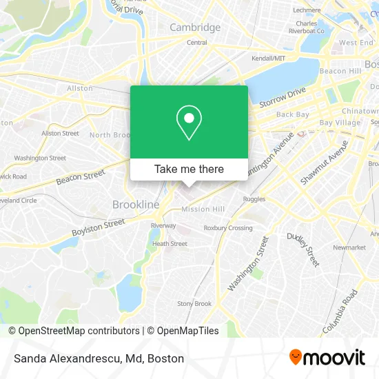
See Sanda Alexandrescu, Md, Boston, on the map
Public Transit to Sanda Alexandrescu, Md in Boston
Wondering how to get to Sanda Alexandrescu, Md in Boston? Moovit helps you find the best way to get to Sanda Alexandrescu, Md with step-by-step directions from the nearest public transit station.
Moovit provides free maps and live directions to help you navigate through your city. View schedules, routes, timetables, and find out how long does it take to get to Sanda Alexandrescu, Md in real time.
Looking for the nearest stop or station to Sanda Alexandrescu, Md? Check out this list of stops closest to your destination: Longwood Ave @ Blackfan St; Longwood Ave @ Binney St; Ave Louis Pasteur @ Longwood Ave; Brookline Ave @ Longwood Ave; Longwood Medical Area; 677 Huntington Ave; Tremont St @ Huntington Ave; Chapel St.
Bus: 39, 47, 8, 85, 19, 9, CT3, 22, 28, 35, 57, 60, 65, GREEN LINE D SHUTTLE, GREEN LINE D SHUTTLE, GREEN LINE D SHUTTLE.Train: NEEDHAM, PROVIDENCE/STOUGHTON.Subway: GREEN LINE E, GREEN LINE D.
Want to see if there’s another route that gets you there at an earlier time? Moovit helps you find alternative routes or times. Get directions from and directions to Sanda Alexandrescu, Md easily from the Moovit App or Website.
We make riding to Sanda Alexandrescu, Md easy, which is why over 1.7 million users, including users in Boston, trust Moovit as the best app for public transit. You don’t need to download an individual bus app or train app, Moovit is your all-in-one transit app that helps you find the best bus time or train time available.
For information on prices of bus, subway and train, costs and ride fares to Sanda Alexandrescu, Md, please check the Moovit app.
Use the app to navigate to popular places including to the airport, hospital, stadium, grocery store, mall, coffee shop, school, college, and university.
Sanda Alexandrescu, Md Address: 300 Longwood Ave street in Boston
- Boston Children's Hospital CF Clinic,
- Michael O'Brien MD,
- Partha Sekhar Ghosh MD,
- Anna Helon, Pharmd,
- Khashayar Vakili MD,
- Boston Children's Primary Care Alliance,
- Michele Burns, MD,
- Mark Proctor MD,
- Fetal Cardiology Program,
- Karameh Hawash-Kuemmerle, MD,
- Rima Rachid MD,
- Avram Z. Traum, MD,
- Meredith van der Velden, MD,
- BJ's Playground,
- Pediatric Kidney Transplant Program,
- Harleen Kumar BDSC DCD,
- Asha Nair MD,
- Luis Alvernaz, MD,
- Paul A. Arandia, LCSW,
- Demers, Shaela M
Places Near Sanda Alexandrescu, Md (Boston)
- Wang Theater, Boston,
- Isabella Stewart Gardner Museum, Boston,
- Leader Bank Pavilion (Leader Bank Pavillion), Boston,
- North End, Boston,
- Castle Island, Boston,
- Quincy Market, Boston,
- Boston Common, Boston,
- Boston Children's Hospital, Boston,
- Prudential Center, Boston,
- Faneuil Hall, Boston,
- Seaport District, Boston,
- House Of Blues, Boston,
- Boston Medical Center, Boston,
- Museum Of Science, Boston,
- Cheers, Boston,
- Mgm Music Hall, Boston,
- Boston Convention & Exhibition Center, Boston,
- Wilbur Theatre, Boston,
- Td Garden, Boston,
- Massachusetts General Hospital, Boston
How to get to popular places in Boston with public transit
Get around Boston by public transit!
Traveling around Boston has never been so easy. See step by step directions as you travel to any attraction, street or major public transit station. View bus and train schedules, arrival times, service alerts and detailed routes on a map, so you know exactly how to get to anywhere in Boston.
When traveling to any destination around Boston use Moovit's Live Directions with Get Off Notifications to know exactly where and how far to walk, how long to wait for your line, and how many stops are left. Moovit will alert you when it's time to get off — no need to constantly re-check whether yours is the next stop.
Wondering how to use public transit in Boston or how to pay for public transit in Boston? Moovit public transit app can help you navigate your way with public transit easily, and at minimum cost. It includes public transit fees, ticket prices, and costs. Looking for a map of Boston public transit lines? Moovit public transit app shows all public transit maps in Boston with all Bus, Train, Subway and Ferry routes and stops on an interactive map.
Boston has 4 transit type(s), including: Bus, Train, Subway and Ferry, operated by several transit agencies, including MBTA, Southeastern Regional Transit Authority, MetroWest Regional Transit Authority, Rhode Island Public Transit Authority, WRTA, Lowell Regional Transit Authority, Merrimack Valley Transit, Montachusett Regional Transit Authority, Cape Cod Regional Transit Authority, Brockton Area Transit Authority, Martha's Vineyard Transit Authority, the WAVE - Nantucket Regional Transit Authority, GATRA, Cape Ann Transportation Authority and Massport