Directions to Santander Bank Atm (Quincy) with public transportation
The following transit lines have routes that pass near Santander Bank Atm
 Bus: 201, 210, 211, 217.
- Subway: RED LINE, MATTAPAN LINE.
- Ferry: QUINCY FERRY, WINTHROP/QUINCY FERRY.
How to get to Santander Bank Atm by bus?
Click on the bus route to see step by step directions with maps, line arrival times and updated time schedules.
From Hewlett Room 32-G882 (MIT Stata Center), Cambridge
119 minFrom Fire + Ice, Boston
95 minFrom Cambridgeside, Cambridge
137 minFrom CambridgeSide (Cambridgeside Galleria), Cambridge
137 minFrom South Boston, Boston
82 minFrom The Friendly Toast, Boston
98 minFrom The Castle, Boston
108 minFrom Theatre District, Boston
87 minFrom Brookline High School (Brookline Town High School), Brookline
113 min
How to get to Santander Bank Atm by subway?
Click on the subway route to see step by step directions with maps, line arrival times and updated time schedules.
From Hewlett Room 32-G882 (MIT Stata Center), Cambridge
50 minFrom Fire + Ice, Boston
53 minFrom Cambridgeside, Cambridge
62 minFrom Boston Navy Yard, Boston
70 minFrom CambridgeSide (Cambridgeside Galleria), Cambridge
63 minFrom South Boston, Boston
45 minFrom The Friendly Toast, Boston
49 minFrom The Castle, Boston
68 minFrom Theatre District, Boston
49 minFrom Brookline High School (Brookline Town High School), Brookline
70 min
Bus stops near Santander Bank Atm in Quincy
Subway stations near Santander Bank Atm in Quincy
Ferry station near Santander Bank Atm in Quincy
- Quincy, 29 min walk,VIEW
What are the closest stations to Santander Bank Atm?
The closest stations to Santander Bank Atm are:
- E Squantum St Opp Hummock Rd is 117 yards away, 2 min walk.
- E Squantum St @ Faxon Rd. is 1085 yards away, 13 min walk.
- Wollaston is 2379 yards away, 28 min walk.
- Quincy is 2451 yards away, 29 min walk.
- Cedar Grove is 5010 yards away, 59 min walk.
Which bus lines stop near Santander Bank Atm?
These bus lines stop near Santander Bank Atm: 201, 210, 211.
Which subway line stops near Santander Bank Atm?
RED LINE (Ashmont/Braintree)
What’s the nearest subway station to Santander Bank Atm in Quincy?
The nearest subway station to Santander Bank Atm in Quincy is Wollaston. It’s a 28 min walk away.
What’s the nearest bus station to Santander Bank Atm in Quincy?
The nearest bus station to Santander Bank Atm in Quincy is E Squantum St Opp Hummock Rd. It’s a 2 min walk away.
What’s the nearest ferry station to Santander Bank Atm in Quincy?
The nearest ferry station to Santander Bank Atm in Quincy is Quincy. It’s a 29 min walk away.
What time is the first subway to Santander Bank Atm in Quincy?
The MATTAPAN LINE is the first subway that goes to Santander Bank Atm in Quincy. It stops nearby at 5:10 AM.
What time is the last subway to Santander Bank Atm in Quincy?
The MATTAPAN LINE is the last subway that goes to Santander Bank Atm in Quincy. It stops nearby at 2:31 AM.
What time is the first bus to Santander Bank Atm in Quincy?
The 211 is the first bus that goes to Santander Bank Atm in Quincy. It stops nearby at 5:49 AM.
What time is the last bus to Santander Bank Atm in Quincy?
The 211 is the last bus that goes to Santander Bank Atm in Quincy. It stops nearby at 8:20 PM.
What time is the first ferry to Santander Bank Atm in Quincy?
The QUINCY FERRY is the first ferry that goes to Santander Bank Atm in Quincy. It stops nearby at 6:15 AM.
What time is the last ferry to Santander Bank Atm in Quincy?
The QUINCY FERRY is the last ferry that goes to Santander Bank Atm in Quincy. It stops nearby at 8:55 PM.
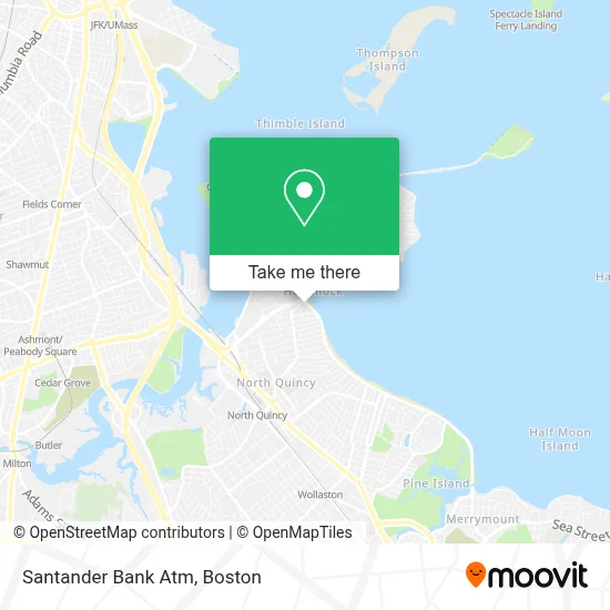
See Santander Bank Atm, Quincy, on the map
Public Transit to Santander Bank Atm in Quincy
Wondering how to get to Santander Bank Atm in Quincy? Moovit helps you find the best way to get to Santander Bank Atm with step-by-step directions from the nearest public transit station.
Moovit provides free maps and live directions to help you navigate through your city. View schedules, routes, timetables, and find out how long does it take to get to Santander Bank Atm in real time.
Looking for the nearest stop or station to Santander Bank Atm? Check out this list of stops closest to your destination: E Squantum St Opp Hummock Rd; E Squantum St @ Faxon Rd.; Wollaston; Quincy; Cedar Grove.
Bus: 201, 210, 211, 217.Subway: RED LINE, MATTAPAN LINE.Ferry: QUINCY FERRY, WINTHROP/QUINCY FERRY.
Want to see if there’s another route that gets you there at an earlier time? Moovit helps you find alternative routes or times. Get directions from and directions to Santander Bank Atm easily from the Moovit App or Website.
We make riding to Santander Bank Atm easy, which is why over 1.7 million users, including users in Quincy, trust Moovit as the best app for public transit. You don’t need to download an individual bus app or train app, Moovit is your all-in-one transit app that helps you find the best bus time or train time available.
For information on prices of bus and subway, costs and ride fares to Santander Bank Atm, please check the Moovit app.
Use the app to navigate to popular places including to the airport, hospital, stadium, grocery store, mall, coffee shop, school, college, and university.
Santander Bank Atm Address: 321 Quincy Shore Dr street in Quincy
- Cvs Pharmacy,
- Cvs Store #02454,
- Cvs Quincy Shore Drive,
- Atm Cvs,
- Manar Usa,
- Quincy Shore Service,
- Busy Bees Clubhouse,
- City Of Quincy Health Department,
- Quincy Health Department,
- Quincy Animal Shelter,
- The Kennedy Center,
- Supreme Home Improvement Inc,
- Jake Ollmann Electrical,
- Boston Rocks,
- Wollaston Beach-West,
- Wollaston Beach,
- Kc Visuals Unlimited,
- Bayside Jewel - Private Beach Vacation Rental,
- Prime Locksmith Mobile Service,
- Paul's Rubbish Removal And Demolition
Places Near Santander Bank Atm (Quincy)
- Td Garden, Boston,
- Wang Theater, Boston,
- Museum Of Science, Boston,
- North End, Boston,
- Isabella Stewart Gardner Museum, Boston,
- Faneuil Hall, Boston,
- Boston Medical Center, Boston,
- Wilbur Theatre, Boston,
- Prudential Center, Boston,
- Cheers, Boston,
- Boston Common, Boston,
- Mgm Music Hall, Boston,
- House Of Blues, Boston,
- Massachusetts General Hospital, Boston,
- Quincy Market, Boston,
- Boston Children's Hospital, Boston,
- Boston Convention & Exhibition Center, Boston,
- Seaport District, Boston,
- Leader Bank Pavilion (Leader Bank Pavillion), Boston,
- Castle Island, Boston
How to get to popular places in Boston with public transit
Get around Quincy by public transit!
Traveling around Quincy has never been so easy. See step by step directions as you travel to any attraction, street or major public transit station. View bus and train schedules, arrival times, service alerts and detailed routes on a map, so you know exactly how to get to anywhere in Quincy.
When traveling to any destination around Quincy use Moovit's Live Directions with Get Off Notifications to know exactly where and how far to walk, how long to wait for your line, and how many stops are left. Moovit will alert you when it's time to get off — no need to constantly re-check whether yours is the next stop.
Wondering how to use public transit in Quincy or how to pay for public transit in Quincy? Moovit public transit app can help you navigate your way with public transit easily, and at minimum cost. It includes public transit fees, ticket prices, and costs. Looking for a map of Quincy public transit lines? Moovit public transit app shows all public transit maps in Quincy with all Bus, Train, Subway and Ferry routes and stops on an interactive map.
Boston has 4 transit type(s), including: Bus, Train, Subway and Ferry, operated by several transit agencies, including MBTA, Southeastern Regional Transit Authority, MetroWest Regional Transit Authority, Rhode Island Public Transit Authority, WRTA, Lowell Regional Transit Authority, Merrimack Valley Transit, Montachusett Regional Transit Authority, Cape Cod Regional Transit Authority, Brockton Area Transit Authority, Martha's Vineyard Transit Authority, the WAVE - Nantucket Regional Transit Authority, GATRA, Cape Ann Transportation Authority and Massport