Directions to Santander Bank Atm (Boston) with public transportation
The following transit lines have routes that pass near Santander Bank Atm
 Bus: 426, 43, 92, 93, EZRIDE.
- Train: FAIRMOUNT, FITCHBURG, FRAMINGHAM/WORCESTER, NEEDHAM, HAVERHILL.
- Subway: GREEN LINE D, GREEN LINE E, ORANGE LINE, GREEN LINE B, GREEN LINE C.
- Ferry: LOVEJOY - FAN PIER - PIER 10.
How to get to Santander Bank Atm by bus?
Click on the bus route to see step by step directions with maps, line arrival times and updated time schedules.
From MSPCA Angell Animal Medical Center, Boston
63 minFrom Franklin Park, Boston
65 minFrom Davis Sq, Somerville
44 minFrom Alumni Stadium, Newton
80 minFrom FOUR POINTS BY SHERATON Boston Newton, Newton
51 minFrom Lower Mills, Boston
108 minFrom Wollaston Beach, Quincy
142 minFrom 110 Francis Street Garage, Boston
65 minFrom Saugus, MA, Saugus
50 minFrom Staybridge Suites Boston-Quincy, Quincy
117 min
How to get to Santander Bank Atm by train?
Click on the train route to see step by step directions with maps, line arrival times and updated time schedules.
How to get to Santander Bank Atm by subway?
Click on the subway route to see step by step directions with maps, line arrival times and updated time schedules.
From MSPCA Angell Animal Medical Center, Boston
40 minFrom Franklin Park, Boston
37 minFrom Davis Sq, Somerville
34 minFrom Alumni Stadium, Newton
64 minFrom Lower Mills, Boston
48 minFrom Wollaston Beach, Quincy
51 minFrom 110 Francis Street Garage, Boston
42 minFrom Staybridge Suites Boston-Quincy, Quincy
36 min
Subway stations near Santander Bank Atm in Boston
Bus stops near Santander Bank Atm in Boston
- North Station - Nashua St @ Red Auerbach Way, 7 min walk,VIEW
- N Washington St @ Medford St, 8 min walk,VIEW
- North Station, 8 min walk,VIEW
- Congress St @ Sudbury St, 8 min walk,VIEW
- Haymarket - Congress St @ New Sudbury St, 8 min walk,VIEW
- Surface Rd @ Hanover St, 9 min walk,VIEW
- North Station - Haverhill St @ Causeway St, 11 min walk,VIEW
- Sudbury St @ Congress St - Haymarket Sta, 13 min walk,VIEW
Train station near Santander Bank Atm in Boston
- North Station, 7 min walk,VIEW
Ferry station near Santander Bank Atm in Boston
- North Station (Lovejoy Wharf), 12 min walk,VIEW
Bus lines to Santander Bank Atm in Boston
- GREEN LINE E SHUTTLE, Government Center - Medford/Tufts (Shuttle),VIEW
- GREEN LINE E SHUTTLE, North Station - Medford/Tufts (Shuttle),VIEW
- GREEN LINE E SHUTTLE, Medford/Tufts - North Station,VIEW
- GREEN LINE SHUTTLE, Union Square - North Station,VIEW
- GREEN LINE SHUTTLE, Medford/Tufts - Government Center via Union Square,VIEW
- GREEN LINE SHUTTLE, Lechmere - North Station,VIEW
- GREEN LINE SHUTTLE, North Station - Sullivan Square via East Somerville,VIEW
- GREEN LINE SHUTTLE, Union Square - Government Center,VIEW
- 92, Sullivan,VIEW
- 93, Sullivan Via Navy Yard,VIEW
- 111, Haymarket,VIEW
- 426, Haymarket Via Cliftondale,VIEW
- 428, Haymarket Via Cliftondale (Express),VIEW
- 89/93, Haymarket Via Sullivan,VIEW
- ORANGE LINE SHUTTLE, Sullivan (Shuttle),VIEW
- EZRIDE, Inbound To North Station From Erie St,VIEW
- EZRIDE, Outbound North Station To Erie St Via Lechmere And Kendall,VIEW
- EZRIDE, Outbound To Erie St From North Station,VIEW
- EZRIDE, Inbound To North Station Via Kendall And Lechmere,VIEW
- 4, Design Center,VIEW
What are the closest stations to Santander Bank Atm?
The closest stations to Santander Bank Atm are:
- Haymarket is 389 yards away, 5 min walk.
- North Station - Nashua St @ Red Auerbach Way is 504 yards away, 7 min walk.
- North Station is 546 yards away, 7 min walk.
- N Washington St @ Medford St is 612 yards away, 8 min walk.
- Congress St @ Sudbury St is 636 yards away, 8 min walk.
- Causeway St (East) is 653 yards away, 8 min walk.
- Haymarket - Congress St @ New Sudbury St is 656 yards away, 8 min walk.
- Surface Rd @ Hanover St is 701 yards away, 9 min walk.
- North Station - Haverhill St @ Causeway St is 887 yards away, 11 min walk.
- North Station (Lovejoy Wharf) is 953 yards away, 12 min walk.
- Sudbury St @ Congress St - Haymarket Sta is 1055 yards away, 13 min walk.
Which bus lines stop near Santander Bank Atm?
These bus lines stop near Santander Bank Atm: 426, 43, 92, 93, EZRIDE, SL4.
Which train lines stop near Santander Bank Atm?
These train lines stop near Santander Bank Atm: FAIRMOUNT, FITCHBURG, FRAMINGHAM/WORCESTER, NEEDHAM.
Which subway lines stop near Santander Bank Atm?
These subway lines stop near Santander Bank Atm: GREEN LINE D, GREEN LINE E, ORANGE LINE.
What’s the nearest subway station to Santander Bank Atm in Boston?
The nearest subway station to Santander Bank Atm in Boston is Haymarket. It’s a 5 min walk away.
What’s the nearest train station to Santander Bank Atm in Boston?
The nearest train station to Santander Bank Atm in Boston is North Station. It’s a 7 min walk away.
What’s the nearest bus station to Santander Bank Atm in Boston?
The nearest bus station to Santander Bank Atm in Boston is North Station - Nashua St @ Red Auerbach Way. It’s a 7 min walk away.
What’s the nearest ferry station to Santander Bank Atm in Boston?
The nearest ferry station to Santander Bank Atm in Boston is North Station (Lovejoy Wharf). It’s a 12 min walk away.
What time is the first subway to Santander Bank Atm in Boston?
The GREEN LINE E is the first subway that goes to Santander Bank Atm in Boston. It stops nearby at 5:01 AM.
What time is the last subway to Santander Bank Atm in Boston?
The GREEN LINE E is the last subway that goes to Santander Bank Atm in Boston. It stops nearby at 2:24 AM.
What time is the first train to Santander Bank Atm in Boston?
The LOWELL is the first train that goes to Santander Bank Atm in Boston. It stops nearby at 5:20 AM.
What time is the last train to Santander Bank Atm in Boston?
The LOWELL is the last train that goes to Santander Bank Atm in Boston. It stops nearby at 12:34 AM.
What time is the first bus to Santander Bank Atm in Boston?
The 111 is the first bus that goes to Santander Bank Atm in Boston. It stops nearby at 4:49 AM.
What time is the last bus to Santander Bank Atm in Boston?
The 111 is the last bus that goes to Santander Bank Atm in Boston. It stops nearby at 2:16 AM.
What time is the first ferry to Santander Bank Atm in Boston?
The LOVEJOY - FAN PIER - PIER 10 is the first ferry that goes to Santander Bank Atm in Boston. It stops nearby at 6:20 AM.
What time is the last ferry to Santander Bank Atm in Boston?
The LOVEJOY - FAN PIER - PIER 10 is the last ferry that goes to Santander Bank Atm in Boston. It stops nearby at 7:35 PM.
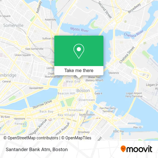
See Santander Bank Atm, Boston, on the map
Public Transit to Santander Bank Atm in Boston
Wondering how to get to Santander Bank Atm in Boston? Moovit helps you find the best way to get to Santander Bank Atm with step-by-step directions from the nearest public transit station.
Moovit provides free maps and live directions to help you navigate through your city. View schedules, routes, timetables, and find out how long does it take to get to Santander Bank Atm in real time.
Looking for the nearest stop or station to Santander Bank Atm? Check out this list of stops closest to your destination: Haymarket; North Station - Nashua St @ Red Auerbach Way; North Station; N Washington St @ Medford St; Congress St @ Sudbury St; Causeway St (East); Haymarket - Congress St @ New Sudbury St; Surface Rd @ Hanover St; North Station - Haverhill St @ Causeway St; North Station (Lovejoy Wharf); Sudbury St @ Congress St - Haymarket Sta.
Bus: 426, 43, 92, 93, EZRIDE, SL4, GREEN LINE E SHUTTLE, GREEN LINE E SHUTTLE, GREEN LINE E SHUTTLE, GREEN LINE SHUTTLE, GREEN LINE SHUTTLE, 111, 428.Train: FAIRMOUNT, FITCHBURG, FRAMINGHAM/WORCESTER, NEEDHAM, HAVERHILL, LOWELL, NEWBURYPORT/ROCKPORT, DOWNEASTER.Subway: GREEN LINE D, GREEN LINE E, ORANGE LINE, GREEN LINE B, GREEN LINE C, HAVERHILL LINE SHUTTLE, HAVERHILL LINE SHUTTLE, LOWELL LINE SHUTTLE, LOWELL LINE SHUTTLE, NEWBURYPORT/ROCKPORT LINE SHUTTLE.Ferry: LOVEJOY - FAN PIER - PIER 10.
Want to see if there’s another route that gets you there at an earlier time? Moovit helps you find alternative routes or times. Get directions from and directions to Santander Bank Atm easily from the Moovit App or Website.
We make riding to Santander Bank Atm easy, which is why over 1.7 million users, including users in Boston, trust Moovit as the best app for public transit. You don’t need to download an individual bus app or train app, Moovit is your all-in-one transit app that helps you find the best bus time or train time available.
For information on prices of subway, bus and train, costs and ride fares to Santander Bank Atm, please check the Moovit app.
Use the app to navigate to popular places including to the airport, hospital, stadium, grocery store, mall, coffee shop, school, college, and university.
Santander Bank Atm Address: 101 Canal St street in Boston
- North Station - Causeway St, Haverhill St,
- The Fours,
- MBTA Green Line Shuttle - Lechmere / North Station,
- Warehouse,
- The Paramount,
- Anthony "Rip" Valenti Way,
- West End,
- Combat Sports Boston,
- 197 Friend St,
- TD Garden (Shawmut Center),
- TD Garden (Boston Garden),
- North Station Garage,
- Hotel Indigo Boston Garden an IHG Hotel,
- A&B Kitchen • Bar,
- TD Bank,
- NMETC,
- Kimpton Hotel & Restaurant (Nine Zero A Kimpton Hotel),
- Onyx Hotel (Onyx Boston Downtown),
- US Passport Agency,
- Friend St Ticket Agency (Friend Street)
Places Near Santander Bank Atm (Boston)
- Faneuil Hall, Boston,
- Boston Medical Center, Boston,
- Museum Of Science, Boston,
- Td Garden, Boston,
- Castle Island, Boston,
- Mgm Music Hall, Boston,
- Prudential Center, Boston,
- Leader Bank Pavilion (Leader Bank Pavillion), Boston,
- Boston Children's Hospital, Boston,
- North End, Boston,
- Seaport District, Boston,
- Quincy Market, Boston,
- Cheers, Boston,
- Wang Theater, Boston,
- Isabella Stewart Gardner Museum, Boston,
- Wilbur Theatre, Boston,
- Massachusetts General Hospital, Boston,
- House Of Blues, Boston,
- Boston Common, Boston,
- Boston Convention & Exhibition Center, Boston
How to get to popular places in Boston with public transit
Get around Boston by public transit!
Traveling around Boston has never been so easy. See step by step directions as you travel to any attraction, street or major public transit station. View bus and train schedules, arrival times, service alerts and detailed routes on a map, so you know exactly how to get to anywhere in Boston.
When traveling to any destination around Boston use Moovit's Live Directions with Get Off Notifications to know exactly where and how far to walk, how long to wait for your line, and how many stops are left. Moovit will alert you when it's time to get off — no need to constantly re-check whether yours is the next stop.
Wondering how to use public transit in Boston or how to pay for public transit in Boston? Moovit public transit app can help you navigate your way with public transit easily, and at minimum cost. It includes public transit fees, ticket prices, and costs. Looking for a map of Boston public transit lines? Moovit public transit app shows all public transit maps in Boston with all Bus, Train, Subway and Ferry routes and stops on an interactive map.
Boston has 4 transit type(s), including: Bus, Train, Subway and Ferry, operated by several transit agencies, including MBTA, Southeastern Regional Transit Authority, MetroWest Regional Transit Authority, Rhode Island Public Transit Authority, WRTA, Lowell Regional Transit Authority, Merrimack Valley Transit, Montachusett Regional Transit Authority, Cape Cod Regional Transit Authority, Brockton Area Transit Authority, Martha's Vineyard Transit Authority, the WAVE - Nantucket Regional Transit Authority, GATRA, Cape Ann Transportation Authority and Massport