Directions to Santander Bank Atm (Boston) with public transportation
The following transit lines have routes that pass near Santander Bank Atm
 Bus: 19, 39, 47, 8, 85.
- Train: FRAMINGHAM/WORCESTER.
- Subway: GREEN LINE D, GREEN LINE E, ORANGE LINE, GREEN LINE C.
How to get to Santander Bank Atm by bus?
Click on the bus route to see step by step directions with maps, line arrival times and updated time schedules.
From Wollaston Beach, Quincy
108 minFrom Everett, MA, Everett
63 minFrom Edic Pier, Boston
64 minFrom Black Falcon Cruise Terminal, Boston
62 minFrom Mass Eye And Ear, Boston
55 minFrom MBTA Suffolk Downs Station, Boston
80 minFrom Suffolk Downs, Boston
76 minFrom Davis Sq, Somerville
59 minFrom Belle Isle Lobster & Seafood, Winthrop Town
105 min
How to get to Santander Bank Atm by train?
Click on the train route to see step by step directions with maps, line arrival times and updated time schedules.
How to get to Santander Bank Atm by subway?
Click on the subway route to see step by step directions with maps, line arrival times and updated time schedules.
Bus stops near Santander Bank Atm in Boston
Subway stations near Santander Bank Atm in Boston
Bus lines to Santander Bank Atm in Boston
- 8, Kenmore via South Bay Center - Harbor Point via South Bay Center,VIEW
- 9, Copley - City Point,VIEW
- 19, Kenmore - Fields Corner,VIEW
- 47, Broadway - Central Square,VIEW
- 85, Ruggles - Assembly,VIEW
- CT3, Andrew (Limited Stops) - Avenue Louis Pasteur (Limited Stops),VIEW
- 60, Kenmore - Chestnut Hill Mall,VIEW
- 65, Kenmore - Brighton Center,VIEW
- 55, West Fenway,VIEW
- GREEN LINE D SHUTTLE, Reservoir - Fenway,VIEW
- GREEN LINE D SHUTTLE, Riverside - Fenway,VIEW
- GREEN LINE D SHUTTLE, Newton Highlands - Kenmore,VIEW
- GREEN LINE D SHUTTLE, Newton Highlands - Fenway,VIEW
- GREEN LINE D SHUTTLE, Reservoir - Kenmore,VIEW
- GREEN LINE D SHUTTLE, Brookline Hills - Kenmore,VIEW
- GREEN LINE D SHUTTLE, Newton Highlands - Kenmore via Saint Mary's Street,VIEW
- GREEN LINE D SHUTTLE, Riverside - Kenmore,VIEW
- GREEN LINE D SHUTTLE, Riverside - Kenmore via Saint Mary's Street,VIEW
- GREEN LINE D SHUTTLE, Riverside - Kenmore (Shuttle),VIEW
- GREEN LINE D SHUTTLE, Brookline Hills - Back Bay (Shuttle),VIEW
What are the closest stations to Santander Bank Atm?
The closest stations to Santander Bank Atm are:
- Longwood Ave @ Binney St is 93 yards away, 2 min walk.
- Brookline Ave @ Boylston St is 107 yards away, 2 min walk.
- Brigham Circle is 207 yards away, 3 min walk.
- Kilmarnock St @ Peterborough St is 270 yards away, 4 min walk.
- Brookline Ave @ Longwood Ave is 281 yards away, 4 min walk.
- Fenway is 705 yards away, 9 min walk.
- Ave Louis Pasteur @ the Fenway is 726 yards away, 9 min walk.
- Saint Marys Street is 745 yards away, 9 min walk.
- Ave Louis Pasteur @ Longwood Ave is 753 yards away, 9 min walk.
Which bus lines stop near Santander Bank Atm?
These bus lines stop near Santander Bank Atm: 19, 39, 47, 8, 85, CT3.
Which train line stops near Santander Bank Atm?
FRAMINGHAM/WORCESTER (#525 | Worcester)
Which subway lines stop near Santander Bank Atm?
These subway lines stop near Santander Bank Atm: GREEN LINE D, GREEN LINE E, ORANGE LINE.
What’s the nearest subway station to Santander Bank Atm in Boston?
The nearest subway station to Santander Bank Atm in Boston is Brigham Circle. It’s a 3 min walk away.
What’s the nearest bus station to Santander Bank Atm in Boston?
The nearest bus stations to Santander Bank Atm in Boston are Longwood Ave @ Binney St and Brookline Ave @ Boylston St. The closest one is a 2 min walk away.
What time is the first subway to Santander Bank Atm in Boston?
The GREEN LINE D is the first subway that goes to Santander Bank Atm in Boston. It stops nearby at 4:55 AM.
What time is the last subway to Santander Bank Atm in Boston?
The GREEN LINE D is the last subway that goes to Santander Bank Atm in Boston. It stops nearby at 2:22 AM.
What time is the first bus to Santander Bank Atm in Boston?
The 60 is the first bus that goes to Santander Bank Atm in Boston. It stops nearby at 5:22 AM.
What time is the last bus to Santander Bank Atm in Boston?
The 47 is the last bus that goes to Santander Bank Atm in Boston. It stops nearby at 1:13 AM.
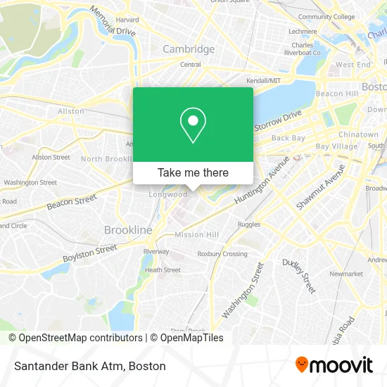
See Santander Bank Atm, Boston, on the map
Public Transit to Santander Bank Atm in Boston
Wondering how to get to Santander Bank Atm in Boston? Moovit helps you find the best way to get to Santander Bank Atm with step-by-step directions from the nearest public transit station.
Moovit provides free maps and live directions to help you navigate through your city. View schedules, routes, timetables, and find out how long does it take to get to Santander Bank Atm in real time.
Looking for the nearest stop or station to Santander Bank Atm? Check out this list of stops closest to your destination: Longwood Ave @ Binney St; Brookline Ave @ Boylston St; Brigham Circle; Kilmarnock St @ Peterborough St; Brookline Ave @ Longwood Ave; Fenway; Ave Louis Pasteur @ the Fenway; Saint Marys Street; Ave Louis Pasteur @ Longwood Ave.
Bus: 19, 39, 47, 8, 85, CT3, 60, 65, 9, 55.Train: FRAMINGHAM/WORCESTER.Subway: GREEN LINE D, GREEN LINE E, ORANGE LINE, GREEN LINE C.
Want to see if there’s another route that gets you there at an earlier time? Moovit helps you find alternative routes or times. Get directions from and directions to Santander Bank Atm easily from the Moovit App or Website.
We make riding to Santander Bank Atm easy, which is why over 1.7 million users, including users in Boston, trust Moovit as the best app for public transit. You don’t need to download an individual bus app or train app, Moovit is your all-in-one transit app that helps you find the best bus time or train time available.
For information on prices of bus, subway and train, costs and ride fares to Santander Bank Atm, please check the Moovit app.
Use the app to navigate to popular places including to the airport, hospital, stadium, grocery store, mall, coffee shop, school, college, and university.
Santander Bank Atm Address: 1420 Massachusetts Ave street in Boston
- Emmanuel College,
- Merck,
- 400 Fenway,
- Emmanuel College MA USA,
- Merck Research Laboratories,
- Merck & Co.,
- Beth Israel Hospital,
- Shapiro Clinical Center,
- Preeti S Shastri, MD,
- COVID-19 Testing Site: Beth Israel Deaconess Medical Center,
- Roberto Clemente Field (Roberto Clemente Park),
- Simmons College,
- Gryzmish Wing,
- Munish Gupta, Md, Mmsc,
- Camilia R. Martin, Md,
- Shattuck International House,
- Emmanuel college auditorium,
- Park Science Center, Simmons College,
- Beth Israel Deaconess Medical Center,
- BWH
Places Near Santander Bank Atm (Boston)
- Wang Theater, Boston,
- Massachusetts General Hospital, Boston,
- Cheers, Boston,
- Td Garden, Boston,
- Boston Medical Center, Boston,
- Quincy Market, Boston,
- North End, Boston,
- Seaport District, Boston,
- Faneuil Hall, Boston,
- Isabella Stewart Gardner Museum, Boston,
- Boston Convention & Exhibition Center, Boston,
- Museum Of Science, Boston,
- Boston Common, Boston,
- Leader Bank Pavilion (Leader Bank Pavillion), Boston,
- Wilbur Theatre, Boston,
- Mgm Music Hall, Boston,
- Prudential Center, Boston,
- Castle Island, Boston,
- House Of Blues, Boston,
- Boston Children's Hospital, Boston
How to get to popular places in Boston with public transit
Get around Boston by public transit!
Traveling around Boston has never been so easy. See step by step directions as you travel to any attraction, street or major public transit station. View bus and train schedules, arrival times, service alerts and detailed routes on a map, so you know exactly how to get to anywhere in Boston.
When traveling to any destination around Boston use Moovit's Live Directions with Get Off Notifications to know exactly where and how far to walk, how long to wait for your line, and how many stops are left. Moovit will alert you when it's time to get off — no need to constantly re-check whether yours is the next stop.
Wondering how to use public transit in Boston or how to pay for public transit in Boston? Moovit public transit app can help you navigate your way with public transit easily, and at minimum cost. It includes public transit fees, ticket prices, and costs. Looking for a map of Boston public transit lines? Moovit public transit app shows all public transit maps in Boston with all Bus, Train, Subway and Ferry routes and stops on an interactive map.
Boston has 4 transit type(s), including: Bus, Train, Subway and Ferry, operated by several transit agencies, including MBTA, Southeastern Regional Transit Authority, MetroWest Regional Transit Authority, Rhode Island Public Transit Authority, WRTA, Lowell Regional Transit Authority, Merrimack Valley Transit, Montachusett Regional Transit Authority, Cape Cod Regional Transit Authority, Brockton Area Transit Authority, Martha's Vineyard Transit Authority, the WAVE - Nantucket Regional Transit Authority, GATRA, Cape Ann Transportation Authority and Massport