Directions to Santander Bank Branch (Boston) with public transportation
The following transit lines have routes that pass near Santander Bank Branch
 Bus: 1, 28, 47, CT3, SL4.
- Train: PROVIDENCE/STOUGHTON, FRANKLIN/FOXBORO, NEEDHAM, ORANGE LINE.
- Subway: ORANGE LINE, GREEN LINE E.
How to get to Santander Bank Branch by bus?
Click on the bus route to see step by step directions with maps, line arrival times and updated time schedules.
From Mount Auburn, Cambridge
54 minFrom Chevalier Theater, Medford
81 minFrom Harvard Square, Cambridge
35 minFrom Suffolk Downs, Boston
77 minFrom Georgetown, Massachusetts, Boston
66 minFrom Chevalier Theatre (Chevalier Theater Show Line), Medford
81 minFrom Granite Links Golf Club at Quarry Hills, Quincy
84 minFrom East Boston, Boston
65 minFrom Hyatt Place Medford, Medford
53 minFrom Revere, MA, Revere
76 min
How to get to Santander Bank Branch by train?
Click on the train route to see step by step directions with maps, line arrival times and updated time schedules.
How to get to Santander Bank Branch by subway?
Click on the subway route to see step by step directions with maps, line arrival times and updated time schedules.
Bus stops near Santander Bank Branch in Boston
Train station near Santander Bank Branch in Boston
- Ruggles, 12 min walk,VIEW
Subway station near Santander Bank Branch in Boston
- Museum Of Fine Arts, 20 min walk,VIEW
Bus lines to Santander Bank Branch in Boston
- 1, Nubian - Harvard,VIEW
- 8, Kenmore via South Bay Center - Harbor Point via South Bay Center,VIEW
- 15, Ruggles - Fields Corner,VIEW
- 19, Kenmore - Fields Corner,VIEW
- 47, Broadway - Central Square,VIEW
- 171, - Logan Airport via Andrew,VIEW
- 14, Heath St - Roslindale Square,VIEW
- 23, Ruggles - Ashmont,VIEW
- 28, Ruggles - Mattapan,VIEW
- 41, JFK/UMass - Centre St & Eliot St,VIEW
- 42, Nubian - Forest Hills,VIEW
- 44, Ruggles - Jackson Square,VIEW
- 45, Ruggles - Franklin Park,VIEW
- 66, Nubian via Allston - Harvard via Allston,VIEW
- SL4, South Station - Nubian,VIEW
- SL5, Downtown - Nubian,VIEW
- CT3, Avenue Louis Pasteur (Limited Stops),VIEW
- 9, City Point,VIEW
What are the closest stations to Santander Bank Branch?
The closest stations to Santander Bank Branch are:
- Washington St Opp Ruggles St is 126 yards away, 2 min walk.
- Nubian is 174 yards away, 3 min walk.
- Melnea Cass Blvd @ Washington St is 342 yards away, 5 min walk.
- Melnea Cass Blvd @ Harrison Ave is 414 yards away, 5 min walk.
- Ruggles is 967 yards away, 12 min walk.
- Museum Of Fine Arts is 1634 yards away, 20 min walk.
Which bus lines stop near Santander Bank Branch?
These bus lines stop near Santander Bank Branch: 1, 28, 47, CT3, SL4, SL5.
Which train line stops near Santander Bank Branch?
PROVIDENCE/STOUGHTON (#824 | South Station)
Which subway line stops near Santander Bank Branch?
ORANGE LINE (Forest Hills)
What’s the nearest subway station to Santander Bank Branch in Boston?
The nearest subway station to Santander Bank Branch in Boston is Museum Of Fine Arts. It’s a 20 min walk away.
What’s the nearest train station to Santander Bank Branch in Boston?
The nearest train station to Santander Bank Branch in Boston is Ruggles. It’s a 12 min walk away.
What’s the nearest bus station to Santander Bank Branch in Boston?
The nearest bus station to Santander Bank Branch in Boston is Washington St Opp Ruggles St. It’s a 2 min walk away.
What time is the first subway to Santander Bank Branch in Boston?
The GREEN LINE E is the first subway that goes to Santander Bank Branch in Boston. It stops nearby at 5:20 AM.
What time is the last subway to Santander Bank Branch in Boston?
The GREEN LINE E is the last subway that goes to Santander Bank Branch in Boston. It stops nearby at 2:07 AM.
What time is the first train to Santander Bank Branch in Boston?
The PROVIDENCE/STOUGHTON is the first train that goes to Santander Bank Branch in Boston. It stops nearby at 4:28 AM.
What time is the last train to Santander Bank Branch in Boston?
The PROVIDENCE/STOUGHTON is the last train that goes to Santander Bank Branch in Boston. It stops nearby at 12:34 AM.
What time is the first bus to Santander Bank Branch in Boston?
The 28 is the first bus that goes to Santander Bank Branch in Boston. It stops nearby at 3:20 AM.
What time is the last bus to Santander Bank Branch in Boston?
The 1 is the last bus that goes to Santander Bank Branch in Boston. It stops nearby at 2:44 AM.
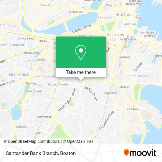
See Santander Bank Branch, Boston, on the map
Public Transit to Santander Bank Branch in Boston
Wondering how to get to Santander Bank Branch in Boston? Moovit helps you find the best way to get to Santander Bank Branch with step-by-step directions from the nearest public transit station.
Moovit provides free maps and live directions to help you navigate through your city. View schedules, routes, timetables, and find out how long does it take to get to Santander Bank Branch in real time.
Looking for the nearest stop or station to Santander Bank Branch? Check out this list of stops closest to your destination: Washington St Opp Ruggles St; Nubian; Melnea Cass Blvd @ Washington St; Melnea Cass Blvd @ Harrison Ave; Ruggles; Museum Of Fine Arts.
Bus: 1, 28, 47, CT3, SL4, SL5, 8, 15, 19, 14, 23, 41, 42, 9.Train: PROVIDENCE/STOUGHTON, FRANKLIN/FOXBORO, NEEDHAM, ORANGE LINE.Subway: ORANGE LINE, GREEN LINE E.
Want to see if there’s another route that gets you there at an earlier time? Moovit helps you find alternative routes or times. Get directions from and directions to Santander Bank Branch easily from the Moovit App or Website.
We make riding to Santander Bank Branch easy, which is why over 1.7 million users, including users in Boston, trust Moovit as the best app for public transit. You don’t need to download an individual bus app or train app, Moovit is your all-in-one transit app that helps you find the best bus time or train time available.
For information on prices of bus, subway and train, costs and ride fares to Santander Bank Branch, please check the Moovit app.
Use the app to navigate to popular places including to the airport, hospital, stadium, grocery store, mall, coffee shop, school, college, and university.
Santander Bank Branch Address: 2189 Washington St street in Boston
- 2201 Washington Street,
- Ashley Stewart -- Dudley Square,
- Umbrella Marketing Group,
- Massachusetts Committee,
- Roxbury Defenders Unit,
- Center for Working Families, City of Boston,
- Dudley Halal Market,
- Yamacu Cafe (Community Tables at Haley House Bakery Cafe),
- Cobalt's Kingdom,
- Dahlak Restaurant,
- Jackiss Gifts,
- Innovation Studio,
- Bruce C. Bolling Municipal Building,
- English High School,
- Performers the Act 1,
- Central Boston Elder Services (Central Boston Elderly Supportive Housing),
- Brand Nubian,
- MBTA Dudley Square Station,
- Repair Shops,
- Morgan Memorial Cafeteria
Places Near Santander Bank Branch (Boston)
- Wang Theater, Boston,
- Isabella Stewart Gardner Museum, Boston,
- Leader Bank Pavilion (Leader Bank Pavillion), Boston,
- North End, Boston,
- Castle Island, Boston,
- Quincy Market, Boston,
- Boston Common, Boston,
- Boston Children's Hospital, Boston,
- Prudential Center, Boston,
- Faneuil Hall, Boston,
- Seaport District, Boston,
- House Of Blues, Boston,
- Boston Medical Center, Boston,
- Museum Of Science, Boston,
- Cheers, Boston,
- Mgm Music Hall, Boston,
- Boston Convention & Exhibition Center, Boston,
- Wilbur Theatre, Boston,
- Td Garden, Boston,
- Massachusetts General Hospital, Boston
How to get to popular places in Boston with public transit
Get around Boston by public transit!
Traveling around Boston has never been so easy. See step by step directions as you travel to any attraction, street or major public transit station. View bus and train schedules, arrival times, service alerts and detailed routes on a map, so you know exactly how to get to anywhere in Boston.
When traveling to any destination around Boston use Moovit's Live Directions with Get Off Notifications to know exactly where and how far to walk, how long to wait for your line, and how many stops are left. Moovit will alert you when it's time to get off — no need to constantly re-check whether yours is the next stop.
Wondering how to use public transit in Boston or how to pay for public transit in Boston? Moovit public transit app can help you navigate your way with public transit easily, and at minimum cost. It includes public transit fees, ticket prices, and costs. Looking for a map of Boston public transit lines? Moovit public transit app shows all public transit maps in Boston with all Bus, Train, Subway and Ferry routes and stops on an interactive map.
Boston has 4 transit type(s), including: Bus, Train, Subway and Ferry, operated by several transit agencies, including MBTA, Southeastern Regional Transit Authority, MetroWest Regional Transit Authority, Rhode Island Public Transit Authority, WRTA, Lowell Regional Transit Authority, Merrimack Valley Transit, Montachusett Regional Transit Authority, Cape Cod Regional Transit Authority, Brockton Area Transit Authority, Martha's Vineyard Transit Authority, the WAVE - Nantucket Regional Transit Authority, GATRA, Cape Ann Transportation Authority and Massport