Directions to Saugus ITAM with public transportation
The following transit lines have routes that pass near Saugus ITAM
 Bus: 116, 426, 430, 450, 455.
- Train: NEWBURYPORT/ROCKPORT.
- Subway: BLUE LINE.
- Ferry: LYNN FERRY.
How to get to Saugus ITAM by bus?
Click on the bus route to see step by step directions with maps, line arrival times and updated time schedules.
From East Boston
87 minFrom Winthrop
123 minFrom Wakefield, MA
91 minFrom Residence Inn by Marriott Boston Harbor on Tudor Wharf
86 minFrom Bunker Hill Community College
70 minFrom Deer Island
129 minFrom Battery Wharf Hotel
79 minFrom Piers Park
61 minFrom Chevalier Theater
70 minFrom Wellington Station
50 min
How to get to Saugus ITAM by train?
Click on the train route to see step by step directions with maps, line arrival times and updated time schedules.
Bus stops near Saugus ITAM
Train station near Saugus ITAM
- River Works, 41 min walk,VIEW
Ferry station near Saugus ITAM
- Blossom Street Pier, 56 min walk,VIEW
Subway station near Saugus ITAM
- Wonderland, 62 min walk,VIEW
Bus lines to Saugus ITAM
What are the closest stations to Saugus ITAM?
The closest stations to Saugus ITAM are:
- Lincoln Ave @ Bristow St is 690 yards away, 9 min walk.
- Salem Tnpk @ Ballard St is 1312 yards away, 16 min walk.
- River Works is 3518 yards away, 41 min walk.
- Blossom Street Pier is 4744 yards away, 56 min walk.
- Wonderland is 5303 yards away, 62 min walk.
Which bus lines stop near Saugus ITAM?
These bus lines stop near Saugus ITAM: 116, 426, 430, 450, 455.
Which train line stops near Saugus ITAM?
NEWBURYPORT/ROCKPORT (#111 | Rockport)
What’s the nearest bus station to Saugus ITAM?
The nearest bus station to Saugus ITAM is Lincoln Ave @ Bristow St. It’s a 9 min walk away.
What time is the first subway to Saugus ITAM?
The BLUE LINE is the first subway that goes to Saugus ITAM. It stops nearby at 5:24 AM.
What time is the last subway to Saugus ITAM?
The BLUE LINE is the last subway that goes to Saugus ITAM. It stops nearby at 1:12 AM.
What time is the first train to Saugus ITAM?
The NEWBURYPORT/ROCKPORT is the first train that goes to Saugus ITAM. It stops nearby at 5:33 AM.
What time is the last train to Saugus ITAM?
The NEWBURYPORT/ROCKPORT is the last train that goes to Saugus ITAM. It stops nearby at 12:08 AM.
What time is the first bus to Saugus ITAM?
The 116 is the first bus that goes to Saugus ITAM. It stops nearby at 4:21 AM.
What time is the last bus to Saugus ITAM?
The 426 is the last bus that goes to Saugus ITAM. It stops nearby at 1:27 AM.
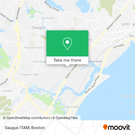
See Saugus ITAM on the map
Public Transportation to Saugus ITAM
Wondering how to get to Saugus ITAM? Moovit helps you find the best way to get to Saugus ITAM with step-by-step directions from the nearest public transit station.
Moovit provides free maps and live directions to help you navigate through your city. View schedules, routes, timetables, and find out how long does it take to get to Saugus ITAM in real time.
Looking for the nearest stop or station to Saugus ITAM? Check out this list of stops closest to your destination: Lincoln Ave @ Bristow St; Salem Tnpk @ Ballard St; River Works; Blossom Street Pier; Wonderland.
Bus: 116, 426, 430, 450, 455, 428, 424.Train: NEWBURYPORT/ROCKPORT.Subway: BLUE LINE.Ferry: LYNN FERRY.
Want to see if there’s another route that gets you there at an earlier time? Moovit helps you find alternative routes or times. Get directions from and directions to Saugus ITAM easily from the Moovit App or Website.
We make riding to Saugus ITAM easy, which is why over 1.7 million users, including users in Saugus, trust Moovit as the best app for public transit. You don’t need to download an individual bus app or train app, Moovit is your all-in-one transit app that helps you find the best bus time or train time available.
For information on prices of bus, subway and train, costs and ride fares to Saugus ITAM, please check the Moovit app.
Use the app to navigate to popular places including to the airport, hospital, stadium, grocery store, mall, coffee shop, school, college, and university.
Location: Saugus, Boston
- Ea Building and Remodeling,
- Remark Deal,
- Paniago & Son General Construction Services,
- Dustin St,
- Cogliano Plaza,
- Work'n Gear,
- Razors Edge Barbershop,
- Joe Beer and Wine,
- Family Place Roast Beef And Pizza,
- DSS-Thermo King,
- Vincenzo Giovinco & Son Ceramic Tile & Installation,
- Elite Realty Investments,
- Saugus River,
- Kids Cuts and Fun,
- A St,
- F Malatesta Sons Wheel FD Service,
- 128 Plumbing Heating and Cooling,
- MBTA 426 / 426W to Haymarket / Wonderland,
- Junkar Ninja,
- Baker Hill
Places Near Saugus ITAM
- Td Garden, Boston,
- Wilbur Theatre, Boston,
- Seaport District, Boston,
- Faneuil Hall, Boston,
- Wang Theater, Boston,
- Leader Bank Pavilion (Leader Bank Pavillion), Boston,
- Boston Medical Center, Boston,
- Castle Island, Boston,
- North End, Boston,
- Boston Convention & Exhibition Center, Boston,
- Mgm Music Hall, Boston,
- Isabella Stewart Gardner Museum, Boston,
- Boston Common, Boston,
- Quincy Market, Boston,
- Prudential Center, Boston,
- House Of Blues, Boston,
- Boston Children's Hospital, Boston,
- Massachusetts General Hospital, Boston,
- Museum Of Science, Boston,
- Cheers, Boston
How to get to popular places in Boston with public transit
Get around Saugus by public transit!
Traveling around Saugus has never been so easy. See step by step directions as you travel to any attraction, street or major public transit station. View bus and train schedules, arrival times, service alerts and detailed routes on a map, so you know exactly how to get to anywhere in Saugus.
When traveling to any destination around Saugus use Moovit's Live Directions with Get Off Notifications to know exactly where and how far to walk, how long to wait for your line, and how many stops are left. Moovit will alert you when it's time to get off — no need to constantly re-check whether yours is the next stop.
Wondering how to use public transit in Saugus or how to pay for public transit in Saugus? Moovit public transit app can help you navigate your way with public transit easily, and at minimum cost. It includes public transit fees, ticket prices, and costs. Looking for a map of Saugus public transit lines? Moovit public transit app shows all public transit maps in Saugus with all Bus, Train, Subway and Ferry routes and stops on an interactive map.
Boston has 4 transit type(s), including: Bus, Train, Subway and Ferry, operated by several transit agencies, including MBTA, Southeastern Regional Transit Authority, MetroWest Regional Transit Authority, Rhode Island Public Transit Authority, WRTA, Lowell Regional Transit Authority, Merrimack Valley Transit, Montachusett Regional Transit Authority, Cape Cod Regional Transit Authority, Brockton Area Transit Authority, Martha's Vineyard Transit Authority, the WAVE - Nantucket Regional Transit Authority, GATRA, Cape Ann Transportation Authority and Massport