Directions to Say Coffee Co (Boston) with public transportation
The following transit lines have routes that pass near Say Coffee Co
 Bus: 47, 60, 8, 85, 9.
- Train: FRAMINGHAM/WORCESTER.
- Subway: GREEN LINE D, GREEN LINE C, GREEN LINE B.
How to get to Say Coffee Co by bus?
Click on the bus route to see step by step directions with maps, line arrival times and updated time schedules.
From Suffolk Downs, Boston
83 minFrom Apple Cinemas, Cambridge
61 minFrom Doubletree-Boston Bayside, Boston
54 minFrom MBTA Suffolk Downs Station, Boston
86 minFrom Canobie Lake Park, Chelsea
67 minFrom Terrace Room, Paige Hall, Medford
66 minFrom Conte Forum, Boston
46 minFrom Hampton Inn Boston Logan Airport, Revere
69 minFrom Milton, MA, Milton
83 min
How to get to Say Coffee Co by train?
Click on the train route to see step by step directions with maps, line arrival times and updated time schedules.
How to get to Say Coffee Co by subway?
Click on the subway route to see step by step directions with maps, line arrival times and updated time schedules.
From Suffolk Downs, Boston
54 minFrom Apple Cinemas, Cambridge
56 minFrom Doubletree-Boston Bayside, Boston
44 minFrom MBTA Suffolk Downs Station, Boston
42 minFrom Terrace Room, Paige Hall, Medford
52 minFrom Conte Forum, Boston
36 minFrom Hampton Inn Boston Logan Airport, Revere
64 minFrom Milton, MA, Milton
88 min
Train station near Say Coffee Co in Boston
- Lansdowne, 4 min walk,VIEW
Bus stops near Say Coffee Co in Boston
- 132 Brookline Ave Opp Fullerton St, 4 min walk,VIEW
- Brookline Ave @ Pilgrim Rd / Fenway Campus, 6 min walk,VIEW
- Kilmarnock St @ Peterborough St, 6 min walk,VIEW
- Saint Mary's Street - Beacon St @ Saint Mary's St, 7 min walk,VIEW
- Park Dr @ Fenway Station SB, 8 min walk,VIEW
- Park Dr @ Fenway Station NB, 8 min walk,VIEW
Subway stations near Say Coffee Co in Boston
Bus lines to Say Coffee Co in Boston
- 8, Kenmore via South Bay Center - Harbor Point via South Bay Center,VIEW
- 9, Copley - City Point,VIEW
- 19, Kenmore - Fields Corner,VIEW
- 60, Kenmore - Chestnut Hill Mall,VIEW
- 65, Kenmore - Brighton Center,VIEW
- 47, Broadway,VIEW
- 85, Ruggles,VIEW
- 55, West Fenway,VIEW
- GREEN LINE C SHUTTLE, Cleveland Circle - Saint Mary's Street,VIEW
- GREEN LINE C SHUTTLE, Saint Mary's Street - Back Bay,VIEW
- GREEN LINE C SHUTTLE, Saint Mary's Street - Kenmore,VIEW
- GREEN LINE D SHUTTLE, Riverside - Kenmore via Saint Mary's Street,VIEW
- GREEN LINE D SHUTTLE, Newton Highlands - Kenmore via Saint Mary's Street,VIEW
- GREEN LINE D SHUTTLE, Riverside - Kenmore (Shuttle),VIEW
- GREEN LINE D SHUTTLE, Reservoir - Fenway,VIEW
- GREEN LINE D SHUTTLE, Reservoir - Kenmore,VIEW
- GREEN LINE D SHUTTLE, Newton Highlands - Kenmore,VIEW
- GREEN LINE D SHUTTLE, Riverside - Fenway,VIEW
- GREEN LINE D SHUTTLE, Newton Highlands - Fenway,VIEW
- GREEN LINE D SHUTTLE, Brookline Hills - Kenmore,VIEW
What are the closest stations to Say Coffee Co?
The closest stations to Say Coffee Co are:
- Lansdowne is 267 yards away, 4 min walk.
- 132 Brookline Ave Opp Fullerton St is 306 yards away, 4 min walk.
- Brookline Ave @ Pilgrim Rd / Fenway Campus is 411 yards away, 6 min walk.
- Kilmarnock St @ Peterborough St is 493 yards away, 6 min walk.
- Saint Mary's Street - Beacon St @ Saint Mary's St is 519 yards away, 7 min walk.
- Chapel St, Colchester St is 565 yards away, 7 min walk.
- Park Dr @ Fenway Station SB is 595 yards away, 8 min walk.
- Park Dr @ Fenway Station NB is 597 yards away, 8 min walk.
- Saint Marys Street is 915 yards away, 12 min walk.
- Blandford Street is 2136 yards away, 25 min walk.
Which bus lines stop near Say Coffee Co?
These bus lines stop near Say Coffee Co: 47, 60, 8, 85.
Which train line stops near Say Coffee Co?
FRAMINGHAM/WORCESTER (#525 | Worcester)
Which subway line stops near Say Coffee Co?
GREEN LINE D (Riverside)
What’s the nearest subway station to Say Coffee Co in Boston?
The nearest subway station to Say Coffee Co in Boston is Chapel St, Colchester St. It’s a 7 min walk away.
What’s the nearest train station to Say Coffee Co in Boston?
The nearest train station to Say Coffee Co in Boston is Lansdowne. It’s a 4 min walk away.
What’s the nearest bus station to Say Coffee Co in Boston?
The nearest bus station to Say Coffee Co in Boston is 132 Brookline Ave Opp Fullerton St. It’s a 4 min walk away.
What time is the first subway to Say Coffee Co in Boston?
The GREEN LINE D is the first subway that goes to Say Coffee Co in Boston. It stops nearby at 4:55 AM.
What time is the last subway to Say Coffee Co in Boston?
The GREEN LINE D is the last subway that goes to Say Coffee Co in Boston. It stops nearby at 2:22 AM.
What time is the first train to Say Coffee Co in Boston?
The FRAMINGHAM/WORCESTER is the first train that goes to Say Coffee Co in Boston. It stops nearby at 4:55 AM.
What time is the last train to Say Coffee Co in Boston?
The FRAMINGHAM/WORCESTER is the last train that goes to Say Coffee Co in Boston. It stops nearby at 12:06 AM.
What time is the first bus to Say Coffee Co in Boston?
The 60 is the first bus that goes to Say Coffee Co in Boston. It stops nearby at 5:22 AM.
What time is the last bus to Say Coffee Co in Boston?
The 47 is the last bus that goes to Say Coffee Co in Boston. It stops nearby at 1:09 AM.
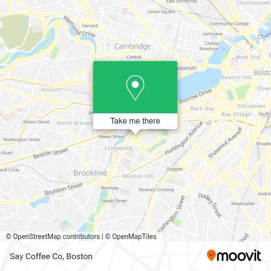
See Say Coffee Co, Boston, on the map
Public Transit to Say Coffee Co in Boston
Wondering how to get to Say Coffee Co in Boston? Moovit helps you find the best way to get to Say Coffee Co with step-by-step directions from the nearest public transit station.
Moovit provides free maps and live directions to help you navigate through your city. View schedules, routes, timetables, and find out how long does it take to get to Say Coffee Co in real time.
Looking for the nearest stop or station to Say Coffee Co? Check out this list of stops closest to your destination: Lansdowne; 132 Brookline Ave Opp Fullerton St; Brookline Ave @ Pilgrim Rd / Fenway Campus; Kilmarnock St @ Peterborough St; Saint Mary's Street - Beacon St @ Saint Mary's St; Chapel St; Park Dr @ Fenway Station SB; Park Dr @ Fenway Station NB; Saint Marys Street; Blandford Street.
Bus: 47, 60, 8, 85, 9, 19, 65.Train: FRAMINGHAM/WORCESTER.Subway: GREEN LINE D, GREEN LINE C, GREEN LINE B.
Want to see if there’s another route that gets you there at an earlier time? Moovit helps you find alternative routes or times. Get directions from and directions to Say Coffee Co easily from the Moovit App or Website.
We make riding to Say Coffee Co easy, which is why over 1.7 million users, including users in Boston, trust Moovit as the best app for public transit. You don’t need to download an individual bus app or train app, Moovit is your all-in-one transit app that helps you find the best bus time or train time available.
For information on prices of subway, bus and train, costs and ride fares to Say Coffee Co, please check the Moovit app.
Use the app to navigate to popular places including to the airport, hospital, stadium, grocery store, mall, coffee shop, school, college, and university.
Say Coffee Co Address: 401 Park Dr street in Boston
- BED BATH & BEYOND - Fenway Park,
- The Green,
- MBTA-Fenway (Park Dr @ Fenway Station),
- Pulse,
- Trillium Fenway,
- Whoop,
- Harvard,
- 401 Park,
- Saltie Girl,
- 401 Park Dr / P1-2,
- 200 Brookline,
- Landmark Center,
- Sonder at Pierce Boston ,
- Rei,
- Landmark Center (Landmark Square Apartments),
- Fenway Triangle Trilogy Garage,
- 5 Wits,
- Pierce Boston,
- Emmanuel college auditorium,
- Cb2
Places Near Say Coffee Co (Boston)
- Castle Island, Boston,
- Faneuil Hall, Boston,
- Boston Common, Boston,
- Cheers, Boston,
- Boston Convention & Exhibition Center, Boston,
- House Of Blues, Boston,
- Boston Children's Hospital, Boston,
- Wilbur Theatre, Boston,
- Massachusetts General Hospital, Boston,
- Leader Bank Pavilion (Leader Bank Pavillion), Boston,
- Boston Medical Center, Boston,
- Quincy Market, Boston,
- Isabella Stewart Gardner Museum, Boston,
- Prudential Center, Boston,
- Td Garden, Boston,
- North End, Boston,
- Seaport District, Boston,
- Wang Theater, Boston,
- Museum Of Science, Boston,
- Mgm Music Hall, Boston
How to get to popular places in Boston with public transit
Get around Boston by public transit!
Traveling around Boston has never been so easy. See step by step directions as you travel to any attraction, street or major public transit station. View bus and train schedules, arrival times, service alerts and detailed routes on a map, so you know exactly how to get to anywhere in Boston.
When traveling to any destination around Boston use Moovit's Live Directions with Get Off Notifications to know exactly where and how far to walk, how long to wait for your line, and how many stops are left. Moovit will alert you when it's time to get off — no need to constantly re-check whether yours is the next stop.
Wondering how to use public transit in Boston or how to pay for public transit in Boston? Moovit public transit app can help you navigate your way with public transit easily, and at minimum cost. It includes public transit fees, ticket prices, and costs. Looking for a map of Boston public transit lines? Moovit public transit app shows all public transit maps in Boston with all Bus, Train, Subway and Ferry routes and stops on an interactive map.
Boston has 4 transit type(s), including: Bus, Train, Subway and Ferry, operated by several transit agencies, including MBTA, Southeastern Regional Transit Authority, MetroWest Regional Transit Authority, Rhode Island Public Transit Authority, WRTA, Lowell Regional Transit Authority, Merrimack Valley Transit, Montachusett Regional Transit Authority, Cape Cod Regional Transit Authority, Brockton Area Transit Authority, Martha's Vineyard Transit Authority, the WAVE - Nantucket Regional Transit Authority, GATRA, Cape Ann Transportation Authority and Massport