Directions to Science Club For Girls (Cambridge) with public transportation
The following transit lines have routes that pass near Science Club For Girls
 Bus: 64, 68, 85, EZRIDE.
- Train: FAIRMOUNT, HAVERHILL, LOWELL, NEEDHAM.
- Subway: RED LINE, GREEN LINE D, GREEN LINE E, GREEN LINE B, GREEN LINE C.
How to get to Science Club For Girls by bus?
Click on the bus route to see step by step directions with maps, line arrival times and updated time schedules.
From Lower Mills, Boston
94 minFrom West Roxbury, Boston
76 minFrom Franklin Park Zoo, Boston
72 minFrom Winchester, MA, Winchester
75 minFrom Medford Square, Medford
53 minFrom Uscis Biometrics Office, Revere
72 minFrom Best Western Adams Inn Quincy - Boston, Quincy
95 minFrom Melrose, MA, Melrose
84 minFrom Home2 Suites-Boston South Bay (Home2 Stes by Hilton Boston S Bay), Boston
70 minFrom Brighton, Boston
38 min
How to get to Science Club For Girls by train?
Click on the train route to see step by step directions with maps, line arrival times and updated time schedules.
How to get to Science Club For Girls by subway?
Click on the subway route to see step by step directions with maps, line arrival times and updated time schedules.
From Lower Mills, Boston
54 minFrom Franklin Park Zoo, Boston
61 minFrom Medford Square, Medford
67 minFrom Uscis Biometrics Office, Revere
58 minFrom Best Western Adams Inn Quincy - Boston, Quincy
52 minFrom Home2 Suites-Boston South Bay (Home2 Stes by Hilton Boston S Bay), Boston
37 minFrom Brighton, Boston
73 min
Bus stops near Science Club For Girls in Cambridge
Subway stations near Science Club For Girls in Cambridge
Bus lines to Science Club For Girls in Cambridge
What are the closest stations to Science Club For Girls?
The closest stations to Science Club For Girls are:
- Albany St./Main St. is 203 yards away, 3 min walk.
- Broadway @ Columbia St is 319 yards away, 4 min walk.
- Hampshire St @ Cardinal Medeiros Ave is 355 yards away, 5 min walk.
- Galileo Way @ Main St is 499 yards away, 6 min walk.
- Kendall/MIT is 1114 yards away, 14 min walk.
- Union Square is 1418 yards away, 17 min walk.
- Lechmere is 1598 yards away, 19 min walk.
Which bus lines stop near Science Club For Girls?
These bus lines stop near Science Club For Girls: 64, 68, 85, EZRIDE.
Which train lines stop near Science Club For Girls?
These train lines stop near Science Club For Girls: FAIRMOUNT, HAVERHILL, LOWELL, NEEDHAM.
Which subway line stops near Science Club For Girls?
RED LINE (Alewife)
What’s the nearest subway station to Science Club For Girls in Cambridge?
The nearest subway station to Science Club For Girls in Cambridge is Kendall/MIT. It’s a 14 min walk away.
What’s the nearest bus station to Science Club For Girls in Cambridge?
The nearest bus station to Science Club For Girls in Cambridge is Albany St./Main St.. It’s a 3 min walk away.
What time is the first subway to Science Club For Girls in Cambridge?
The GREEN LINE E is the first subway that goes to Science Club For Girls in Cambridge. It stops nearby at 4:49 AM.
What time is the last subway to Science Club For Girls in Cambridge?
The GREEN LINE E is the last subway that goes to Science Club For Girls in Cambridge. It stops nearby at 2:34 AM.
What time is the first bus to Science Club For Girls in Cambridge?
The 64 is the first bus that goes to Science Club For Girls in Cambridge. It stops nearby at 5:27 AM.
What time is the last bus to Science Club For Girls in Cambridge?
The 64 is the last bus that goes to Science Club For Girls in Cambridge. It stops nearby at 1:07 AM.
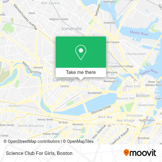
See Science Club For Girls, Cambridge, on the map
Public Transit to Science Club For Girls in Cambridge
Wondering how to get to Science Club For Girls in Cambridge? Moovit helps you find the best way to get to Science Club For Girls with step-by-step directions from the nearest public transit station.
Moovit provides free maps and live directions to help you navigate through your city. View schedules, routes, timetables, and find out how long does it take to get to Science Club For Girls in real time.
Looking for the nearest stop or station to Science Club For Girls? Check out this list of stops closest to your destination: Albany St./Main St.; Broadway @ Columbia St; Hampshire St @ Cardinal Medeiros Ave; Galileo Way @ Main St; Kendall/MIT; Union Square; Lechmere.
Bus: 64, 68, 85, EZRIDE.Train: FAIRMOUNT, HAVERHILL, LOWELL, NEEDHAM.Subway: RED LINE, GREEN LINE D, GREEN LINE E, GREEN LINE B, GREEN LINE C.
Want to see if there’s another route that gets you there at an earlier time? Moovit helps you find alternative routes or times. Get directions from and directions to Science Club For Girls easily from the Moovit App or Website.
We make riding to Science Club For Girls easy, which is why over 1.7 million users, including users in Cambridge, trust Moovit as the best app for public transit. You don’t need to download an individual bus app or train app, Moovit is your all-in-one transit app that helps you find the best bus time or train time available.
For information on prices of bus, subway and train, costs and ride fares to Science Club For Girls, please check the Moovit app.
Use the app to navigate to popular places including to the airport, hospital, stadium, grocery store, mall, coffee shop, school, college, and university.
Science Club For Girls Address: 210 Broadway street in Cambridge
- Port Landing,
- Akamai Technologies,
- The Garment District,
- MERL,
- Radius Health,
- MITSUBISHI Electric Research Laboratories - Merl,
- Glaxosmithkline / Astrazeneca,
- The TARDIS,
- Dante Alighieri Italian Cultural Center,
- Pisani Center,
- Spit Meter the Reckoning,
- Hampshire St @ Cardinal Medeiros Ave (Hampshire St @ Portland St),
- 100,
- Kendall Square,
- RB Farina Roofing & Gutters,
- Abcam,
- Jas Consolidation,
- Windsor Street Dental Clinic,
- Mamaleh's Delicatessen (Memaleh's Delicatessen Restaurant),
- Rubius Therapeutics (Relay Therapeutics)
Places Near Science Club For Girls (Cambridge)
- Td Garden, Boston,
- Castle Island, Boston,
- Wilbur Theatre, Boston,
- Prudential Center, Boston,
- North End, Boston,
- Faneuil Hall, Boston,
- Massachusetts General Hospital, Boston,
- Seaport District, Boston,
- Boston Medical Center, Boston,
- House Of Blues, Boston,
- Boston Common, Boston,
- Boston Convention & Exhibition Center, Boston,
- Museum Of Science, Boston,
- Cheers, Boston,
- Boston Children's Hospital, Boston,
- Mgm Music Hall, Boston,
- Quincy Market, Boston,
- Isabella Stewart Gardner Museum, Boston,
- Wang Theater, Boston,
- Leader Bank Pavilion (Leader Bank Pavillion), Boston
How to get to popular places in Boston with public transit
Get around Cambridge by public transit!
Traveling around Cambridge has never been so easy. See step by step directions as you travel to any attraction, street or major public transit station. View bus and train schedules, arrival times, service alerts and detailed routes on a map, so you know exactly how to get to anywhere in Cambridge.
When traveling to any destination around Cambridge use Moovit's Live Directions with Get Off Notifications to know exactly where and how far to walk, how long to wait for your line, and how many stops are left. Moovit will alert you when it's time to get off — no need to constantly re-check whether yours is the next stop.
Wondering how to use public transit in Cambridge or how to pay for public transit in Cambridge? Moovit public transit app can help you navigate your way with public transit easily, and at minimum cost. It includes public transit fees, ticket prices, and costs. Looking for a map of Cambridge public transit lines? Moovit public transit app shows all public transit maps in Cambridge with all Bus, Train, Subway and Ferry routes and stops on an interactive map.
Boston has 4 transit type(s), including: Bus, Train, Subway and Ferry, operated by several transit agencies, including MBTA, Southeastern Regional Transit Authority, MetroWest Regional Transit Authority, Rhode Island Public Transit Authority, WRTA, Lowell Regional Transit Authority, Merrimack Valley Transit, Montachusett Regional Transit Authority, Cape Cod Regional Transit Authority, Brockton Area Transit Authority, Martha's Vineyard Transit Authority, the WAVE - Nantucket Regional Transit Authority, GATRA, Cape Ann Transportation Authority and Massport