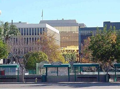
See Seccombe Lane, Los Angeles, on the map
Directions to Seccombe Lane (Los Angeles) with public transportation
The following transit lines have routes that pass near Seccombe Lane
Bus:
Train:
How to get to Seccombe Lane by Bus?
Click on the Bus route to see step by step directions with maps, line arrival times and updated time schedules.
How to get to Seccombe Lane by Train?
Click on the Train route to see step by step directions with maps, line arrival times and updated time schedules.
Bus stations near Seccombe Lane in Los Angeles
- Waterman @ Olive Nb FS,3 min walk,
- Baseline At Waterman Wb Fs,4 min walk,
- Baseline At Sepulveda,5 min walk,
Bus lines to Seccombe Lane in Los Angeles
- 1,NB Colton-Armc-Del Rosa,
- 4,CB San Bdno-Baseline-Highland,
- 3,CB San Bdno-Baseline-Highland,
What are the closest stations to Seccombe Lane?
The closest stations to Seccombe Lane are:
- Waterman @ Olive Nb FS is 224 yards away, 3 min walk.
- Baseline At Waterman Wb Fs is 271 yards away, 4 min walk.
- Baseline At Sepulveda is 336 yards away, 5 min walk.
Which Bus lines stop near Seccombe Lane?
These Bus lines stop near Seccombe Lane: 1, 3, 4
Which Train lines stop near Seccombe Lane?
These Train lines stop near Seccombe Lane: SAN BERNARDINO LINE
What’s the nearest bus stop to Seccombe Lane in Los Angeles?
The nearest bus stop to Seccombe Lane in Los Angeles is Waterman @ Olive Nb FS. It’s a 3 min walk away.
See Seccombe Lane, Los Angeles, on the map

Public Transit to Seccombe Lane in Los Angeles
Wondering how to get to Seccombe Lane in Los Angeles, United States? Moovit helps you find the best way to get to Seccombe Lane with step-by-step directions from the nearest public transit station.
Moovit provides free maps and live directions to help you navigate through your city. View schedules, routes, timetables, and find out how long does it take to get to Seccombe Lane in real time.
Looking for the nearest stop or station to Seccombe Lane? Check out this list of stops closest to your destination: Waterman @ Olive Nb FS; Baseline At Waterman Wb Fs; Baseline At Sepulveda.
Bus:Train:
Want to see if there’s another route that gets you there at an earlier time? Moovit helps you find alternative routes or times. Get directions from and directions to Seccombe Lane easily from the Moovit App or Website.
We make riding to Seccombe Lane easy, which is why over 1.5 million users, including users in Los Angeles, trust Moovit as the best app for public transit. You don’t need to download an individual bus app or train app, Moovit is your all-in-one transit app that helps you find the best bus time or train time available.
For information on prices of Bus and Train, costs and ride fares to Seccombe Lane, please check the Moovit app.
Get to Seccombe Lane with public transit and pay for the ride in the Moovit app. In addition to all info you may need for your trip to Seccombe Lane, including live directions, real-time arrivals and fare prices, you can also buy public transit passes for your rides. No need for cash or paper tickets to get to Seccombe Lane - everything you need is accessible in the app with a click of the button.
Use the app to navigate to popular places including to the airport, hospital, stadium, grocery store, mall, coffee shop, school, college, and university.
Location: Los Angeles

Attractions near Seccombe Lane
- 265 E 11th St
- Weinerschnitzel
- 255 Baseline St
- Louisiana Fried Chicken
- Der Wienerschnitzel
- 279 West Base Line Street
- Joy's Beauty Supply
- East 11th Street
- Crown Wigs & Beauty Supply
- Church's Chicken
- Speedy Cash
- 237 E Base Line St
- United Oil
- Las Islas Marias Mariscos
- We Got It! Food Mart
- Lotus Restaurant
- Cost-U-Less
- 275 East Olive Street
- 303 E Base Line St
- 300 E Olive St
How to get to popular attractions in Los Angeles with public transit
- Mickey & Friends Tram, Anaheim
- City of Los Angeles, Downtown, La
- Mitsuwa Marketplace, Costa Mesa
- IKEA, Costa Mesa
- Anaheim Marriott, Anaheim
- Pomona, CA, Pomona
- City of Irvine, Irvine
- City of Rancho Cucamonga, Rancho Cucamonga
- Corona del Mar State Beach, Newport Beach
- Sleeping Beauty Castle, Anaheim
- Main Street, U.S.A., Anaheim
- The Boiling Crab, Koreatown, La
- Paradise Pier, Anaheim
- MainPlace Mall, Santa Ana
- Harbor Pointe, Anaheim
- Anaheim GardenWalk, Anaheim
- Tito's Tacos, Culver City
- Finding Nemo Submarine Voyage, Anaheim
- Redlands, CA, Redlands
- Pacific View Mall, San Buenaventura (Ventura)