Directions to Silk Events (Boston) with public transportation
The following transit lines have routes that pass near Silk Events
 Bus: 501, 64, 86, 57, 66.
- Train: FRAMINGHAM/WORCESTER.
- Subway: GREEN LINE B, GREEN LINE D.
How to get to Silk Events by bus?
Click on the bus route to see step by step directions with maps, line arrival times and updated time schedules.
From Dana Farber Cancer Institute, Boston
66 minFrom Boston Marriott Cambridge, Cambridge
35 minFrom The Westin Waltham Boston, Waltham
79 minFrom Haymarket, Boston, Boston
67 minFrom Newton Wellesley Hospital Green Building, Newton
80 minFrom Tatte Bakery & Cafe, Boston
39 minFrom Faulkner Hospital, Boston
62 minFrom Rental Car Center - Logan Airport, Boston
51 minFrom East Boston, Boston
52 minFrom Hyatt Regency-Boston Harbor (Hyatt Harborside At Boston's Logan International Airport Hotel Boston), Boston
57 min
How to get to Silk Events by train?
Click on the train route to see step by step directions with maps, line arrival times and updated time schedules.
How to get to Silk Events by subway?
Click on the subway route to see step by step directions with maps, line arrival times and updated time schedules.
From Hyatt Regency-Boston Harbor (Hyatt Harborside At Boston's Logan International Airport Hotel Boston), Boston
88 minFrom East Boston, Boston
65 minFrom Boston Marriott Cambridge, Cambridge
63 minFrom Haymarket, Boston, Boston
70 minFrom Newton Wellesley Hospital Green Building, Newton
57 minFrom Tatte Bakery & Cafe, Boston
59 minFrom Faulkner Hospital, Boston
91 minFrom Rental Car Center - Logan Airport, Boston
67 min
Bus stops near Silk Events in Boston
Subway station near Silk Events in Boston
- Sutherland Road, 11 min walk,VIEW
Bus lines to Silk Events in Boston
What are the closest stations to Silk Events?
The closest stations to Silk Events are:
- Cambridge St @ Sparhawk St is 184 yards away, 3 min walk.
- Market St @ Gardena St is 277 yards away, 4 min walk.
- N Beacon St Opp Vineland St is 794 yards away, 10 min walk.
- Sutherland Road is 908 yards away, 11 min walk.
Which bus lines stop near Silk Events?
These bus lines stop near Silk Events: 501, 64, 86.
Which train line stops near Silk Events?
FRAMINGHAM/WORCESTER (#525 | Worcester)
Which subway lines stop near Silk Events?
These subway lines stop near Silk Events: GREEN LINE B, GREEN LINE D.
What’s the nearest subway station to Silk Events in Boston?
The nearest subway station to Silk Events in Boston is Sutherland Road. It’s a 11 min walk away.
What’s the nearest bus station to Silk Events in Boston?
The nearest bus station to Silk Events in Boston is Cambridge St @ Sparhawk St. It’s a 3 min walk away.
What time is the first subway to Silk Events in Boston?
The GREEN LINE B is the first subway that goes to Silk Events in Boston. It stops nearby at 5:08 AM.
What time is the last subway to Silk Events in Boston?
The GREEN LINE B is the last subway that goes to Silk Events in Boston. It stops nearby at 2:31 AM.
What time is the first bus to Silk Events in Boston?
The 64 is the first bus that goes to Silk Events in Boston. It stops nearby at 5:08 AM.
What time is the last bus to Silk Events in Boston?
The 57 is the last bus that goes to Silk Events in Boston. It stops nearby at 2:24 AM.
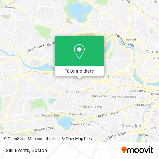
See Silk Events, Boston, on the map
Public Transit to Silk Events in Boston
Wondering how to get to Silk Events in Boston? Moovit helps you find the best way to get to Silk Events with step-by-step directions from the nearest public transit station.
Moovit provides free maps and live directions to help you navigate through your city. View schedules, routes, timetables, and find out how long does it take to get to Silk Events in real time.
Looking for the nearest stop or station to Silk Events? Check out this list of stops closest to your destination: Cambridge St @ Sparhawk St; Market St @ Gardena St; N Beacon St Opp Vineland St; Sutherland Road.
Bus: 501, 64, 86, 57, 66.Train: FRAMINGHAM/WORCESTER.Subway: GREEN LINE B, GREEN LINE D.
Want to see if there’s another route that gets you there at an earlier time? Moovit helps you find alternative routes or times. Get directions from and directions to Silk Events easily from the Moovit App or Website.
We make riding to Silk Events easy, which is why over 1.7 million users, including users in Boston, trust Moovit as the best app for public transit. You don’t need to download an individual bus app or train app, Moovit is your all-in-one transit app that helps you find the best bus time or train time available.
For information on prices of bus, subway and train, costs and ride fares to Silk Events, please check the Moovit app.
Use the app to navigate to popular places including to the airport, hospital, stadium, grocery store, mall, coffee shop, school, college, and university.
Silk Events Address: 7 Cypress Rd #702 street in Boston
- New Balance Factory Store,
- Cradles To Crayons,
- Sonia,
- Cozy Paws Care,
- William Marshall Baritone Allentown Pa,
- WGBH,
- Zonin Fitness Club,
- NB Fitness Club,
- Western Union,
- Darbar Restaurant,
- New Balance,
- Major League Lacrosse,
- Boston Orthopaedic and Spine,
- Spaulding Rehabilitation Center,
- Roadrunner,
- Auerbach Center,
- Action Boston,
- Mass General Brigham Sports Medicine at Boston Landing,
- The Pearl Boston Landing,
- The Auerbach Center
Places Near Silk Events (Boston)
- Castle Island, Boston,
- Boston Common, Boston,
- North End, Boston,
- Massachusetts General Hospital, Boston,
- Seaport District, Boston,
- Leader Bank Pavilion (Leader Bank Pavillion), Boston,
- House Of Blues, Boston,
- Isabella Stewart Gardner Museum, Boston,
- Wang Theater, Boston,
- Museum Of Science, Boston,
- Boston Children's Hospital, Boston,
- Quincy Market, Boston,
- Cheers, Boston,
- Faneuil Hall, Boston,
- Wilbur Theatre, Boston,
- Mgm Music Hall, Boston,
- Boston Convention & Exhibition Center, Boston,
- Boston Medical Center, Boston,
- Prudential Center, Boston,
- Td Garden, Boston
How to get to popular places in Boston with public transit
Get around Boston by public transit!
Traveling around Boston has never been so easy. See step by step directions as you travel to any attraction, street or major public transit station. View bus and train schedules, arrival times, service alerts and detailed routes on a map, so you know exactly how to get to anywhere in Boston.
When traveling to any destination around Boston use Moovit's Live Directions with Get Off Notifications to know exactly where and how far to walk, how long to wait for your line, and how many stops are left. Moovit will alert you when it's time to get off — no need to constantly re-check whether yours is the next stop.
Wondering how to use public transit in Boston or how to pay for public transit in Boston? Moovit public transit app can help you navigate your way with public transit easily, and at minimum cost. It includes public transit fees, ticket prices, and costs. Looking for a map of Boston public transit lines? Moovit public transit app shows all public transit maps in Boston with all Bus, Train, Subway and Ferry routes and stops on an interactive map.
Boston has 4 transit type(s), including: Bus, Train, Subway and Ferry, operated by several transit agencies, including MBTA, Southeastern Regional Transit Authority, MetroWest Regional Transit Authority, Rhode Island Public Transit Authority, WRTA, Lowell Regional Transit Authority, Merrimack Valley Transit, Montachusett Regional Transit Authority, Cape Cod Regional Transit Authority, Brockton Area Transit Authority, Martha's Vineyard Transit Authority, the WAVE - Nantucket Regional Transit Authority, GATRA, Cape Ann Transportation Authority and Massport