Directions to Sint-Agatha-Rode station (Huldenberg) with public transit
The following transit lines have routes that pass near Sint-Agatha-Rode
How to get to Sint-Agatha-Rode station by bus?
Click on the bus route to see step by step directions with maps, line arrival times and updated time schedules.
How to get to Sint-Agatha-Rode station by train?
Click on the train route to see step by step directions with maps, line arrival times and updated time schedules.
Bus stops near Sint-Agatha-Rode in Huldenberg
- Sint-Agatha-Rode Dorp, 3 min walk,
- Neerijse Weg Naar Sint-Agatha-Rode, 13 min walk,
Train station near Sint-Agatha-Rode in Huldenberg
- Sint-Joris-Weert, 30 min walk,
Bus lines to Sint-Agatha-Rode station in Huldenberg
- 79, Waver Parc Artisanal,
- N8, Ottenburg Steenbakkerij,
- 79, Leuven Station Perron 1,
- N8, Bierbeek De Borre,
- X77, Sint-Joris-Weert Station,
- X77, Oudergem Herrmann-Debroux,
What are the closest stations to Sint-Agatha-Rode?
The closest stations to Sint-Agatha-Rode are:
- Sint-Agatha-Rode Dorp is 167 meters away, 3 min walk.
- Neerijse Weg Naar Sint-Agatha-Rode is 938 meters away, 13 min walk.
- Sint-Joris-Weert is 2329 meters away, 30 min walk.
Which bus lines stop near Sint-Agatha-Rode?
These bus lines stop near Sint-Agatha-Rode: 79, X77.
Which train line stops near Sint-Agatha-Rode?
S20 (Ottignies→Louvain)
What’s the nearest train station to Sint-Agatha-Rode in Huldenberg?
The nearest train station to Sint-Agatha-Rode in Huldenberg is Sint-Joris-Weert. It’s a 30 min walk away.
What’s the nearest bus station to Sint-Agatha-Rode in Huldenberg?
The nearest bus station to Sint-Agatha-Rode in Huldenberg is Sint-Agatha-Rode Dorp. It’s a 3 min walk away.
What time is the first train to Sint-Agatha-Rode in Huldenberg?
The S20 is the first train that goes to Sint-Agatha-Rode in Huldenberg. It stops nearby at 5:53 AM.
What time is the last train to Sint-Agatha-Rode in Huldenberg?
The S20 is the last train that goes to Sint-Agatha-Rode in Huldenberg. It stops nearby at 10:39 PM.
What time is the first bus to Sint-Agatha-Rode in Huldenberg?
The X77 is the first bus that goes to Sint-Agatha-Rode in Huldenberg. It stops nearby at 6:08 AM.
What time is the last bus to Sint-Agatha-Rode in Huldenberg?
The 79 is the last bus that goes to Sint-Agatha-Rode in Huldenberg. It stops nearby at 9:59 PM.
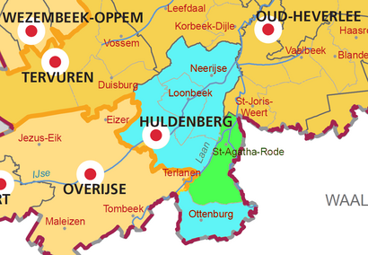
See Sint-Agatha-Rode, Huldenberg, on the map
Public Transit to Sint-Agatha-Rode in Huldenberg
Wondering how to get to Sint-Agatha-Rode in Huldenberg, Belgium? Moovit helps you find the best way to get to Sint-Agatha-Rode with step-by-step directions from the nearest public transit station.
Moovit provides free maps and live directions to help you navigate through your city. View schedules, routes, timetables, and find out how long does it take to get to Sint-Agatha-Rode in real time.
Looking for the nearest stop or station to Sint-Agatha-Rode? Check out this list of stops closest to your destination: Sint-Agatha-Rode Dorp; Neerijse Weg Naar Sint-Agatha-Rode; Sint-Joris-Weert.
Bus: 79, X77, N8, N8.Train: S20.
Want to see if there’s another route that gets you there at an earlier time? Moovit helps you find alternative routes or times. Get directions from and directions to Sint-Agatha-Rode easily from the Moovit App or Website.
We make riding to Sint-Agatha-Rode easy, which is why over 1.5 million users, including users in Huldenberg, trust Moovit as the best app for public transit. You don’t need to download an individual bus app or train app, Moovit is your all-in-one transit app that helps you find the best bus time or train time available.
For information on prices of bus and train, costs and ride fares to Sint-Agatha-Rode, please check the Moovit app.
Use the app to navigate to popular places including to the airport, hospital, stadium, grocery store, mall, coffee shop, school, college, and university.
Sint-Agatha-Rode Address: St-Agathastraat street in Huldenberg
Places Near Sint-Agatha-Rode (Huldenberg)
How to get to popular places in Belgium with public transit
Get around Huldenberg by public transit!
Traveling around Huldenberg has never been so easy. See step by step directions as you travel to any attraction, street or major public transit station. View bus and train schedules, arrival times, service alerts and detailed routes on a map, so you know exactly how to get to anywhere in Huldenberg.
When traveling to any destination around Huldenberg use Moovit's Live Directions with Get Off Notifications to know exactly where and how far to walk, how long to wait for your line, and how many stops are left. Moovit will alert you when it's time to get off — no need to constantly re-check whether yours is the next stop.
Wondering how to use public transit in Huldenberg or how to pay for public transit in Huldenberg? Moovit public transit app can help you navigate your way with public transit easily, and at minimum cost. It includes public transit fees, ticket prices, and costs. Looking for a map of Huldenberg public transit lines? Moovit public transit app shows all public transit maps in Huldenberg with all Bus, Train, Subway, Light Rail and Ferry routes and stops on an interactive map.
Belgium has 5 transit type(s), including: Bus, Train, Subway, Light Rail and Ferry, operated by several transit agencies, including STIB, De Lijn, NMBS/SNCB, TEC Charleroi, TEC Brabant Wallon, TEC Liège - Verviers, TEC Namur - Luxembourg, TEC Hainaut, DeWaterbus, FlixBus and Brussels City Shuttle