Directions to Slater Park (Boston) with public transportation
The following transit lines have routes that pass near Slater Park
 Bus: 1, 80, R, 76, 78.
- Train: PROVIDENCE/STOUGHTON, FOXBORO EVENT SERVICE.
How to get to Slater Park by bus?
Click on the bus route to see step by step directions with maps, line arrival times and updated time schedules.
How to get to Slater Park by train?
Click on the train route to see step by step directions with maps, line arrival times and updated time schedules.
Train station near Slater Park in Boston
- Pawtucket/Central Falls, 10 min walk,VIEW
Bus lines to Slater Park in Boston
What are the closest stations to Slater Park?
The closest stations to Slater Park are:
- Roosevelt Avenue is 174 yards away, 3 min walk.
- Goff Avenue is 266 yards away, 4 min walk.
- Pawtucket/Central Falls is 787 yards away, 10 min walk.
Which bus lines stop near Slater Park?
These bus lines stop near Slater Park: 1, 80, R.
Which train line stops near Slater Park?
PROVIDENCE/STOUGHTON (#819 | Providence)
What’s the nearest train station to Slater Park in Boston?
The nearest train station to Slater Park in Boston is Pawtucket/Central Falls. It’s a 10 min walk away.
What’s the nearest bus station to Slater Park in Boston?
The nearest bus station to Slater Park in Boston is Roosevelt Avenue. It’s a 3 min walk away.
What time is the first train to Slater Park in Boston?
The PROVIDENCE/STOUGHTON is the first train that goes to Slater Park in Boston. It stops nearby at 4:16 AM.
What time is the last train to Slater Park in Boston?
The PROVIDENCE/STOUGHTON is the last train that goes to Slater Park in Boston. It stops nearby at 12:56 AM.
What time is the first bus to Slater Park in Boston?
The 78 is the first bus that goes to Slater Park in Boston. It stops nearby at 5:09 AM.
What time is the last bus to Slater Park in Boston?
The R is the last bus that goes to Slater Park in Boston. It stops nearby at 1:01 AM.
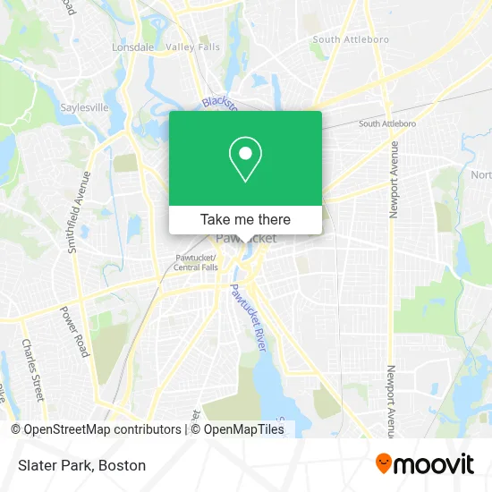
See Slater Park, Boston, on the map
Public Transit to Slater Park in Boston
Wondering how to get to Slater Park in Boston? Moovit helps you find the best way to get to Slater Park with step-by-step directions from the nearest public transit station.
Moovit provides free maps and live directions to help you navigate through your city. View schedules, routes, timetables, and find out how long does it take to get to Slater Park in real time.
Looking for the nearest stop or station to Slater Park? Check out this list of stops closest to your destination: Roosevelt Avenue; Goff Avenue; Pawtucket/Central Falls.
Bus: 1, 80, R, 76, 78, 71.Train: PROVIDENCE/STOUGHTON, FOXBORO EVENT SERVICE.
Want to see if there’s another route that gets you there at an earlier time? Moovit helps you find alternative routes or times. Get directions from and directions to Slater Park easily from the Moovit App or Website.
We make riding to Slater Park easy, which is why over 1.7 million users, including users in Boston, trust Moovit as the best app for public transit. You don’t need to download an individual bus app or train app, Moovit is your all-in-one transit app that helps you find the best bus time or train time available.
For information on prices of bus and train, costs and ride fares to Slater Park, please check the Moovit app.
Use the app to navigate to popular places including to the airport, hospital, stadium, grocery store, mall, coffee shop, school, college, and university.
Slater Park Address: 137 Roosevelt Ave street in Boston
- Insurance Plans Chiropractic,
- City of Pawtucket,
- Pawtucket's Veterans Memorial Amphitheater,
- Pawtucket, RI,
- Pawtucket,
- A & R Appliance Repair,
- Studio 505 Skin Perks,
- East Coast Auto,
- Mountain Miracle Fire Miracles Ministries,
- Allstate Insurance,
- M R Williams FNRL Hme,
- Blackstone River Valley National Historical Park,
- All Digital Group,
- Designs by Lolita,
- Dana Siles Photographer,
- Small Pleasures Florist,
- Garage Door Repair Pawtucket,
- Evergreen Solar Ri & Ma Solar Panel Company,
- Cacd,
- Ccap Learn To Earn
Places Near Slater Park (Boston)
- Cheers, Boston,
- Seaport District, Boston,
- North End, Boston,
- Faneuil Hall, Boston,
- Castle Island, Boston,
- Wilbur Theatre, Boston,
- Boston Children's Hospital, Boston,
- Boston Convention & Exhibition Center, Boston,
- Boston Medical Center, Boston,
- Museum Of Science, Boston,
- Prudential Center, Boston,
- House Of Blues, Boston,
- Mgm Music Hall, Boston,
- Massachusetts General Hospital, Boston,
- Boston Common, Boston,
- Wang Theater, Boston,
- Leader Bank Pavilion (Leader Bank Pavillion), Boston,
- Quincy Market, Boston,
- Isabella Stewart Gardner Museum, Boston,
- Td Garden, Boston
How to get to popular places in Boston with public transit
Get around Boston by public transit!
Traveling around Boston has never been so easy. See step by step directions as you travel to any attraction, street or major public transit station. View bus and train schedules, arrival times, service alerts and detailed routes on a map, so you know exactly how to get to anywhere in Boston.
When traveling to any destination around Boston use Moovit's Live Directions with Get Off Notifications to know exactly where and how far to walk, how long to wait for your line, and how many stops are left. Moovit will alert you when it's time to get off — no need to constantly re-check whether yours is the next stop.
Wondering how to use public transit in Boston or how to pay for public transit in Boston? Moovit public transit app can help you navigate your way with public transit easily, and at minimum cost. It includes public transit fees, ticket prices, and costs. Looking for a map of Boston public transit lines? Moovit public transit app shows all public transit maps in Boston with all Bus, Train, Subway and Ferry routes and stops on an interactive map.
Boston has 4 transit type(s), including: Bus, Train, Subway and Ferry, operated by several transit agencies, including MBTA, Southeastern Regional Transit Authority, MetroWest Regional Transit Authority, Rhode Island Public Transit Authority, WRTA, Lowell Regional Transit Authority, Merrimack Valley Transit, Montachusett Regional Transit Authority, Cape Cod Regional Transit Authority, Brockton Area Transit Authority, Martha's Vineyard Transit Authority, the WAVE - Nantucket Regional Transit Authority, GATRA, Cape Ann Transportation Authority and Massport