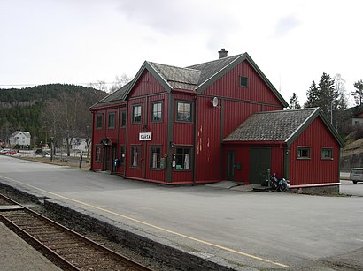
Snåsa Stasjon stop - Thursday schedule
| Line | Direction | Time |
|---|---|---|
| 733 | Steinkjer Montessoriskole | 06:40 |
| 7327 | Agle Øst | 07:30 |
| 7906 | Snåsa Stasjon | 07:30 |
| 7327 | Agle Øst | 07:35 |
| 7329 | Snåsa Stasjon | 07:37 |
| 7327 | Snåsa Stasjon | 07:39 |
| 612 | Grong St. Via Grong Vgs. | 07:40 |
| 7906 | Snåsa Skole Via Moum | 08:37 |
| 7328 | Snåsa Stasjon | 08:38 |
| 7329 | Snåsa Stasjon | 08:46 |
| 7327 | Snåsa Via Kolven | 08:49 |
| 7328 | Oldernesset Vegdele | 14:35 |
| 7327 | Snåsa Skole | 14:40 |
| 7906 | Hammer Via Moum | 14:47 |
| 7329 | Imsdalen | 16:05 |
| 7327 | Ålmo | 16:08 |
| 612 | Snåsa Stasjon | 16:10 |
| 733 | Snåsa Stasjon | 17:12 |
Directions to Snåsa Stasjon stop (Norway) with public transit
The following transit lines have routes that pass near Snåsa Stasjon
How to get to Snåsa Stasjon stop by train?
Click on the train route to see step by step directions with maps, line arrival times and updated time schedules.
Train stations near Snåsa Stasjon station in Norway
- Snåsa Stasjon, 1 min walk,
Bus stops near Snåsa Stasjon stop in Norway
- Snåsa Skole, 16 min walk,
- Viosen, 16 min walk,
Bus lines to Snåsa Stasjon stop in Norway
- 7327, Snåsa Via Kolven,
- 7328, Oldernesset Vegdele,
- 7329, Snåsa Stasjon,
- 7330, Kjenstadberget,
- 7906, Hammer Via Moum,
- 612, Snåsa Stasjon,
What are the closest stations to Snåsa Stasjon?
The closest stations to Snåsa Stasjon are:
- Snåsa Stasjon is 64 meters away, 1 min walk.
- Snåsa Skole is 1199 meters away, 16 min walk.
- Viosen is 1214 meters away, 16 min walk.
Which bus lines stop near Snåsa Stasjon?
These bus lines stop near Snåsa Stasjon: 612, 733.
Which train line stops near Snåsa Stasjon?
F7 (Mo I Rana)
What’s the nearest train station to Snåsa Stasjon in Norway?
The nearest train station to Snåsa Stasjon in Norway is Snåsa Stasjon. It’s a 1 min walk away.
What time is the first train to Snåsa Stasjon in Norway?
The F7 is the first train that goes to Snåsa Stasjon in Norway. It stops nearby at 10:08 AM.
What time is the last train to Snåsa Stasjon in Norway?
The F7 is the last train that goes to Snåsa Stasjon in Norway. It stops nearby at 7:48 PM.
What time is the first bus to Snåsa Stasjon in Norway?
The 7906 is the first bus that goes to Snåsa Stasjon in Norway. It stops nearby at 7:28 AM.
What time is the last bus to Snåsa Stasjon in Norway?
The 7327 is the last bus that goes to Snåsa Stasjon in Norway. It stops nearby at 4:10 PM.
See Snåsa Stasjon stop, Norway, on the map
Public transit to Snåsa Stasjon stop in Norway
Looking for directions to Snåsa Stasjon in Norway, Norway?
Download the Moovit App to find the current schedule and step-by-step directions for Train or Bus routes that pass through Snåsa Stasjon.
Looking for the nearest stops closest to Snåsa Stasjon ? Check out this list of closest stops to your destination: Snåsa Stasjon; Snåsa Skole; Viosen.
Bus: 612, 733, 7327, 7328, 7329, 7330, 7906.Train: F7.
We make riding on public transit to Snåsa Stasjon easy, which is why over 1.5 million users, including users in Norway trust Moovit as the best app for public transit.
Use the app to navigate to popular places including to the airport, hospital, stadium, grocery store, mall, coffee shop, school, college, and university.
The first line to this stop is 733, at 06:40, and the last line is 733 at 17:12.
Sørsivegen 12, Norway
This stop serves AtB’s lines
Train station near Snåsa Stasjon station
Popular public transit stations in Norway
Get around Norway by public transit!
Traveling around Norway has never been so easy. See step by step directions as you travel to any attraction, street or major public transit station. View bus and train schedules, arrival times, service alerts and detailed routes on a map, so you know exactly how to get to anywhere in Norway.
When traveling to any destination around Norway use Moovit's Live Directions with Get Off Notifications to know exactly where and how far to walk, how long to wait for your line, and how many stops are left. Moovit will alert you when it's time to get off — no need to constantly re-check whether yours is the next stop.
Wondering how to use public transit in Norway or how to pay for public transit in Norway? Moovit public transit app can help you navigate your way with public transit easily, and at minimum cost. It includes public transit fees, ticket prices, and costs. Looking for a map of Norway public transit lines? Moovit public transit app shows all public transit maps in Norway with all Bus, Train, Subway, Light Rail, Ferry and Cable Car routes and stops on an interactive map.
Norway has 6 transit type(s), including: Bus, Train, Subway, Light Rail, Ferry and Cable Car, operated by several transit agencies, including Skyss, SJ, Snelandia, Svipper, Ruter, Vy, FRAM, Flybussen Connect, Vestfold Kollektivtrafikk as, Kolumbus, Flytoget, Telemark Fylkeskommune, NOR-WAY Bussekspress AS, FlixBus and Brakar