Directions to Snowden Dining Hall (Boston) with public transportation
The following transit lines have routes that pass near Snowden Dining Hall
 Bus: 1, 22, 24L, 3, 35.
- Train: NORTHEAST REGIONAL, PROVIDENCE/STOUGHTON, ACELA, PROVIDENCE LINE SHUTTLE, PROVIDENCE LINE SHUTTLE.
How to get to Snowden Dining Hall by bus?
Click on the bus route to see step by step directions with maps, line arrival times and updated time schedules.
How to get to Snowden Dining Hall by train?
Click on the train route to see step by step directions with maps, line arrival times and updated time schedules.
Bus stops near Snowden Dining Hall in Boston
Train stations near Snowden Dining Hall in Boston
- Providence, 18 min walk,VIEW
Bus lines to Snowden Dining Hall in Boston
- 1, Eddy St/Hope St/Benefit St,VIEW
- 3, Warwick Ave/Oakland Beach,VIEW
- 4, Pawtuxet Village/Warwick Neck,VIEW
- 51, Charles St/Twin River/CCRI Lincoln,VIEW
- 54, Lincoln/Woonsocket,VIEW
- 58, Mineral Spring Ave/North Providence,VIEW
- 72, Weeden St (Central Falls),VIEW
- 92, East Side/Federal Hill/RI College,VIEW
- 17, Stop&Shop (Atwood Ave - Cranston),VIEW
- 18, Kennedy Plaza,VIEW
- 19, Walmart (Cranston),VIEW
- 31, Kennedy Plaza Then Mt Pleasant Hs,VIEW
- 6, Roger Williams Zoo,VIEW
- 20, Job Lot (Elmwood Ave - Cranston),VIEW
- 22, Kennedy Plaza Via Pontiac Ave,VIEW
- R, Broad/North Main,VIEW
- 9X, Pascoag Express,VIEW
- 10X, North Scituate Express,VIEW
- 12X, Arctic/RI-117 Express,VIEW
- 59X, North Smithfield/Lincoln Express,VIEW
What are the closest stations to Snowden Dining Hall?
The closest stations to Snowden Dining Hall are:
- Dyer Before Ship is 73 yards away, 2 min walk.
- Washington Before Clemence is 163 yards away, 3 min walk.
- Washington Before Snow is 190 yards away, 3 min walk.
- Westminster Street is 257 yards away, 4 min walk.
- Kennedy Plaza (Stop B) is 411 yards away, 5 min walk.
- Kennedy Plaza (Stop C) is 451 yards away, 6 min walk.
- Providence is 1451 yards away, 18 min walk.
Which bus lines stop near Snowden Dining Hall?
These bus lines stop near Snowden Dining Hall: 1, 22, 24L, 3, 35, 51, 54.
Which train lines stop near Snowden Dining Hall?
These train lines stop near Snowden Dining Hall: NORTHEAST REGIONAL, PROVIDENCE/STOUGHTON.
What’s the nearest train station to Snowden Dining Hall in Boston?
The nearest train station to Snowden Dining Hall in Boston is Providence. It’s a 18 min walk away.
What’s the nearest bus station to Snowden Dining Hall in Boston?
The nearest bus station to Snowden Dining Hall in Boston is Dyer Before Ship. It’s a 2 min walk away.
What time is the first train to Snowden Dining Hall in Boston?
The PROVIDENCE/STOUGHTON is the first train that goes to Snowden Dining Hall in Boston. It stops nearby at 4:10 AM.
What time is the last train to Snowden Dining Hall in Boston?
The NORTHEAST REGIONAL is the last train that goes to Snowden Dining Hall in Boston. It stops nearby at 9:17 AM.
What time is the first bus to Snowden Dining Hall in Boston?
The 54 is the first bus that goes to Snowden Dining Hall in Boston. It stops nearby at 5:13 AM.
What time is the last bus to Snowden Dining Hall in Boston?
The 20 is the last bus that goes to Snowden Dining Hall in Boston. It stops nearby at 1:10 AM.
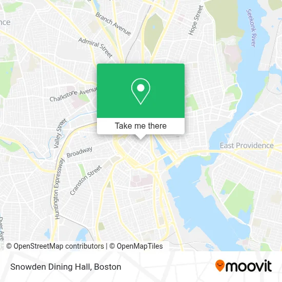
See Snowden Dining Hall, Boston, on the map
Public Transit to Snowden Dining Hall in Boston
Wondering how to get to Snowden Dining Hall in Boston? Moovit helps you find the best way to get to Snowden Dining Hall with step-by-step directions from the nearest public transit station.
Moovit provides free maps and live directions to help you navigate through your city. View schedules, routes, timetables, and find out how long does it take to get to Snowden Dining Hall in real time.
Looking for the nearest stop or station to Snowden Dining Hall? Check out this list of stops closest to your destination: Dyer Before Ship; Washington Before Clemence; Washington Before Snow; Westminster Street; Kennedy Plaza (Stop B); Kennedy Plaza (Stop C); Providence.
Bus: 1, 22, 24L, 3, 35, 51, 54, 4, 17, 18, 19, 31, 6, 20, R, 9X, 10X, 12X, 59X.Train: NORTHEAST REGIONAL, PROVIDENCE/STOUGHTON, ACELA, PROVIDENCE LINE SHUTTLE, PROVIDENCE LINE SHUTTLE, PROVIDENCE LINE SHUTTLE, FOXBORO EVENT SERVICE.
Want to see if there’s another route that gets you there at an earlier time? Moovit helps you find alternative routes or times. Get directions from and directions to Snowden Dining Hall easily from the Moovit App or Website.
We make riding to Snowden Dining Hall easy, which is why over 1.7 million users, including users in Boston, trust Moovit as the best app for public transit. You don’t need to download an individual bus app or train app, Moovit is your all-in-one transit app that helps you find the best bus time or train time available.
For information on prices of bus and train, costs and ride fares to Snowden Dining Hall, please check the Moovit app.
Use the app to navigate to popular places including to the airport, hospital, stadium, grocery store, mall, coffee shop, school, college, and university.
Snowden Dining Hall Address: Snowden Dining Hall, 32 Page St street in Boston
- Providence Performing Arts Center,
- Gaebe Commons,
- Fletcher Building,
- Central Parking System,
- Culture Games,
- Kulture,
- 35 Richmond St Garage,
- Providence Health Club/ Eagles Nest,
- Eagle's Nest,
- Met Lot,
- Gift Horse,
- Sami & Polat International Stone,
- Arthur Chatfield III Attorney at Law,
- Better Lives Ri,
- Jeffrey Appliances,
- Defender Security Company,
- Del Sesto Building,
- Queen of Hearts and Modern Love,
- 29-37 Musalla St,
- Julie Longtin-Cityside Properties
Places Near Snowden Dining Hall (Boston)
- North End, Boston,
- Mgm Music Hall, Boston,
- Wilbur Theatre, Boston,
- Seaport District, Boston,
- Massachusetts General Hospital, Boston,
- Boston Convention & Exhibition Center, Boston,
- Museum Of Science, Boston,
- Boston Children's Hospital, Boston,
- Boston Common, Boston,
- Castle Island, Boston,
- Faneuil Hall, Boston,
- Leader Bank Pavilion (Leader Bank Pavillion), Boston,
- Td Garden, Boston,
- Cheers, Boston,
- Quincy Market, Boston,
- House Of Blues, Boston,
- Wang Theater, Boston,
- Isabella Stewart Gardner Museum, Boston,
- Boston Medical Center, Boston,
- Prudential Center, Boston
How to get to popular places in Boston with public transit
Get around Boston by public transit!
Traveling around Boston has never been so easy. See step by step directions as you travel to any attraction, street or major public transit station. View bus and train schedules, arrival times, service alerts and detailed routes on a map, so you know exactly how to get to anywhere in Boston.
When traveling to any destination around Boston use Moovit's Live Directions with Get Off Notifications to know exactly where and how far to walk, how long to wait for your line, and how many stops are left. Moovit will alert you when it's time to get off — no need to constantly re-check whether yours is the next stop.
Wondering how to use public transit in Boston or how to pay for public transit in Boston? Moovit public transit app can help you navigate your way with public transit easily, and at minimum cost. It includes public transit fees, ticket prices, and costs. Looking for a map of Boston public transit lines? Moovit public transit app shows all public transit maps in Boston with all Bus, Train, Subway and Ferry routes and stops on an interactive map.
Boston has 4 transit type(s), including: Bus, Train, Subway and Ferry, operated by several transit agencies, including MBTA, Southeastern Regional Transit Authority, MetroWest Regional Transit Authority, Rhode Island Public Transit Authority, WRTA, Lowell Regional Transit Authority, Merrimack Valley Transit, Montachusett Regional Transit Authority, Cape Cod Regional Transit Authority, Brockton Area Transit Authority, Martha's Vineyard Transit Authority, the WAVE - Nantucket Regional Transit Authority, GATRA, Cape Ann Transportation Authority and Massport