Directions to Solve - Mit (Cambridge) with public transportation
The following transit lines have routes that pass near Solve - Mit
 Bus: 1, 450, 70, 85, EZRIDE.
- Train: HAVERHILL, NEEDHAM.
- Subway: RED LINE, GREEN LINE B, GREEN LINE C, GREEN LINE D, GREEN LINE E.
How to get to Solve - Mit by bus?
Click on the bus route to see step by step directions with maps, line arrival times and updated time schedules.
From Belmont, MA, Belmont
43 minFrom Best Western Adams Inn Quincy - Boston, Quincy
94 minFrom Arsenal Yards, Watertown Town
40 minFrom Suffolk Downs, Boston
65 minFrom Lower Mills, Boston
86 minFrom West Roxbury, Boston
75 minFrom Winthrop, Winthrop Town
106 minFrom VFW Parkway, Boston
73 minFrom Melrose, MA, Melrose
85 minFrom Hyatt Regency-Boston Harbor (Hyatt Harborside At Boston's Logan International Airport Hotel Boston), Boston
61 min
How to get to Solve - Mit by train?
Click on the train route to see step by step directions with maps, line arrival times and updated time schedules.
How to get to Solve - Mit by subway?
Click on the subway route to see step by step directions with maps, line arrival times and updated time schedules.
Subway stations near Solve - Mit in Cambridge
Bus stops near Solve - Mit in Cambridge
Bus lines to Solve - Mit in Cambridge
- 85, Ruggles,VIEW
- EZRIDE, Inbound To North Station From Erie St,VIEW
- EZRIDE, Outbound North Station To Erie St Via Lechmere And Kendall,VIEW
- EZRIDE, Outbound To Erie St From North Station,VIEW
- 1, Harvard,VIEW
- EZRIDE, Inbound To North Station Via Kendall And Lechmere,VIEW
- EZRIDE, Outbound Lechemere To Kendall,VIEW
- 64, Kendall/MIT - Oak Square,VIEW
- 68, Kendall/MIT - Harvard,VIEW
- EZRIDE, Inbound Kendall To Lechmere,VIEW
What are the closest stations to Solve - Mit?
The closest stations to Solve - Mit are:
- Central is 20 yards away, 1 min walk.
- Hampshire St @ Cardinal Medeiros Ave is 110 yards away, 2 min walk.
- Vassar St./Mass. Ave. is 229 yards away, 3 min walk.
- Massachusetts Ave @ Albany St is 311 yards away, 4 min walk.
- Albany St./Osborn St. is 378 yards away, 5 min walk.
- Ames St @ Main St is 428 yards away, 6 min walk.
- Main St @ Galileo Way is 451 yards away, 6 min walk.
- Galileo Way @ Main St is 571 yards away, 7 min walk.
- Kenmore is 865 yards away, 11 min walk.
- Lechmere is 1555 yards away, 19 min walk.
Which bus lines stop near Solve - Mit?
These bus lines stop near Solve - Mit: 1, 450, 70, 85, EZRIDE.
Which train lines stop near Solve - Mit?
These train lines stop near Solve - Mit: HAVERHILL, NEEDHAM.
Which subway line stops near Solve - Mit?
RED LINE (Ashmont/Braintree)
What’s the nearest subway station to Solve - Mit in Cambridge?
The nearest subway station to Solve - Mit in Cambridge is Central. It’s a 1 min walk away.
What’s the nearest bus station to Solve - Mit in Cambridge?
The nearest bus station to Solve - Mit in Cambridge is Hampshire St @ Cardinal Medeiros Ave. It’s a 2 min walk away.
What time is the first subway to Solve - Mit in Cambridge?
The GREEN LINE E is the first subway that goes to Solve - Mit in Cambridge. It stops nearby at 4:50 AM.
What time is the last subway to Solve - Mit in Cambridge?
The GREEN LINE E is the last subway that goes to Solve - Mit in Cambridge. It stops nearby at 2:30 AM.
What time is the first bus to Solve - Mit in Cambridge?
The 1 is the first bus that goes to Solve - Mit in Cambridge. It stops nearby at 4:55 AM.
What time is the last bus to Solve - Mit in Cambridge?
The 1 is the last bus that goes to Solve - Mit in Cambridge. It stops nearby at 2:26 AM.
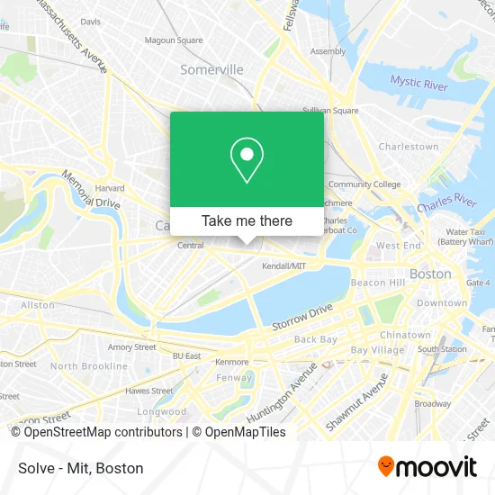
See Solve - Mit, Cambridge, on the map
Public Transit to Solve - Mit in Cambridge
Wondering how to get to Solve - Mit in Cambridge? Moovit helps you find the best way to get to Solve - Mit with step-by-step directions from the nearest public transit station.
Moovit provides free maps and live directions to help you navigate through your city. View schedules, routes, timetables, and find out how long does it take to get to Solve - Mit in real time.
Looking for the nearest stop or station to Solve - Mit? Check out this list of stops closest to your destination: Central; Hampshire St @ Cardinal Medeiros Ave; Vassar St./Mass. Ave.; Massachusetts Ave @ Albany St; Albany St./Osborn St.; Ames St @ Main St; Main St @ Galileo Way; Galileo Way @ Main St; Kenmore; Lechmere.
Bus: 1, 450, 70, 85, EZRIDE.Train: HAVERHILL, NEEDHAM.Subway: RED LINE, GREEN LINE B, GREEN LINE C, GREEN LINE D, GREEN LINE E.
Want to see if there’s another route that gets you there at an earlier time? Moovit helps you find alternative routes or times. Get directions from and directions to Solve - Mit easily from the Moovit App or Website.
We make riding to Solve - Mit easy, which is why over 1.7 million users, including users in Cambridge, trust Moovit as the best app for public transit. You don’t need to download an individual bus app or train app, Moovit is your all-in-one transit app that helps you find the best bus time or train time available.
For information on prices of bus, subway and train, costs and ride fares to Solve - Mit, please check the Moovit app.
Use the app to navigate to popular places including to the airport, hospital, stadium, grocery store, mall, coffee shop, school, college, and university.
Solve - Mit Address: 600 Technology Sq street in Cambridge
- Ragon Institute,
- 300 Technology Square,
- The TARDIS,
- Pisani Center,
- The Charles Stark Draper Laboratory, Inc,
- Glaxosmithkline / Astrazeneca,
- LabCentral,
- Port Landing,
- Singleton Auditorium,
- Stata Center (Csail),
- Hewlett Room 32-G882 (MIT Stata Center),
- Whitehead Institute Cafeteria,
- Sean Collier Memorial,
- MIT R&D Pub,
- The Garment District,
- K B Aruda Construction,
- MITSUBISHI Electric Research Laboratories - Merl,
- Radius Health,
- Kendall Square,
- 32-D463 (MIT Stata Center)
Places Near Solve - Mit (Cambridge)
- Mgm Music Hall, Boston,
- House Of Blues, Boston,
- Boston Medical Center, Boston,
- Castle Island, Boston,
- Leader Bank Pavilion (Leader Bank Pavillion), Boston,
- Museum Of Science, Boston,
- Boston Convention & Exhibition Center, Boston,
- Massachusetts General Hospital, Boston,
- Cheers, Boston,
- Wang Theater, Boston,
- Wilbur Theatre, Boston,
- Td Garden, Boston,
- Boston Common, Boston,
- Faneuil Hall, Boston,
- Isabella Stewart Gardner Museum, Boston,
- Quincy Market, Boston,
- Boston Children's Hospital, Boston,
- Prudential Center, Boston,
- Seaport District, Boston,
- North End, Boston
How to get to popular places in Boston with public transit
Get around Cambridge by public transit!
Traveling around Cambridge has never been so easy. See step by step directions as you travel to any attraction, street or major public transit station. View bus and train schedules, arrival times, service alerts and detailed routes on a map, so you know exactly how to get to anywhere in Cambridge.
When traveling to any destination around Cambridge use Moovit's Live Directions with Get Off Notifications to know exactly where and how far to walk, how long to wait for your line, and how many stops are left. Moovit will alert you when it's time to get off — no need to constantly re-check whether yours is the next stop.
Wondering how to use public transit in Cambridge or how to pay for public transit in Cambridge? Moovit public transit app can help you navigate your way with public transit easily, and at minimum cost. It includes public transit fees, ticket prices, and costs. Looking for a map of Cambridge public transit lines? Moovit public transit app shows all public transit maps in Cambridge with all Bus, Train, Subway and Ferry routes and stops on an interactive map.
Boston has 4 transit type(s), including: Bus, Train, Subway and Ferry, operated by several transit agencies, including MBTA, Southeastern Regional Transit Authority, MetroWest Regional Transit Authority, Rhode Island Public Transit Authority, WRTA, Lowell Regional Transit Authority, Merrimack Valley Transit, Montachusett Regional Transit Authority, Cape Cod Regional Transit Authority, Brockton Area Transit Authority, Martha's Vineyard Transit Authority, the WAVE - Nantucket Regional Transit Authority, GATRA, Cape Ann Transportation Authority and Massport