Directions to Soul Of Design (Boston) with public transportation
The following transit lines have routes that pass near Soul Of Design
 Bus: 354, 43, 504, SL5, 15.
- Train: FAIRMOUNT, FRAMINGHAM/WORCESTER, HAVERHILL, NEEDHAM.
- Subway: GREEN LINE B, GREEN LINE C, GREEN LINE D, GREEN LINE E, ORANGE LINE.
How to get to Soul Of Design by bus?
Click on the bus route to see step by step directions with maps, line arrival times and updated time schedules.
From Boda Borg, Malden
46 minFrom Brookline High School (Brookline Town High School), Brookline
54 minFrom Qea, Quincy
113 minFrom Melrose, MA, Melrose
65 minFrom Spaulding Rehab, Boston
71 minFrom Washington St, Boston
83 minFrom Ac Hotel Cambridge, Cambridge
99 minFrom FOUR POINTS BY SHERATON Boston Newton, Newton
40 minFrom Arlington, MA, Arlington
77 minFrom The Mall At Chestnut Hill, Newton
79 min
How to get to Soul Of Design by train?
Click on the train route to see step by step directions with maps, line arrival times and updated time schedules.
How to get to Soul Of Design by subway?
Click on the subway route to see step by step directions with maps, line arrival times and updated time schedules.
Bus stops near Soul Of Design in Boston
- Tremont St @ Beacon St, 1 min walk,VIEW
- Congress St @ Haymarket Sta, 4 min walk,VIEW
- Haymarket - Congress St Opp Hanover St, 4 min walk,VIEW
- Haymarket - Congress St @ Hanover St, 5 min walk,VIEW
- Government Center - Cambridge St @ Sudbury St, 7 min walk,VIEW
- State St @ Washington Mall - State St Sta, 8 min walk,VIEW
- Cambridge St @ Government Ctr Sta, 8 min walk,VIEW
Subway stations near Soul Of Design in Boston
Bus lines to Soul Of Design in Boston
- 15, Haymarket Via Fields Corner & Nubian,VIEW
- 39, Haymarket Via Forest Hills,VIEW
- 57, Haymarket Via Kenmore,VIEW
- 4, North Station,VIEW
- 92, Sullivan,VIEW
- 93, Sullivan Via Navy Yard,VIEW
- 116, Haymarket Via Maverick,VIEW
- 426, Haymarket Via Cliftondale,VIEW
- 428, Oaklandvale Via Cliftondale (Express),VIEW
- 450, Salem Depot,VIEW
- BLUE LINE SHUTTLE, Airport (Express Shuttle),VIEW
- BLUE LINE SHUTTLE, Airport (Local Shuttle),VIEW
- BLUE LINE SHUTTLE, Airport (Shuttle),VIEW
- ORANGE LINE SHUTTLE, State (Shuttle),VIEW
- RED LINE SHUTTLE, Harvard (Shuttle),VIEW
- RED LINE SHUTTLE, Jfk/Umass (Shuttle),VIEW
- RED LINE SHUTTLE, Kendall/MIT (Shuttle),VIEW
- GREEN LINE SHUTTLE, North Station (Shuttle),VIEW
- GREEN LINE SHUTTLE, Union Square (Shuttle),VIEW
- BLUE LINE SHUTTLE, Government Center Via Maverick (Shuttle),VIEW
What are the closest stations to Soul Of Design?
The closest stations to Soul Of Design are:
- Tremont St @ Beacon St is 55 yards away, 1 min walk.
- Congress St @ Haymarket Sta is 257 yards away, 4 min walk.
- Haymarket - Congress St Opp Hanover St is 301 yards away, 4 min walk.
- Haymarket - Congress St @ Hanover St is 315 yards away, 5 min walk.
- Government Center is 357 yards away, 5 min walk.
- State Street is 482 yards away, 7 min walk.
- Government Center - Cambridge St @ Sudbury St is 518 yards away, 7 min walk.
- Park Street is 583 yards away, 7 min walk.
- State St @ Washington Mall - State St Sta is 620 yards away, 8 min walk.
- Cambridge St @ Government Ctr Sta is 645 yards away, 8 min walk.
Which bus lines stop near Soul Of Design?
These bus lines stop near Soul Of Design: 354, 43, 504, SL5.
Which train lines stop near Soul Of Design?
These train lines stop near Soul Of Design: FAIRMOUNT, FRAMINGHAM/WORCESTER, HAVERHILL, NEEDHAM.
Which subway lines stop near Soul Of Design?
These subway lines stop near Soul Of Design: GREEN LINE B, GREEN LINE C, GREEN LINE D, GREEN LINE E, ORANGE LINE, RED LINE.
What’s the nearest subway station to Soul Of Design in Boston?
The nearest subway station to Soul Of Design in Boston is Government Center. It’s a 5 min walk away.
What’s the nearest bus station to Soul Of Design in Boston?
The nearest bus station to Soul Of Design in Boston is Tremont St @ Beacon St. It’s a 1 min walk away.
What time is the first subway to Soul Of Design in Boston?
The GREEN LINE E is the first subway that goes to Soul Of Design in Boston. It stops nearby at 5:03 AM.
What time is the last subway to Soul Of Design in Boston?
The GREEN LINE E is the last subway that goes to Soul Of Design in Boston. It stops nearby at 2:22 AM.
What time is the first bus to Soul Of Design in Boston?
The 116 is the first bus that goes to Soul Of Design in Boston. It stops nearby at 4:55 AM.
What time is the last bus to Soul Of Design in Boston?
The 116 is the last bus that goes to Soul Of Design in Boston. It stops nearby at 1:58 AM.
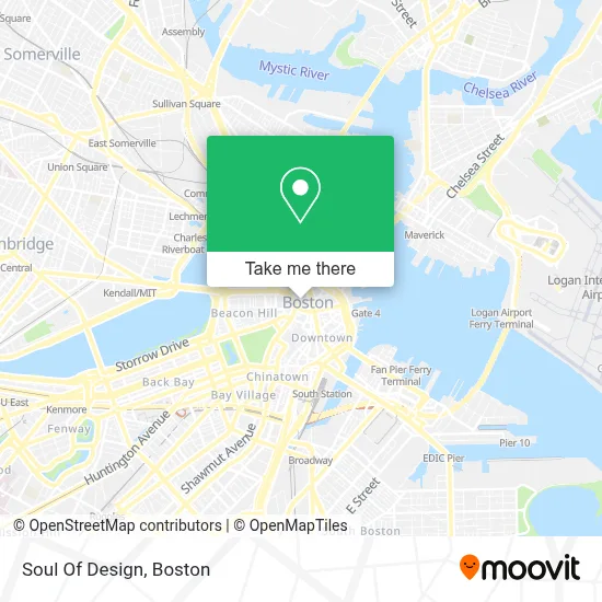
See Soul Of Design, Boston, on the map
Public Transit to Soul Of Design in Boston
Wondering how to get to Soul Of Design in Boston? Moovit helps you find the best way to get to Soul Of Design with step-by-step directions from the nearest public transit station.
Moovit provides free maps and live directions to help you navigate through your city. View schedules, routes, timetables, and find out how long does it take to get to Soul Of Design in real time.
Looking for the nearest stop or station to Soul Of Design? Check out this list of stops closest to your destination: Tremont St @ Beacon St; Congress St @ Haymarket Sta; Haymarket - Congress St Opp Hanover St; Haymarket - Congress St @ Hanover St; Government Center; State Street; Government Center - Cambridge St @ Sudbury St; Park Street; State St @ Washington Mall - State St Sta; Cambridge St @ Government Ctr Sta.
Bus: 354, 43, 504, SL5, 15, 39, 57, 4, 92, 93, 116, 426, GREEN LINE SHUTTLE, GREEN LINE SHUTTLE.Train: FAIRMOUNT, FRAMINGHAM/WORCESTER, HAVERHILL, NEEDHAM.Subway: GREEN LINE B, GREEN LINE C, GREEN LINE D, GREEN LINE E, ORANGE LINE, RED LINE, BLUE LINE.
Want to see if there’s another route that gets you there at an earlier time? Moovit helps you find alternative routes or times. Get directions from and directions to Soul Of Design easily from the Moovit App or Website.
We make riding to Soul Of Design easy, which is why over 1.7 million users, including users in Boston, trust Moovit as the best app for public transit. You don’t need to download an individual bus app or train app, Moovit is your all-in-one transit app that helps you find the best bus time or train time available.
For information on prices of bus, subway and train, costs and ride fares to Soul Of Design, please check the Moovit app.
Use the app to navigate to popular places including to the airport, hospital, stadium, grocery store, mall, coffee shop, school, college, and university.
Soul Of Design Address: A&M Auto Services, 368 Main St street in Boston
- City Hall Plaza,
- Boston City Hall Plaza,
- City of Boston Economic Development (City of Boston Administrative Offices Main Number),
- Boston City Hall (Boston Office of Fair Housing & Equity),
- MBTA Government Center Station,
- Fan Festival - City Hall Plaza,
- 200 Frontage Rd,
- MBTA-Government Center,
- Scollay Square,
- Bill Russell Statue,
- Mezzetti Construction,
- Food Trucks at City Hall,
- Boston Transportation Department,
- Lightview,
- Dubliner,
- One Washington Mall,
- Government Center/Faneuil Hall,
- McCormack Building,
- Staples,
- Tobin Bridge
Places Near Soul Of Design (Boston)
- Museum Of Science, Boston,
- Wilbur Theatre, Boston,
- Quincy Market, Boston,
- Leader Bank Pavilion (Leader Bank Pavillion), Boston,
- Boston Convention & Exhibition Center, Boston,
- Cheers, Boston,
- Prudential Center, Boston,
- Boston Common, Boston,
- House Of Blues, Boston,
- Boston Children's Hospital, Boston,
- Massachusetts General Hospital, Boston,
- Isabella Stewart Gardner Museum, Boston,
- Wang Theater, Boston,
- Boston Medical Center, Boston,
- Castle Island, Boston,
- Seaport District, Boston,
- Td Garden, Boston,
- North End, Boston,
- Mgm Music Hall, Boston,
- Faneuil Hall, Boston
How to get to popular places in Boston with public transit
Get around Boston by public transit!
Traveling around Boston has never been so easy. See step by step directions as you travel to any attraction, street or major public transit station. View bus and train schedules, arrival times, service alerts and detailed routes on a map, so you know exactly how to get to anywhere in Boston.
When traveling to any destination around Boston use Moovit's Live Directions with Get Off Notifications to know exactly where and how far to walk, how long to wait for your line, and how many stops are left. Moovit will alert you when it's time to get off — no need to constantly re-check whether yours is the next stop.
Wondering how to use public transit in Boston or how to pay for public transit in Boston? Moovit public transit app can help you navigate your way with public transit easily, and at minimum cost. It includes public transit fees, ticket prices, and costs. Looking for a map of Boston public transit lines? Moovit public transit app shows all public transit maps in Boston with all Bus, Train, Subway and Ferry routes and stops on an interactive map.
Boston has 4 transit type(s), including: Bus, Train, Subway and Ferry, operated by several transit agencies, including MBTA, Southeastern Regional Transit Authority, MetroWest Regional Transit Authority, Rhode Island Public Transit Authority, WRTA, Lowell Regional Transit Authority, Merrimack Valley Transit, Montachusett Regional Transit Authority, Cape Cod Regional Transit Authority, Brockton Area Transit Authority, Martha's Vineyard Transit Authority, the WAVE - Nantucket Regional Transit Authority, GATRA, Cape Ann Transportation Authority and Massport