Directions to Spruhan Engineering (Newton) with public transportation
The following transit lines have routes that pass near Spruhan Engineering
 Bus: 504, 57, 52, 501, 553.
- Train: FITCHBURG, FRAMINGHAM/WORCESTER.
- Subway: GREEN LINE D, GREEN LINE B.
How to get to Spruhan Engineering by bus?
Click on the bus route to see step by step directions with maps, line arrival times and updated time schedules.
From Centre St, Boston
63 minFrom Bunker Hill Community College, Boston
77 minFrom MGH Bigelow 11 - General Medicine, Boston
42 minFrom John Hancock Tower (200 Clarendon), Boston
18 minFrom Fairfield Inn Suites by Marriott Boston Cambridge, Cambridge
64 minFrom Old Town Trolley Tours of Boston, Boston
21 minFrom Massachusetts General Hospital, Boston
40 minFrom Park Plaza Hotel Boston, Boston
21 minFrom Jamaica Plain, Boston
53 minFrom Eliot Hotel, Boston
31 min
How to get to Spruhan Engineering by train?
Click on the train route to see step by step directions with maps, line arrival times and updated time schedules.
From MGH Bigelow 11 - General Medicine, Boston
81 minFrom John Hancock Tower (200 Clarendon), Boston
43 minFrom Old Town Trolley Tours of Boston, Boston
49 minFrom Massachusetts General Hospital, Boston
82 minFrom Park Plaza Hotel Boston, Boston
46 minFrom Jamaica Plain, Boston
143 minFrom Eliot Hotel, Boston
47 min
How to get to Spruhan Engineering by subway?
Click on the subway route to see step by step directions with maps, line arrival times and updated time schedules.
From Centre St, Boston
102 minFrom Bunker Hill Community College, Boston
106 minFrom MGH Bigelow 11 - General Medicine, Boston
104 minFrom John Hancock Tower (200 Clarendon), Boston
83 minFrom Fairfield Inn Suites by Marriott Boston Cambridge, Cambridge
104 minFrom Old Town Trolley Tours of Boston, Boston
84 minFrom Massachusetts General Hospital, Boston
104 minFrom Park Plaza Hotel Boston, Boston
84 minFrom Jamaica Plain, Boston
111 minFrom Eliot Hotel, Boston
78 min
Bus stops near Spruhan Engineering in Newton
Train stations near Spruhan Engineering in Newton
Subway stations near Spruhan Engineering in Newton
Bus lines to Spruhan Engineering in Newton
What are the closest stations to Spruhan Engineering?
The closest stations to Spruhan Engineering are:
- Washington St @ Bacon St is 167 yards away, 2 min walk.
- Watertown St @ Fifth St is 234 yards away, 3 min walk.
- Newtonville is 1909 yards away, 23 min walk.
- Newton Centre is 2699 yards away, 32 min walk.
- Boston College is 2967 yards away, 35 min walk.
- Waverley is 3439 yards away, 41 min walk.
Which bus lines stop near Spruhan Engineering?
These bus lines stop near Spruhan Engineering: 504, 57.
Which train lines stop near Spruhan Engineering?
These train lines stop near Spruhan Engineering: FITCHBURG, FRAMINGHAM/WORCESTER.
Which subway line stops near Spruhan Engineering?
GREEN LINE D (Riverside)
What’s the nearest train station to Spruhan Engineering in Newton?
The nearest train station to Spruhan Engineering in Newton is Newtonville. It’s a 23 min walk away.
What’s the nearest bus station to Spruhan Engineering in Newton?
The nearest bus station to Spruhan Engineering in Newton is Washington St @ Bacon St. It’s a 2 min walk away.
What time is the first subway to Spruhan Engineering in Newton?
The GREEN LINE D is the first subway that goes to Spruhan Engineering in Newton. It stops nearby at 4:54 AM.
What time is the last subway to Spruhan Engineering in Newton?
The GREEN LINE B is the last subway that goes to Spruhan Engineering in Newton. It stops nearby at 2:39 AM.
What time is the first train to Spruhan Engineering in Newton?
The FRAMINGHAM/WORCESTER is the first train that goes to Spruhan Engineering in Newton. It stops nearby at 5:25 AM.
What time is the last train to Spruhan Engineering in Newton?
The FRAMINGHAM/WORCESTER is the last train that goes to Spruhan Engineering in Newton. It stops nearby at 12:17 AM.
What time is the first bus to Spruhan Engineering in Newton?
The 57 is the first bus that goes to Spruhan Engineering in Newton. It stops nearby at 4:31 AM.
What time is the last bus to Spruhan Engineering in Newton?
The 57 is the last bus that goes to Spruhan Engineering in Newton. It stops nearby at 2:33 AM.
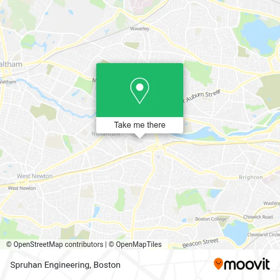
See Spruhan Engineering, Newton, on the map
Public Transit to Spruhan Engineering in Newton
Wondering how to get to Spruhan Engineering in Newton? Moovit helps you find the best way to get to Spruhan Engineering with step-by-step directions from the nearest public transit station.
Moovit provides free maps and live directions to help you navigate through your city. View schedules, routes, timetables, and find out how long does it take to get to Spruhan Engineering in real time.
Looking for the nearest stop or station to Spruhan Engineering? Check out this list of stops closest to your destination: Washington St @ Bacon St; Watertown St @ Fifth St; Newtonville; Newton Centre; Boston College; Waverley.
Bus: 504, 57, 52, 501, 553, 59.Train: FITCHBURG, FRAMINGHAM/WORCESTER.Subway: GREEN LINE D, GREEN LINE B.
Want to see if there’s another route that gets you there at an earlier time? Moovit helps you find alternative routes or times. Get directions from and directions to Spruhan Engineering easily from the Moovit App or Website.
We make riding to Spruhan Engineering easy, which is why over 1.7 million users, including users in Newton, trust Moovit as the best app for public transit. You don’t need to download an individual bus app or train app, Moovit is your all-in-one transit app that helps you find the best bus time or train time available.
For information on prices of bus, subway and train, costs and ride fares to Spruhan Engineering, please check the Moovit app.
Use the app to navigate to popular places including to the airport, hospital, stadium, grocery store, mall, coffee shop, school, college, and university.
Spruhan Engineering Address: 80 Jewett St street in Newton
- House at 115-117 Jewett Street,
- Tortissima,
- Historical Slate Roofing Co.,
- Anything Goes,
- Mir 09,
- Potter Estate,
- Aquinas College (Massachusetts),
- Lincoln-Eliot Pto,
- Sacred Threads Center,
- St. Joseph Spiritual Ministries,
- Genova Construction,
- Jackson Walnut Park Schools,
- Buff's Pub,
- Jackson Walnut Park School,
- FOUR POINTS BY SHERATON Boston Newton,
- Fucci's Photos - Newton Newborns,
- Haywood House,
- Vix Painting,
- I-90 Mass Pike, Exit 17,
- Human Locomotion
Places Near Spruhan Engineering (Newton)
- Wilbur Theatre, Boston,
- Prudential Center, Boston,
- Mgm Music Hall, Boston,
- House Of Blues, Boston,
- Quincy Market, Boston,
- Massachusetts General Hospital, Boston,
- Boston Children's Hospital, Boston,
- North End, Boston,
- Boston Medical Center, Boston,
- Td Garden, Boston,
- Faneuil Hall, Boston,
- Leader Bank Pavilion (Leader Bank Pavillion), Boston,
- Museum Of Science, Boston,
- Boston Convention & Exhibition Center, Boston,
- Boston Common, Boston,
- Cheers, Boston,
- Isabella Stewart Gardner Museum, Boston,
- Castle Island, Boston,
- Wang Theater, Boston,
- Seaport District, Boston
How to get to popular places in Boston with public transit
Get around Newton by public transit!
Traveling around Newton has never been so easy. See step by step directions as you travel to any attraction, street or major public transit station. View bus and train schedules, arrival times, service alerts and detailed routes on a map, so you know exactly how to get to anywhere in Newton.
When traveling to any destination around Newton use Moovit's Live Directions with Get Off Notifications to know exactly where and how far to walk, how long to wait for your line, and how many stops are left. Moovit will alert you when it's time to get off — no need to constantly re-check whether yours is the next stop.
Wondering how to use public transit in Newton or how to pay for public transit in Newton? Moovit public transit app can help you navigate your way with public transit easily, and at minimum cost. It includes public transit fees, ticket prices, and costs. Looking for a map of Newton public transit lines? Moovit public transit app shows all public transit maps in Newton with all Bus, Train, Subway and Ferry routes and stops on an interactive map.
Boston has 4 transit type(s), including: Bus, Train, Subway and Ferry, operated by several transit agencies, including MBTA, Southeastern Regional Transit Authority, MetroWest Regional Transit Authority, Rhode Island Public Transit Authority, WRTA, Lowell Regional Transit Authority, Merrimack Valley Transit, Montachusett Regional Transit Authority, Cape Cod Regional Transit Authority, Brockton Area Transit Authority, Martha's Vineyard Transit Authority, the WAVE - Nantucket Regional Transit Authority, GATRA, Cape Ann Transportation Authority and Massport