Directions to St. Vincent School station (Quezon City) with public transit
The following transit lines have routes that pass near St. Vincent School
How to get to St. Vincent School station by bus?
Click on the bus route to see step by step directions with maps, line arrival times and updated time schedules.
How to get to St. Vincent School station by train?
Click on the train route to see step by step directions with maps, line arrival times and updated time schedules.
Bus stops near St. Vincent School in Quezon City
- St Vincent School, West Avenue / Catanduanes Intersection Quezon City, 3 min walk,
- Bansalangin Intersection, Quezon City, 8 min walk,
- Epifanio De Los Santos Avenue, 888, 10 min walk,
- Epifanio De Los Santos Avenue / Trinoma Access Road, Quezon City, 11 min walk,
- Epifanio De Los Santos Avenue, Quezon City, 11 min walk,
- North Avenue, 12 min walk,
Train stations near St. Vincent School in Quezon City
- Roosevelt Lrt, 18 min walk,
- Kamuning Mrt, 32 min walk,
Bus lines to St. Vincent School station in Quezon City
- JEEP, Proj. 6 - T.M. Kalaw via Quezon Ave.,
- JEEP, Proj 6 Recto via Espana QAve,
- JEEP, Pier South - Proj. 6 via Espana,
- JEEP, Proj 6 - Vito cruz via Quezon Avenue,
- JEEP, PIER SOUTH-PROJ 6,
- JEEP, PagAsa Pier South via Qave,
- JEEP, T.M. Kalaw - West Ave. via Quiapo,
- JEEP, Arroceros Pagasa via Espana QAve,
- JEEP, EDSA/West Ave. - Panay Ave.,
- JEEP, Arroceros Proj 6 via Quezon Ave,
- JEEP, T.M. Kalaw / Maria Y. Orosa St,
- BUS, Ayala Novaliches via EDSA Buendia,
- BUS, Baclaran Navotas via Ayala,
- BUS, Alabang Navotas,
- BUS, Alabang Monumento via EDSA,
- BUS, Monumento Philcite via Ayala EDSA,
- BUS, FTI - Navotas Terminal via EDSA,
- BUS, Ayala Balintawak,
- BUS, Baclaran Novaliches via EDSA Quirino,
- BUS, Ayala Malanday via EDSA,
What are the closest stations to St. Vincent School?
The closest stations to St. Vincent School are:
- St Vincent School, West Avenue / Catanduanes Intersection Quezon City is 55 meters away, 3 min walk.
- Bansalangin Intersection, Quezon City is 538 meters away, 8 min walk.
- Epifanio De Los Santos Avenue, 888 is 716 meters away, 10 min walk.
- Epifanio De Los Santos Avenue / Trinoma Access Road, Quezon City is 747 meters away, 11 min walk.
- Epifanio De Los Santos Avenue, Quezon City is 838 meters away, 11 min walk.
- North Avenue is 906 meters away, 12 min walk.
- Roosevelt Lrt is 1362 meters away, 18 min walk.
- Kamuning Mrt is 2491 meters away, 32 min walk.
Which bus lines stop near St. Vincent School?
These bus lines stop near St. Vincent School: E, JEEP.
Which train lines stop near St. Vincent School?
These train lines stop near St. Vincent School: LRT 1, MRT3.
What’s the nearest train station to St. Vincent School in Quezon City?
The nearest train station to St. Vincent School in Quezon City is Roosevelt Lrt. It’s a 18 min walk away.
What’s the nearest bus station to St. Vincent School in Quezon City?
The nearest bus station to St. Vincent School in Quezon City is St Vincent School, West Avenue / Catanduanes Intersection Quezon City. It’s a 3 min walk away.
What time is the first train to St. Vincent School in Quezon City?
The MRT3 is the first train that goes to St. Vincent School in Quezon City. It stops nearby at 4:59 AM.
What time is the last train to St. Vincent School in Quezon City?
The LRT 1 is the last train that goes to St. Vincent School in Quezon City. It stops nearby at 10:19 PM.
What time is the first bus to St. Vincent School in Quezon City?
The BUS is the first bus that goes to St. Vincent School in Quezon City. It stops nearby at 3:11 AM.
What time is the last bus to St. Vincent School in Quezon City?
The BUS is the last bus that goes to St. Vincent School in Quezon City. It stops nearby at 3:56 AM.
See St. Vincent School, Quezon City, on the map
Public Transit to St. Vincent School in Quezon City
Wondering how to get to St. Vincent School in Quezon City, Philippines? Moovit helps you find the best way to get to St. Vincent School with step-by-step directions from the nearest public transit station.
Moovit provides free maps and live directions to help you navigate through your city. View schedules, routes, timetables, and find out how long does it take to get to St. Vincent School in real time.
Looking for the nearest stop or station to St. Vincent School? Check out this list of stops closest to your destination: St Vincent School; Bansalangin Intersection; Epifanio De Los Santos Avenue; Epifanio De Los Santos Avenue / Trinoma Access Road; Epifanio De Los Santos Avenue; North Avenue; Roosevelt Lrt; Kamuning Mrt.
Bus: E, JEEP, BUS, BUS, BUS, BUS, BUS, BUS, BUS, BUS, BUS, BUS.Train: LRT 1, MRT3.
Want to see if there’s another route that gets you there at an earlier time? Moovit helps you find alternative routes or times. Get directions from and directions to St. Vincent School easily from the Moovit App or Website.
We make riding to St. Vincent School easy, which is why over 1.5 million users, including users in Quezon City, trust Moovit as the best app for public transit. You don’t need to download an individual bus app or train app, Moovit is your all-in-one transit app that helps you find the best bus time or train time available.
For information on prices of bus and train, costs and ride fares to St. Vincent School, please check the Moovit app.
Use the app to navigate to popular places including to the airport, hospital, stadium, grocery store, mall, coffee shop, school, college, and university.
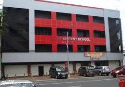
St. Vincent School Address: West Avenue street in Quezon City
Places Near St. Vincent School (Quezon City)
How to get to popular places in Manila with public transit
Get around Quezon City by public transit!
Traveling around Quezon City has never been so easy. See step by step directions as you travel to any attraction, street or major public transit station. View bus and train schedules, arrival times, service alerts and detailed routes on a map, so you know exactly how to get to anywhere in Quezon City.
When traveling to any destination around Quezon City use Moovit's Live Directions with Get Off Notifications to know exactly where and how far to walk, how long to wait for your line, and how many stops are left. Moovit will alert you when it's time to get off — no need to constantly re-check whether yours is the next stop.
Wondering how to use public transit in Quezon City or how to pay for public transit in Quezon City? Moovit public transit app can help you navigate your way with public transit easily, and at minimum cost. It includes public transit fees, ticket prices, and costs. Looking for a map of Quezon City public transit lines? Moovit public transit app shows all public transit maps in Quezon City with all Bus and Train routes and stops on an interactive map.
Manila has 2 transit type(s), including: Bus and Train, operated by several transit agencies, including LRTA, LTFRB, MRTC, PNR, P2P, UV Express and BGC Bus