Directions to Starbucks (Boston) with public transportation
The following transit lines have routes that pass near Starbucks
 Bus: 501, 64, 66, 57, WORCESTER LINE SHUTTLE.
- Train: FRAMINGHAM/WORCESTER.
- Subway: GREEN LINE B.
How to get to Starbucks by bus?
Click on the bus route to see step by step directions with maps, line arrival times and updated time schedules.
From Omni Parker House, Boston
39 minFrom TownePlace Suites Boston Logan Airport/Chelsea, Chelsea
67 minFrom Residence Inn by Marriott Boston Harbor on Tudor Wharf, Boston
68 minFrom Fairfield Inn Suites by Marriott Boston Cambridge, Cambridge
39 minFrom Massport Bus 77 Chelsea Employee Parking, Chelsea
67 minFrom Massachusetts Water Resource Authority (MWRA), Chelsea
71 minFrom 240 Mount Vernon Street, Boston
77 minFrom Grill 23 & Bar, Boston
23 minFrom Silver Line Stop Terminal B, Boston
33 minFrom Boston Logan International Airport (Bos), Boston
31 min
How to get to Starbucks by train?
Click on the train route to see step by step directions with maps, line arrival times and updated time schedules.
How to get to Starbucks by subway?
Click on the subway route to see step by step directions with maps, line arrival times and updated time schedules.
From Omni Parker House, Boston
48 minFrom TownePlace Suites Boston Logan Airport/Chelsea, Chelsea
75 minFrom Residence Inn by Marriott Boston Harbor on Tudor Wharf, Boston
65 minFrom Fairfield Inn Suites by Marriott Boston Cambridge, Cambridge
62 minFrom Massport Bus 77 Chelsea Employee Parking, Chelsea
75 minFrom Silver Line Stop Terminal B, Boston
81 minFrom Massachusetts Water Resource Authority (MWRA), Chelsea
82 minFrom Boston Logan International Airport (Bos), Boston
79 minFrom 240 Mount Vernon Street, Boston
65 minFrom Grill 23 & Bar, Boston
46 min
Bus stops near Starbucks in Boston
Subway station near Starbucks in Boston
- Allston Street, 22 min walk,VIEW
Bus lines to Starbucks in Boston
What are the closest stations to Starbucks?
The closest stations to Starbucks are:
- Cambridge St @ Franklin St is 340 yards away, 5 min walk.
- Cambridge St @ N Beacon St is 457 yards away, 6 min walk.
- Boston Landing is 734 yards away, 9 min walk.
- Allston Street is 1866 yards away, 22 min walk.
Which bus lines stop near Starbucks?
These bus lines stop near Starbucks: 501, 64, 66.
Which train line stops near Starbucks?
FRAMINGHAM/WORCESTER (#521 | Worcester)
Which subway line stops near Starbucks?
GREEN LINE B (Boston College)
What’s the nearest subway station to Starbucks in Boston?
The nearest subway station to Starbucks in Boston is Allston Street. It’s a 22 min walk away.
What’s the nearest bus station to Starbucks in Boston?
The nearest bus station to Starbucks in Boston is Cambridge St @ Franklin St. It’s a 5 min walk away.
What time is the first subway to Starbucks in Boston?
The GREEN LINE B is the first subway that goes to Starbucks in Boston. It stops nearby at 5:12 AM.
What time is the last subway to Starbucks in Boston?
The GREEN LINE B is the last subway that goes to Starbucks in Boston. It stops nearby at 2:28 AM.
What time is the first train to Starbucks in Boston?
The FRAMINGHAM/WORCESTER is the first train that goes to Starbucks in Boston. It stops nearby at 5:00 AM.
What time is the last train to Starbucks in Boston?
The FRAMINGHAM/WORCESTER is the last train that goes to Starbucks in Boston. It stops nearby at 12:12 AM.
What time is the first bus to Starbucks in Boston?
The 57 is the first bus that goes to Starbucks in Boston. It stops nearby at 4:39 AM.
What time is the last bus to Starbucks in Boston?
The 66 is the last bus that goes to Starbucks in Boston. It stops nearby at 2:24 AM.
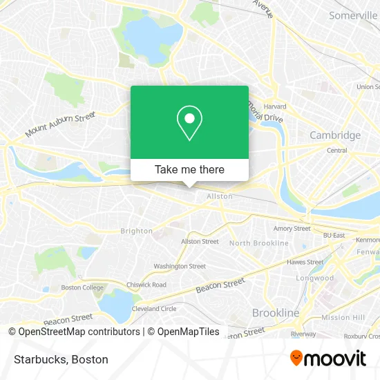
See Starbucks, Boston, on the map
Public Transit to Starbucks in Boston
Wondering how to get to Starbucks in Boston? Moovit helps you find the best way to get to Starbucks with step-by-step directions from the nearest public transit station.
Moovit provides free maps and live directions to help you navigate through your city. View schedules, routes, timetables, and find out how long does it take to get to Starbucks in real time.
Looking for the nearest stop or station to Starbucks? Check out this list of stops closest to your destination: Cambridge St @ Franklin St; Cambridge St @ N Beacon St; Boston Landing; Allston Street.
Bus: 501, 64, 66, 57, WORCESTER LINE SHUTTLE, WORCESTER LINE SHUTTLE, FRAMINGHAM/WORCESTER.Train: FRAMINGHAM/WORCESTER.Subway: GREEN LINE B.
Want to see if there’s another route that gets you there at an earlier time? Moovit helps you find alternative routes or times. Get directions from and directions to Starbucks easily from the Moovit App or Website.
We make riding to Starbucks easy, which is why over 1.7 million users, including users in Boston, trust Moovit as the best app for public transit. You don’t need to download an individual bus app or train app, Moovit is your all-in-one transit app that helps you find the best bus time or train time available.
For information on prices of bus, subway and train, costs and ride fares to Starbucks, please check the Moovit app.
Use the app to navigate to popular places including to the airport, hospital, stadium, grocery store, mall, coffee shop, school, college, and university.
Starbucks Address: 305 Guest St street in Boston
- Boston Landing Station,
- New Balance Global Flagship Store Boston Landing,
- North Brighton, Massachusetts,
- Massachusetts,
- Boston Volvo Village,
- Allston Brighton,
- Boston Commerce, Inc.,
- Fahy Plumbing And Hea,
- Lovejoy Interiors,
- Zomar Inc-the Showroom,
- North Brighton MA USA,
- Bowery Boston,
- Commonwealth Cotton,
- Warrior Ice Arena,
- Rail Stop Restaurant And Bar,
- High Output Brighton,
- The Bagel Table,
- Penniman on the Park,
- Experience Warrior Ice Arena,
- Experience Warrior Ice Arena (Am Warriors League)
Places Near Starbucks (Boston)
- Wang Theater, Boston,
- Wilbur Theatre, Boston,
- Castle Island, Boston,
- Museum Of Science, Boston,
- Boston Children's Hospital, Boston,
- Td Garden, Boston,
- Isabella Stewart Gardner Museum, Boston,
- House Of Blues, Boston,
- Prudential Center, Boston,
- Boston Convention & Exhibition Center, Boston,
- Leader Bank Pavilion (Leader Bank Pavillion), Boston,
- Seaport District, Boston,
- Quincy Market, Boston,
- Boston Medical Center, Boston,
- Cheers, Boston,
- Faneuil Hall, Boston,
- North End, Boston,
- Massachusetts General Hospital, Boston,
- Mgm Music Hall, Boston,
- Boston Common, Boston
How to get to popular places in Boston with public transit
Get around Boston by public transit!
Traveling around Boston has never been so easy. See step by step directions as you travel to any attraction, street or major public transit station. View bus and train schedules, arrival times, service alerts and detailed routes on a map, so you know exactly how to get to anywhere in Boston.
When traveling to any destination around Boston use Moovit's Live Directions with Get Off Notifications to know exactly where and how far to walk, how long to wait for your line, and how many stops are left. Moovit will alert you when it's time to get off — no need to constantly re-check whether yours is the next stop.
Wondering how to use public transit in Boston or how to pay for public transit in Boston? Moovit public transit app can help you navigate your way with public transit easily, and at minimum cost. It includes public transit fees, ticket prices, and costs. Looking for a map of Boston public transit lines? Moovit public transit app shows all public transit maps in Boston with all Bus, Train, Subway and Ferry routes and stops on an interactive map.
Boston has 4 transit type(s), including: Bus, Train, Subway and Ferry, operated by several transit agencies, including MBTA, Southeastern Regional Transit Authority, MetroWest Regional Transit Authority, Rhode Island Public Transit Authority, WRTA, Lowell Regional Transit Authority, Merrimack Valley Transit, Montachusett Regional Transit Authority, Cape Cod Regional Transit Authority, Brockton Area Transit Authority, Martha's Vineyard Transit Authority, the WAVE - Nantucket Regional Transit Authority, GATRA, Cape Ann Transportation Authority and Massport