Directions to Stasher Luggage Storage - Allston (Boston) with public transportation
The following transit lines have routes that pass near Stasher Luggage Storage - Allston
 Bus: 501, 64, 66, 70, 86.
- Train: FITCHBURG, FRAMINGHAM/WORCESTER.
- Subway: GREEN LINE B, RED LINE.
How to get to Stasher Luggage Storage - Allston by bus?
Click on the bus route to see step by step directions with maps, line arrival times and updated time schedules.
From Boston Omni Parker House Hotel, Boston
33 minFrom Malden Catholic High School, Malden
77 minFrom Boston Children's Hospital at Waltham, Waltham
58 minFrom Aloft-Boston Seaport Dist, Boston
38 minFrom Uphams Corner, Boston
66 minFrom Newton-Wellesley Hospital, Newton
72 minFrom Ramada by Wyndham Boston, Boston
89 minFrom Spaulding Rehab, Boston
63 minFrom Newton Wellesley Hospital Green Building, Newton
72 minFrom Hilton Garden Inn Boston Logan Airport, Boston
68 min
How to get to Stasher Luggage Storage - Allston by train?
Click on the train route to see step by step directions with maps, line arrival times and updated time schedules.
How to get to Stasher Luggage Storage - Allston by subway?
Click on the subway route to see step by step directions with maps, line arrival times and updated time schedules.
From Boston Omni Parker House Hotel, Boston
49 minFrom Aloft-Boston Seaport Dist, Boston
65 minFrom Uphams Corner, Boston
71 minFrom Newton-Wellesley Hospital, Newton
65 minFrom Ramada by Wyndham Boston, Boston
88 minFrom Spaulding Rehab, Boston
87 minFrom Newton Wellesley Hospital Green Building, Newton
65 minFrom Hilton Garden Inn Boston Logan Airport, Boston
74 min
Bus stops near Stasher Luggage Storage - Allston in Boston
Subway station near Stasher Luggage Storage - Allston in Boston
- Harvard Ave., 6 min walk,VIEW
Bus lines to Stasher Luggage Storage - Allston in Boston
What are the closest stations to Stasher Luggage Storage - Allston?
The closest stations to Stasher Luggage Storage - Allston are:
- Cambridge St @ Seattle St is 109 yards away, 2 min walk.
- N Harvard St @ Empire St is 212 yards away, 3 min walk.
- Harvard Ave. is 495 yards away, 6 min walk.
- 125 Western Ave is 630 yards away, 8 min walk.
- N Harvard St @ Western Ave is 767 yards away, 10 min walk.
Which bus lines stop near Stasher Luggage Storage - Allston?
These bus lines stop near Stasher Luggage Storage - Allston: 501, 64, 66, 70.
Which train lines stop near Stasher Luggage Storage - Allston?
These train lines stop near Stasher Luggage Storage - Allston: FITCHBURG, FRAMINGHAM/WORCESTER.
Which subway lines stop near Stasher Luggage Storage - Allston?
These subway lines stop near Stasher Luggage Storage - Allston: GREEN LINE B, RED LINE.
What’s the nearest subway station to Stasher Luggage Storage - Allston in Boston?
The nearest subway station to Stasher Luggage Storage - Allston in Boston is Harvard Ave.. It’s a 6 min walk away.
What’s the nearest bus station to Stasher Luggage Storage - Allston in Boston?
The nearest bus station to Stasher Luggage Storage - Allston in Boston is Cambridge St @ Seattle St. It’s a 2 min walk away.
What time is the first subway to Stasher Luggage Storage - Allston in Boston?
The GREEN LINE B is the first subway that goes to Stasher Luggage Storage - Allston in Boston. It stops nearby at 5:14 AM.
What time is the last subway to Stasher Luggage Storage - Allston in Boston?
The GREEN LINE B is the last subway that goes to Stasher Luggage Storage - Allston in Boston. It stops nearby at 2:26 AM.
What time is the first bus to Stasher Luggage Storage - Allston in Boston?
The 70 is the first bus that goes to Stasher Luggage Storage - Allston in Boston. It stops nearby at 4:30 AM.
What time is the last bus to Stasher Luggage Storage - Allston in Boston?
The 66 is the last bus that goes to Stasher Luggage Storage - Allston in Boston. It stops nearby at 2:29 AM.
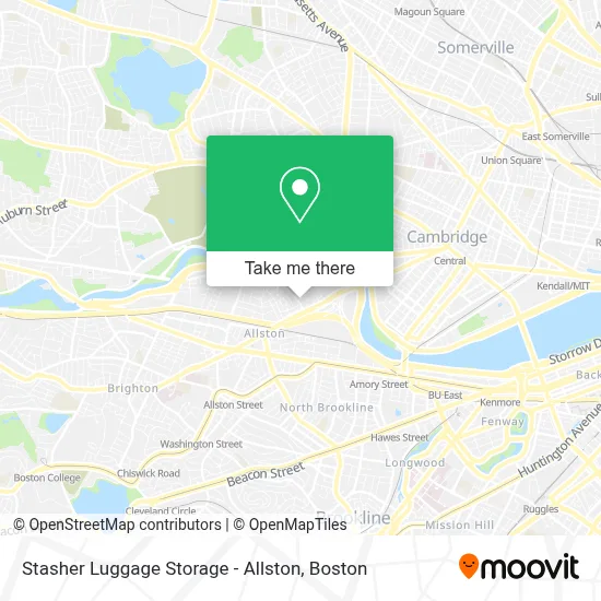
See Stasher Luggage Storage - Allston, Boston, on the map
Public Transit to Stasher Luggage Storage - Allston in Boston
Wondering how to get to Stasher Luggage Storage - Allston in Boston? Moovit helps you find the best way to get to Stasher Luggage Storage - Allston with step-by-step directions from the nearest public transit station.
Moovit provides free maps and live directions to help you navigate through your city. View schedules, routes, timetables, and find out how long does it take to get to Stasher Luggage Storage - Allston in real time.
Looking for the nearest stop or station to Stasher Luggage Storage - Allston? Check out this list of stops closest to your destination: Cambridge St @ Seattle St; N Harvard St @ Empire St; Harvard Ave.; 125 Western Ave; N Harvard St @ Western Ave.
Bus: 501, 64, 66, 70, 86.Train: FITCHBURG, FRAMINGHAM/WORCESTER.Subway: GREEN LINE B, RED LINE.
Want to see if there’s another route that gets you there at an earlier time? Moovit helps you find alternative routes or times. Get directions from and directions to Stasher Luggage Storage - Allston easily from the Moovit App or Website.
We make riding to Stasher Luggage Storage - Allston easy, which is why over 1.7 million users, including users in Boston, trust Moovit as the best app for public transit. You don’t need to download an individual bus app or train app, Moovit is your all-in-one transit app that helps you find the best bus time or train time available.
For information on prices of bus, subway and train, costs and ride fares to Stasher Luggage Storage - Allston, please check the Moovit app.
Use the app to navigate to popular places including to the airport, hospital, stadium, grocery store, mall, coffee shop, school, college, and university.
Stasher Luggage Storage - Allston Address: 23 Farrington Ave street in Boston
- Empire Records,
- Cambridge Crossing,
- Boston Liquors,
- Office of University Publisher,
- Air Express Div Rea Express,
- Harvard University Science And Engineering Complex (Sec),
- Vertex Pharmaceuticals, Inc.,
- Western Ave (western avenue and stadium),
- Smuggler's Notch,
- 219 Western Ave & N Harvard St (Continuum),
- Harvard Innovation Launch Lab,
- Harvard Ed Portal,
- Continuum,
- Beacon Park Yard Redevelopment Site,
- Allston-Brighton Tolls,
- Trader Joe's,
- Spangler Food Court at Harvard Business School,
- Vachina Town,
- Teele Hall (Harvard Business School),
- New Balance Field
Places Near Stasher Luggage Storage - Allston (Boston)
- Boston Common, Boston,
- Prudential Center, Boston,
- Cheers, Boston,
- North End, Boston,
- Quincy Market, Boston,
- Leader Bank Pavilion (Leader Bank Pavillion), Boston,
- Boston Children's Hospital, Boston,
- Museum Of Science, Boston,
- Wilbur Theatre, Boston,
- Mgm Music Hall, Boston,
- Wang Theater, Boston,
- House Of Blues, Boston,
- Td Garden, Boston,
- Seaport District, Boston,
- Faneuil Hall, Boston,
- Massachusetts General Hospital, Boston,
- Isabella Stewart Gardner Museum, Boston,
- Boston Medical Center, Boston,
- Castle Island, Boston,
- Boston Convention & Exhibition Center, Boston
How to get to popular places in Boston with public transit
Get around Boston by public transit!
Traveling around Boston has never been so easy. See step by step directions as you travel to any attraction, street or major public transit station. View bus and train schedules, arrival times, service alerts and detailed routes on a map, so you know exactly how to get to anywhere in Boston.
When traveling to any destination around Boston use Moovit's Live Directions with Get Off Notifications to know exactly where and how far to walk, how long to wait for your line, and how many stops are left. Moovit will alert you when it's time to get off — no need to constantly re-check whether yours is the next stop.
Wondering how to use public transit in Boston or how to pay for public transit in Boston? Moovit public transit app can help you navigate your way with public transit easily, and at minimum cost. It includes public transit fees, ticket prices, and costs. Looking for a map of Boston public transit lines? Moovit public transit app shows all public transit maps in Boston with all Bus, Train, Subway and Ferry routes and stops on an interactive map.
Boston has 4 transit type(s), including: Bus, Train, Subway and Ferry, operated by several transit agencies, including MBTA, Southeastern Regional Transit Authority, MetroWest Regional Transit Authority, Rhode Island Public Transit Authority, WRTA, Lowell Regional Transit Authority, Merrimack Valley Transit, Montachusett Regional Transit Authority, Cape Cod Regional Transit Authority, Brockton Area Transit Authority, Martha's Vineyard Transit Authority, the WAVE - Nantucket Regional Transit Authority, GATRA, Cape Ann Transportation Authority and Massport