Directions to Steingold Collision Center (Boston) with public transportation
The following transit lines have routes that pass near Steingold Collision Center
 Bus: 1, 12, 76.
- Train: PROVIDENCE/STOUGHTON, FOXBORO EVENT SERVICE.
How to get to Steingold Collision Center by bus?
Click on the bus route to see step by step directions with maps, line arrival times and updated time schedules.
How to get to Steingold Collision Center by train?
Click on the train route to see step by step directions with maps, line arrival times and updated time schedules.
Bus stops near Steingold Collision Center in Boston
Train stations near Steingold Collision Center in Boston
Bus lines to Steingold Collision Center in Boston
What are the closest stations to Steingold Collision Center?
The closest stations to Steingold Collision Center are:
- Broadway After Amey is 20 yards away, 1 min walk.
- Stop & Shop (Pawtucket) is 23 yards away, 1 min walk.
- Benefit St. is 1134 yards away, 14 min walk.
- South Attleboro is 1693 yards away, 21 min walk.
- Pawtucket/Central Falls is 3866 yards away, 46 min walk.
Which bus lines stop near Steingold Collision Center?
These bus lines stop near Steingold Collision Center: 1, 12.
Which train line stops near Steingold Collision Center?
PROVIDENCE/STOUGHTON (#828 | South Station)
What’s the nearest train station to Steingold Collision Center in Boston?
The nearest train station to Steingold Collision Center in Boston is South Attleboro. It’s a 21 min walk away.
What’s the nearest bus station to Steingold Collision Center in Boston?
The nearest bus stations to Steingold Collision Center in Boston are Broadway After Amey and Stop & Shop (Pawtucket). The closest one is a 1 min walk away.
What time is the first train to Steingold Collision Center in Boston?
The PROVIDENCE/STOUGHTON is the first train that goes to Steingold Collision Center in Boston. It stops nearby at 4:16 AM.
What time is the last train to Steingold Collision Center in Boston?
The PROVIDENCE/STOUGHTON is the last train that goes to Steingold Collision Center in Boston. It stops nearby at 12:56 AM.
What time is the first bus to Steingold Collision Center in Boston?
The 1 is the first bus that goes to Steingold Collision Center in Boston. It stops nearby at 5:59 AM.
What time is the last bus to Steingold Collision Center in Boston?
The 1 is the last bus that goes to Steingold Collision Center in Boston. It stops nearby at 7:21 PM.
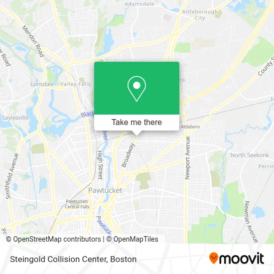
See Steingold Collision Center, Boston, on the map
Public Transit to Steingold Collision Center in Boston
Wondering how to get to Steingold Collision Center in Boston? Moovit helps you find the best way to get to Steingold Collision Center with step-by-step directions from the nearest public transit station.
Moovit provides free maps and live directions to help you navigate through your city. View schedules, routes, timetables, and find out how long does it take to get to Steingold Collision Center in real time.
Looking for the nearest stop or station to Steingold Collision Center? Check out this list of stops closest to your destination: Broadway After Amey; Stop & Shop (Pawtucket); Benefit St.; South Attleboro; Pawtucket/Central Falls.
Bus: 1, 12, 76.Train: PROVIDENCE/STOUGHTON, FOXBORO EVENT SERVICE.
Want to see if there’s another route that gets you there at an earlier time? Moovit helps you find alternative routes or times. Get directions from and directions to Steingold Collision Center easily from the Moovit App or Website.
We make riding to Steingold Collision Center easy, which is why over 1.7 million users, including users in Boston, trust Moovit as the best app for public transit. You don’t need to download an individual bus app or train app, Moovit is your all-in-one transit app that helps you find the best bus time or train time available.
For information on prices of bus and train, costs and ride fares to Steingold Collision Center, please check the Moovit app.
Use the app to navigate to popular places including to the airport, hospital, stadium, grocery store, mall, coffee shop, school, college, and university.
Steingold Collision Center Address: 777 Broadway street in Boston
- Steingold Auto Sales,
- Benefit Auto Trim & Restyling,
- Rhode Island Shotokan Kempo Karate-do,
- Gbarzon District Association,
- Lab401,
- Ed Mens Wear,
- Qodesh Rhode Island-Providence,
- Charcuterie Artisans Employee Center,
- Gulf,
- USA Ishan Investment,
- Tori Uglialoro, DC,
- Juanita Trejo, Interpreter,
- Kiddie Care,
- Hidalgo Restaurant 2 L,
- American Income Life Albert Serur,
- Palencianita Restaurant,
- Atlas ATM,
- Franklin Family Partnership,
- Broadway Vision,
- Kara Wireless Electronics
Places Near Steingold Collision Center (Boston)
- Castle Island, Boston,
- House Of Blues, Boston,
- Leader Bank Pavilion (Leader Bank Pavillion), Boston,
- Mgm Music Hall, Boston,
- Seaport District, Boston,
- Boston Common, Boston,
- Museum Of Science, Boston,
- Prudential Center, Boston,
- North End, Boston,
- Quincy Market, Boston,
- Isabella Stewart Gardner Museum, Boston,
- Faneuil Hall, Boston,
- Boston Medical Center, Boston,
- Wilbur Theatre, Boston,
- Boston Convention & Exhibition Center, Boston,
- Massachusetts General Hospital, Boston,
- Cheers, Boston,
- Wang Theater, Boston,
- Boston Children's Hospital, Boston,
- Td Garden, Boston
How to get to popular places in Boston with public transit
Get around Boston by public transit!
Traveling around Boston has never been so easy. See step by step directions as you travel to any attraction, street or major public transit station. View bus and train schedules, arrival times, service alerts and detailed routes on a map, so you know exactly how to get to anywhere in Boston.
When traveling to any destination around Boston use Moovit's Live Directions with Get Off Notifications to know exactly where and how far to walk, how long to wait for your line, and how many stops are left. Moovit will alert you when it's time to get off — no need to constantly re-check whether yours is the next stop.
Wondering how to use public transit in Boston or how to pay for public transit in Boston? Moovit public transit app can help you navigate your way with public transit easily, and at minimum cost. It includes public transit fees, ticket prices, and costs. Looking for a map of Boston public transit lines? Moovit public transit app shows all public transit maps in Boston with all Bus, Train, Subway and Ferry routes and stops on an interactive map.
Boston has 4 transit type(s), including: Bus, Train, Subway and Ferry, operated by several transit agencies, including MBTA, Southeastern Regional Transit Authority, MetroWest Regional Transit Authority, Rhode Island Public Transit Authority, WRTA, Lowell Regional Transit Authority, Merrimack Valley Transit, Montachusett Regional Transit Authority, Cape Cod Regional Transit Authority, Brockton Area Transit Authority, Martha's Vineyard Transit Authority, the WAVE - Nantucket Regional Transit Authority, GATRA, Cape Ann Transportation Authority and Massport