Directions to Stop & Shop (Boston) with public transportation
The following transit lines have routes that pass near Stop & Shop
How to get to Stop & Shop by bus?
Click on the bus route to see step by step directions with maps, line arrival times and updated time schedules.
From Quincy Center Station, Quincy
85 minFrom Faulkner Hospital, Boston
47 minFrom Uphams Corner, Boston
71 minFrom Archbishop Williams High School, Braintree Town
88 minFrom Lower Mills, Boston
38 minFrom Centre St, Boston
62 minFrom Best Western Adams Inn Quincy - Boston, Quincy
84 minFrom Staybridge Suites Boston-Quincy, Quincy
84 minFrom New England Baptist Hospital, Boston
66 min
How to get to Stop & Shop by train?
Click on the train route to see step by step directions with maps, line arrival times and updated time schedules.
Bus stops near Stop & Shop in Boston
Train station near Stop & Shop in Boston
- Fairmount, 18 min walk,VIEW
Bus lines to Stop & Shop in Boston
What are the closest stations to Stop & Shop?
The closest stations to Stop & Shop are:
- Hyde Park Ave @ Wolcott Square is 429 yards away, 6 min walk.
- Readville is 530 yards away, 7 min walk.
- Washington St @ Needham Rd is 563 yards away, 7 min walk.
- Readville St @ Albermarle St is 1248 yards away, 15 min walk.
- Fairmount is 1515 yards away, 18 min walk.
Which bus lines stop near Stop & Shop?
These bus lines stop near Stop & Shop: 24, 32.
Which train lines stop near Stop & Shop?
These train lines stop near Stop & Shop: FAIRMOUNT, PROVIDENCE/STOUGHTON.
What’s the nearest train station to Stop & Shop in Boston?
The nearest train station to Stop & Shop in Boston is Fairmount. It’s a 18 min walk away.
What’s the nearest bus station to Stop & Shop in Boston?
The nearest bus station to Stop & Shop in Boston is Hyde Park Ave @ Wolcott Square. It’s a 6 min walk away.
What time is the first train to Stop & Shop in Boston?
The FAIRMOUNT is the first train that goes to Stop & Shop in Boston. It stops nearby at 4:33 AM.
What time is the last train to Stop & Shop in Boston?
The PROVIDENCE/STOUGHTON is the last train that goes to Stop & Shop in Boston. It stops nearby at 12:20 AM.
What time is the first bus to Stop & Shop in Boston?
The 32 is the first bus that goes to Stop & Shop in Boston. It stops nearby at 4:47 AM.
What time is the last bus to Stop & Shop in Boston?
The 24 is the last bus that goes to Stop & Shop in Boston. It stops nearby at 1:34 AM.
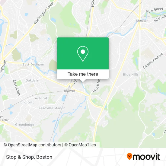
See Stop & Shop, Boston, on the map
Public Transit to Stop & Shop in Boston
Wondering how to get to Stop & Shop in Boston? Moovit helps you find the best way to get to Stop & Shop with step-by-step directions from the nearest public transit station.
Moovit provides free maps and live directions to help you navigate through your city. View schedules, routes, timetables, and find out how long does it take to get to Stop & Shop in real time.
Looking for the nearest stop or station to Stop & Shop? Check out this list of stops closest to your destination: Hyde Park Ave @ Wolcott Square; Readville; Washington St @ Needham Rd; Readville St @ Albermarle St; Fairmount.
Bus: 24, 32, FRANKLIN LINE SHUTTLE, FRANKLIN LINE SHUTTLE, 33.Train: FAIRMOUNT, PROVIDENCE/STOUGHTON, FAIRMOUNT LINE SHUTTLE, FRANKLIN/FOXBORO.
Want to see if there’s another route that gets you there at an earlier time? Moovit helps you find alternative routes or times. Get directions from and directions to Stop & Shop easily from the Moovit App or Website.
We make riding to Stop & Shop easy, which is why over 1.7 million users, including users in Boston, trust Moovit as the best app for public transit. You don’t need to download an individual bus app or train app, Moovit is your all-in-one transit app that helps you find the best bus time or train time available.
For information on prices of bus, train and subway, costs and ride fares to Stop & Shop, please check the Moovit app.
Use the app to navigate to popular places including to the airport, hospital, stadium, grocery store, mall, coffee shop, school, college, and university.
Stop & Shop Address: 1025 Truman Parkway street in Boston
- JXN Services,
- Chiropractic Deep,
- Shell Recharge,
- Perri Electric,
- Coinstar,
- Coinstar - Bitcoin ATM,
- Martini Shell Park,
- Readville,
- Saint Pius X Church,
- JKBM Enterprises,
- Alert Ambulance,
- R and B Painting and Remodeling,
- Global van Lines,
- U-Haul,
- Quality Auto Body,
- DUNKIN',
- Wolcott Sq (wolcott hyde park),
- G Greene,
- Locks & Lockout Service,
- Conrail
Places Near Stop & Shop (Boston)
- Museum Of Science, Boston,
- Quincy Market, Boston,
- House Of Blues, Boston,
- Cheers, Boston,
- Mgm Music Hall, Boston,
- Isabella Stewart Gardner Museum, Boston,
- Boston Children's Hospital, Boston,
- Td Garden, Boston,
- Castle Island, Boston,
- Prudential Center, Boston,
- Faneuil Hall, Boston,
- Boston Convention & Exhibition Center, Boston,
- North End, Boston,
- Massachusetts General Hospital, Boston,
- Wilbur Theatre, Boston,
- Seaport District, Boston,
- Leader Bank Pavilion (Leader Bank Pavillion), Boston,
- Wang Theater, Boston,
- Boston Medical Center, Boston,
- Boston Common, Boston
How to get to popular places in Boston with public transit
Get around Boston by public transit!
Traveling around Boston has never been so easy. See step by step directions as you travel to any attraction, street or major public transit station. View bus and train schedules, arrival times, service alerts and detailed routes on a map, so you know exactly how to get to anywhere in Boston.
When traveling to any destination around Boston use Moovit's Live Directions with Get Off Notifications to know exactly where and how far to walk, how long to wait for your line, and how many stops are left. Moovit will alert you when it's time to get off — no need to constantly re-check whether yours is the next stop.
Wondering how to use public transit in Boston or how to pay for public transit in Boston? Moovit public transit app can help you navigate your way with public transit easily, and at minimum cost. It includes public transit fees, ticket prices, and costs. Looking for a map of Boston public transit lines? Moovit public transit app shows all public transit maps in Boston with all Bus, Train, Subway and Ferry routes and stops on an interactive map.
Boston has 4 transit type(s), including: Bus, Train, Subway and Ferry, operated by several transit agencies, including MBTA, Southeastern Regional Transit Authority, MetroWest Regional Transit Authority, Rhode Island Public Transit Authority, WRTA, Lowell Regional Transit Authority, Merrimack Valley Transit, Montachusett Regional Transit Authority, Cape Cod Regional Transit Authority, Brockton Area Transit Authority, Martha's Vineyard Transit Authority, the WAVE - Nantucket Regional Transit Authority, GATRA, Cape Ann Transportation Authority and Massport