Directions to Stop & Shop #446 (Newton) with public transportation
The following transit lines have routes that pass near Stop & Shop #446
 Bus: 504, 57, 71, 59, 558.
- Train: FITCHBURG, FRAMINGHAM/WORCESTER.
- Subway: GREEN LINE B.
How to get to Stop & Shop #446 by bus?
Click on the bus route to see step by step directions with maps, line arrival times and updated time schedules.
From Charles/MGH T Stop, Boston
48 minFrom Brandy Melville, Boston
42 minFrom Emmanuel College, Boston
58 minFrom Sam Adams Boston Brewery Tour, Boston
77 minFrom Wayfair, Boston
38 minFrom The Friendly Toast, Boston
34 minFrom Fire & Ice (Fire Ice Restaurant), Boston
31 minFrom Harvard Square T Station - Red Line, Cambridge
35 minFrom Hood Park, Boston
80 minFrom Cambridge Crossing, Cambridge
66 min
How to get to Stop & Shop #446 by train?
Click on the train route to see step by step directions with maps, line arrival times and updated time schedules.
From Charles/MGH T Stop, Boston
81 minFrom Brandy Melville, Boston
58 minFrom Emmanuel College, Boston
56 minFrom Sam Adams Boston Brewery Tour, Boston
160 minFrom Wayfair, Boston
57 minFrom The Friendly Toast, Boston
50 minFrom Fire & Ice (Fire Ice Restaurant), Boston
54 minFrom Harvard Square T Station - Red Line, Cambridge
73 minFrom Cambridge Crossing, Cambridge
82 min
Bus stops near Stop & Shop #446 in Newton
Train stations near Stop & Shop #446 in Newton
Subway station near Stop & Shop #446 in Newton
- Boston College, 56 min walk,VIEW
Bus lines to Stop & Shop #446 in Newton
What are the closest stations to Stop & Shop #446?
The closest stations to Stop & Shop #446 are:
- Watertown St @ Pond St is 91 yards away, 2 min walk.
- 84 Chapel St is 509 yards away, 6 min walk.
- Main St Opp Green St is 814 yards away, 10 min walk.
- Waverley is 2469 yards away, 29 min walk.
- Newtonville is 3161 yards away, 38 min walk.
- Boston College is 4696 yards away, 56 min walk.
Which bus lines stop near Stop & Shop #446?
These bus lines stop near Stop & Shop #446: 504, 57, 71.
Which train lines stop near Stop & Shop #446?
These train lines stop near Stop & Shop #446: FITCHBURG, FRAMINGHAM/WORCESTER.
What’s the nearest train station to Stop & Shop #446 in Newton?
The nearest train station to Stop & Shop #446 in Newton is Waverley. It’s a 29 min walk away.
What’s the nearest bus station to Stop & Shop #446 in Newton?
The nearest bus station to Stop & Shop #446 in Newton is Watertown St @ Pond St. It’s a 2 min walk away.
What time is the first subway to Stop & Shop #446 in Newton?
The GREEN LINE B is the first subway that goes to Stop & Shop #446 in Newton. It stops nearby at 5:01 AM.
What time is the last subway to Stop & Shop #446 in Newton?
The GREEN LINE B is the last subway that goes to Stop & Shop #446 in Newton. It stops nearby at 2:39 AM.
What time is the first train to Stop & Shop #446 in Newton?
The FRAMINGHAM/WORCESTER is the first train that goes to Stop & Shop #446 in Newton. It stops nearby at 5:22 AM.
What time is the last train to Stop & Shop #446 in Newton?
The FRAMINGHAM/WORCESTER is the last train that goes to Stop & Shop #446 in Newton. It stops nearby at 12:20 AM.
What time is the first bus to Stop & Shop #446 in Newton?
The 70 is the first bus that goes to Stop & Shop #446 in Newton. It stops nearby at 4:41 AM.
What time is the last bus to Stop & Shop #446 in Newton?
The 70 is the last bus that goes to Stop & Shop #446 in Newton. It stops nearby at 12:48 AM.
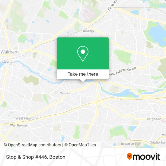
See Stop & Shop #446, Newton, on the map
Public Transit to Stop & Shop #446 in Newton
Wondering how to get to Stop & Shop #446 in Newton? Moovit helps you find the best way to get to Stop & Shop #446 with step-by-step directions from the nearest public transit station.
Moovit provides free maps and live directions to help you navigate through your city. View schedules, routes, timetables, and find out how long does it take to get to Stop & Shop #446 in real time.
Looking for the nearest stop or station to Stop & Shop #446? Check out this list of stops closest to your destination: Watertown St @ Pond St; 84 Chapel St; Main St Opp Green St; Waverley; Newtonville; Boston College.
Bus: 504, 57, 71, 59, 558, 70.Train: FITCHBURG, FRAMINGHAM/WORCESTER.Subway: GREEN LINE B.
Want to see if there’s another route that gets you there at an earlier time? Moovit helps you find alternative routes or times. Get directions from and directions to Stop & Shop #446 easily from the Moovit App or Website.
We make riding to Stop & Shop #446 easy, which is why over 1.7 million users, including users in Newton, trust Moovit as the best app for public transit. You don’t need to download an individual bus app or train app, Moovit is your all-in-one transit app that helps you find the best bus time or train time available.
For information on prices of bus, train and subway, costs and ride fares to Stop & Shop #446, please check the Moovit app.
Use the app to navigate to popular places including to the airport, hospital, stadium, grocery store, mall, coffee shop, school, college, and university.
Stop & Shop #446 Address: 171 Watertown St street in Newton
- The Pappas Company,
- Modera Newton,
- Turtle Studios Newton,
- Alpha Omega Autobody of Watertown,
- Coppola Studios,
- Delio,
- Signs by Tomorrow,
- Watertown Dealtry Pool,
- Applied Image of Watertown,
- Brewbound Experience,
- D and V Realty,
- Fablevision Studios,
- The Watertown Catholic Collaborative of Sacred Heart and Saint Patrick,
- Goddard School,
- Nerd Central,
- Nzuko - Watertown,
- Amethyst Chiropractic,
- Innovative Promotional CNCPTS,
- Mariann Burke Psychotherapy,
- 63 pleasant st, watertown, ma
Places Near Stop & Shop #446 (Newton)
- Boston Convention & Exhibition Center, Boston,
- Wilbur Theatre, Boston,
- Prudential Center, Boston,
- Boston Children's Hospital, Boston,
- Castle Island, Boston,
- Boston Common, Boston,
- Boston Medical Center, Boston,
- Wang Theater, Boston,
- Museum Of Science, Boston,
- Isabella Stewart Gardner Museum, Boston,
- Seaport District, Boston,
- Faneuil Hall, Boston,
- North End, Boston,
- Mgm Music Hall, Boston,
- Massachusetts General Hospital, Boston,
- Cheers, Boston,
- House Of Blues, Boston,
- Leader Bank Pavilion (Leader Bank Pavillion), Boston,
- Td Garden, Boston,
- Quincy Market, Boston
How to get to popular places in Boston with public transit
Get around Newton by public transit!
Traveling around Newton has never been so easy. See step by step directions as you travel to any attraction, street or major public transit station. View bus and train schedules, arrival times, service alerts and detailed routes on a map, so you know exactly how to get to anywhere in Newton.
When traveling to any destination around Newton use Moovit's Live Directions with Get Off Notifications to know exactly where and how far to walk, how long to wait for your line, and how many stops are left. Moovit will alert you when it's time to get off — no need to constantly re-check whether yours is the next stop.
Wondering how to use public transit in Newton or how to pay for public transit in Newton? Moovit public transit app can help you navigate your way with public transit easily, and at minimum cost. It includes public transit fees, ticket prices, and costs. Looking for a map of Newton public transit lines? Moovit public transit app shows all public transit maps in Newton with all Bus, Train, Subway and Ferry routes and stops on an interactive map.
Boston has 4 transit type(s), including: Bus, Train, Subway and Ferry, operated by several transit agencies, including MBTA, Southeastern Regional Transit Authority, MetroWest Regional Transit Authority, Rhode Island Public Transit Authority, WRTA, Lowell Regional Transit Authority, Merrimack Valley Transit, Montachusett Regional Transit Authority, Cape Cod Regional Transit Authority, Brockton Area Transit Authority, Martha's Vineyard Transit Authority, the WAVE - Nantucket Regional Transit Authority, GATRA, Cape Ann Transportation Authority and Massport