Directions to Suffolk County Sheriff's Department (Boston) with public transportation
The following transit lines have routes that pass near Suffolk County Sheriff's Department
 Bus: 1, 10, 8, SL4, 47.
- Train: FAIRMOUNT, NEEDHAM, FRANKLIN/FOXBORO, PROVIDENCE/STOUGHTON.
- Subway: ORANGE LINE, RED LINE.
How to get to Suffolk County Sheriff's Department by bus?
Click on the bus route to see step by step directions with maps, line arrival times and updated time schedules.
From Inman Square, Cambridge
51 minFrom Terrace Room, Paige Hall, Medford
70 minFrom Rental Car Center - Logan Airport, Boston
60 minFrom Newton, MA, Newton
75 minFrom Newton, MA, Newton
54 minFrom Faulkner Hospital, Boston
57 minFrom Medford Square, Medford
79 minFrom Hampton Inn Boston Logan Airport Chelsea, Chelsea
76 minFrom Chevalier Theatre (Chevalier Theater Show Line), Medford
81 minFrom FOUR POINTS BY SHERATON Boston Newton, Newton
39 min
How to get to Suffolk County Sheriff's Department by train?
Click on the train route to see step by step directions with maps, line arrival times and updated time schedules.
How to get to Suffolk County Sheriff's Department by subway?
Click on the subway route to see step by step directions with maps, line arrival times and updated time schedules.
From Inman Square, Cambridge
46 minFrom Terrace Room, Paige Hall, Medford
58 minFrom Rental Car Center - Logan Airport, Boston
40 minFrom Newton, MA, Newton
71 minFrom Newton, MA, Newton
77 minFrom Faulkner Hospital, Boston
56 minFrom Medford Square, Medford
75 minFrom Chevalier Theatre (Chevalier Theater Show Line), Medford
77 min
Subway stations near Suffolk County Sheriff's Department in Boston
Bus stops near Suffolk County Sheriff's Department in Boston
Train station near Suffolk County Sheriff's Department in Boston
- Newmarket, 31 min walk,VIEW
Bus lines to Suffolk County Sheriff's Department in Boston
- 1, Harvard,VIEW
- 8, Harbor Point Via South Bay Center,VIEW
- 10, Townsend & Humboldt,VIEW
- 47, Broadway,VIEW
- CT3, Avenue Louis Pasteur (Limited Stops),VIEW
- 171, Logan Airport Via Andrew,VIEW
- ALBANY/E NEWTON STREET, Student Residence (815 Albany St),VIEW
- 1 BU (CHARLES RIVER-MEDICAL CAMPUS), Comm Ave @ Buick St,VIEW
- 9, City Point,VIEW
What are the closest stations to Suffolk County Sheriff's Department?
The closest stations to Suffolk County Sheriff's Department are:
- Broadway is 573 yards away, 7 min walk.
- Massachusetts Ave @ Albany St is 639 yards away, 8 min walk.
- Albany St Opp Boston Medical is 693 yards away, 9 min walk.
- 91 E Concord St is 939 yards away, 12 min walk.
- 720 Albany Street is 1106 yards away, 14 min walk.
- BU Medical Campus (710 Albany) is 1149 yards away, 14 min walk.
- Massachusetts Ave @ Island St is 1214 yards away, 15 min walk.
- Newmarket is 2610 yards away, 31 min walk.
- Massachusetts Ave. is 2783 yards away, 33 min walk.
Which bus lines stop near Suffolk County Sheriff's Department?
These bus lines stop near Suffolk County Sheriff's Department: 1, 10, 8, SL4.
Which train lines stop near Suffolk County Sheriff's Department?
These train lines stop near Suffolk County Sheriff's Department: FAIRMOUNT, NEEDHAM.
Which subway lines stop near Suffolk County Sheriff's Department?
These subway lines stop near Suffolk County Sheriff's Department: ORANGE LINE, RED LINE.
What’s the nearest subway station to Suffolk County Sheriff's Department in Boston?
The nearest subway station to Suffolk County Sheriff's Department in Boston is Broadway. It’s a 7 min walk away.
What’s the nearest bus station to Suffolk County Sheriff's Department in Boston?
The nearest bus station to Suffolk County Sheriff's Department in Boston is Massachusetts Ave @ Albany St. It’s a 8 min walk away.
What time is the first subway to Suffolk County Sheriff's Department in Boston?
The ORANGE LINE is the first subway that goes to Suffolk County Sheriff's Department in Boston. It stops nearby at 5:24 AM.
What time is the last subway to Suffolk County Sheriff's Department in Boston?
The RED LINE is the last subway that goes to Suffolk County Sheriff's Department in Boston. It stops nearby at 1:53 AM.
What time is the first train to Suffolk County Sheriff's Department in Boston?
The FAIRMOUNT is the first train that goes to Suffolk County Sheriff's Department in Boston. It stops nearby at 4:47 AM.
What time is the last train to Suffolk County Sheriff's Department in Boston?
The FAIRMOUNT is the last train that goes to Suffolk County Sheriff's Department in Boston. It stops nearby at 11:57 PM.
What time is the first bus to Suffolk County Sheriff's Department in Boston?
The 171 is the first bus that goes to Suffolk County Sheriff's Department in Boston. It stops nearby at 3:54 AM.
What time is the last bus to Suffolk County Sheriff's Department in Boston?
The 1 is the last bus that goes to Suffolk County Sheriff's Department in Boston. It stops nearby at 2:39 AM.
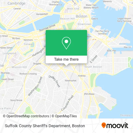
See Suffolk County Sheriff's Department, Boston, on the map
Public Transit to Suffolk County Sheriff's Department in Boston
Wondering how to get to Suffolk County Sheriff's Department in Boston? Moovit helps you find the best way to get to Suffolk County Sheriff's Department with step-by-step directions from the nearest public transit station.
Moovit provides free maps and live directions to help you navigate through your city. View schedules, routes, timetables, and find out how long does it take to get to Suffolk County Sheriff's Department in real time.
Looking for the nearest stop or station to Suffolk County Sheriff's Department? Check out this list of stops closest to your destination: Broadway; Massachusetts Ave @ Albany St; Albany St Opp Boston Medical; 91 E Concord St; 720 Albany Street; BU Medical Campus (710 Albany); Massachusetts Ave @ Island St; Newmarket; Massachusetts Ave..
Bus: 1, 10, 8, SL4, 47, CT3, 171.Train: FAIRMOUNT, NEEDHAM, FRANKLIN/FOXBORO, PROVIDENCE/STOUGHTON.Subway: ORANGE LINE, RED LINE.
Want to see if there’s another route that gets you there at an earlier time? Moovit helps you find alternative routes or times. Get directions from and directions to Suffolk County Sheriff's Department easily from the Moovit App or Website.
We make riding to Suffolk County Sheriff's Department easy, which is why over 1.7 million users, including users in Boston, trust Moovit as the best app for public transit. You don’t need to download an individual bus app or train app, Moovit is your all-in-one transit app that helps you find the best bus time or train time available.
For information on prices of bus, subway and train, costs and ride fares to Suffolk County Sheriff's Department, please check the Moovit app.
Use the app to navigate to popular places including to the airport, hospital, stadium, grocery store, mall, coffee shop, school, college, and university.
Suffolk County Sheriff's Department Address: 20 Bradston St street in Boston
- Suffolk County House Of Correction,
- 3 Day Blinds,
- The Greater Boston Food Bank,
- 670 Albany (BMC),
- BMC ER Ambulance Bay,
- National Emerging Infectious Disease Laboratories (NEIDL),
- Mcdonald's,
- Boston University Henry M. Goldman School of Dental Medicine,
- Boston University Medical Campus,
- Best Western Plus Boston Hotel,
- Woods Mullen Shelter - BPHC,
- Boston Medical Center / Shapiro Center,
- Shapiro Ambulatory Care Center At Boston Medical Center,
- Shapiro Center,
- Cavalier Coach Corporation,
- Hassan, Nisreen N, DDS,
- Majed Khalid M Alshehri BDS,
- Hampton Inn Boston,
- Ching Change,
- Boston University Goldman School of Dental Medicine
Places Near Suffolk County Sheriff's Department (Boston)
- Prudential Center, Boston,
- Wang Theater, Boston,
- Td Garden, Boston,
- North End, Boston,
- House Of Blues, Boston,
- Boston Children's Hospital, Boston,
- Seaport District, Boston,
- Boston Convention & Exhibition Center, Boston,
- Boston Common, Boston,
- Leader Bank Pavilion (Leader Bank Pavillion), Boston,
- Cheers, Boston,
- Massachusetts General Hospital, Boston,
- Mgm Music Hall, Boston,
- Castle Island, Boston,
- Wilbur Theatre, Boston,
- Faneuil Hall, Boston,
- Boston Medical Center, Boston,
- Isabella Stewart Gardner Museum, Boston,
- Quincy Market, Boston,
- Museum Of Science, Boston
How to get to popular places in Boston with public transit
Get around Boston by public transit!
Traveling around Boston has never been so easy. See step by step directions as you travel to any attraction, street or major public transit station. View bus and train schedules, arrival times, service alerts and detailed routes on a map, so you know exactly how to get to anywhere in Boston.
When traveling to any destination around Boston use Moovit's Live Directions with Get Off Notifications to know exactly where and how far to walk, how long to wait for your line, and how many stops are left. Moovit will alert you when it's time to get off — no need to constantly re-check whether yours is the next stop.
Wondering how to use public transit in Boston or how to pay for public transit in Boston? Moovit public transit app can help you navigate your way with public transit easily, and at minimum cost. It includes public transit fees, ticket prices, and costs. Looking for a map of Boston public transit lines? Moovit public transit app shows all public transit maps in Boston with all Bus, Train, Subway and Ferry routes and stops on an interactive map.
Boston has 4 transit type(s), including: Bus, Train, Subway and Ferry, operated by several transit agencies, including MBTA, Southeastern Regional Transit Authority, MetroWest Regional Transit Authority, Rhode Island Public Transit Authority, WRTA, Lowell Regional Transit Authority, Merrimack Valley Transit, Montachusett Regional Transit Authority, Cape Cod Regional Transit Authority, Brockton Area Transit Authority, Martha's Vineyard Transit Authority, the WAVE - Nantucket Regional Transit Authority, GATRA, Cape Ann Transportation Authority and Massport