How to get to Sun Sun Co Inc Warehouse by bus?
Click on the bus route to see step by step directions with maps, line arrival times and updated time schedules.
From Royal Sonesta Hotel, Cambridge
91 minFrom 88 Broad Street, Boston
70 minFrom Belle Isle Lobster & Seafood, Winthrop Town
99 minFrom Freedom Trail, Boston
64 minFrom Hood Park, Boston
54 minFrom Cambridge Crossing, Cambridge
87 minFrom Mr Dooley's Boston Tavern, Boston
69 minFrom Hyatt Centric Faneuil, Boston
67 minFrom Sanofi-aventis, Cambridge
78 minFrom Suffolk University, Boston
69 min
Bus stops near Sun Sun Co Inc Warehouse in Saugus
Train station near Sun Sun Co Inc Warehouse in Saugus
- Oak Grove, 59 min walk,VIEW
Bus lines to Sun Sun Co Inc Warehouse in Saugus
What are the closest stations to Sun Sun Co Inc Warehouse?
The closest stations to Sun Sun Co Inc Warehouse are:
- Kennedy Dr @ Salem St is 203 yards away, 3 min walk.
- 665 Broadway is 783 yards away, 10 min walk.
- Oak Grove is 4977 yards away, 59 min walk.
Which bus lines stop near Sun Sun Co Inc Warehouse?
These bus lines stop near Sun Sun Co Inc Warehouse: 119, 430.
What’s the nearest bus station to Sun Sun Co Inc Warehouse in Saugus?
The nearest bus station to Sun Sun Co Inc Warehouse in Saugus is Kennedy Dr @ Salem St. It’s a 3 min walk away.
What time is the first subway to Sun Sun Co Inc Warehouse in Saugus?
The ORANGE LINE is the first subway that goes to Sun Sun Co Inc Warehouse in Saugus. It stops nearby at 5:15 AM.
What time is the last subway to Sun Sun Co Inc Warehouse in Saugus?
The ORANGE LINE is the last subway that goes to Sun Sun Co Inc Warehouse in Saugus. It stops nearby at 1:59 AM.
What time is the first train to Sun Sun Co Inc Warehouse in Saugus?
The HAVERHILL is the first train that goes to Sun Sun Co Inc Warehouse in Saugus. It stops nearby at 5:35 AM.
What time is the last train to Sun Sun Co Inc Warehouse in Saugus?
The HAVERHILL is the last train that goes to Sun Sun Co Inc Warehouse in Saugus. It stops nearby at 11:53 PM.
What time is the first bus to Sun Sun Co Inc Warehouse in Saugus?
The 411 is the first bus that goes to Sun Sun Co Inc Warehouse in Saugus. It stops nearby at 6:11 AM.
What time is the last bus to Sun Sun Co Inc Warehouse in Saugus?
The 430 is the last bus that goes to Sun Sun Co Inc Warehouse in Saugus. It stops nearby at 10:34 PM.
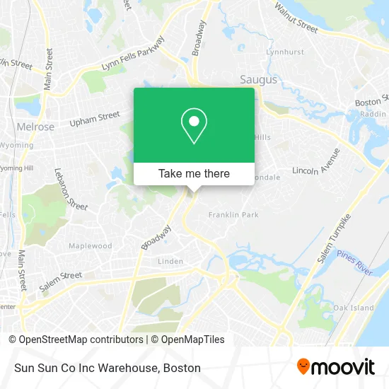
See Sun Sun Co Inc Warehouse, Saugus, on the map
Public Transit to Sun Sun Co Inc Warehouse in Saugus
Wondering how to get to Sun Sun Co Inc Warehouse in Saugus? Moovit helps you find the best way to get to Sun Sun Co Inc Warehouse with step-by-step directions from the nearest public transit station.
Moovit provides free maps and live directions to help you navigate through your city. View schedules, routes, timetables, and find out how long does it take to get to Sun Sun Co Inc Warehouse in real time.
Looking for the nearest stop or station to Sun Sun Co Inc Warehouse? Check out this list of stops closest to your destination: Kennedy Dr @ Salem St; 665 Broadway; Oak Grove.
Bus: 119, 430, 411, 428.Train: HAVERHILL, ORANGE LINE.
Want to see if there’s another route that gets you there at an earlier time? Moovit helps you find alternative routes or times. Get directions from and directions to Sun Sun Co Inc Warehouse easily from the Moovit App or Website.
We make riding to Sun Sun Co Inc Warehouse easy, which is why over 1.7 million users, including users in Saugus, trust Moovit as the best app for public transit. You don’t need to download an individual bus app or train app, Moovit is your all-in-one transit app that helps you find the best bus time or train time available.
For information on prices of bus and subway, costs and ride fares to Sun Sun Co Inc Warehouse, please check the Moovit app.
Use the app to navigate to popular places including to the airport, hospital, stadium, grocery store, mall, coffee shop, school, college, and university.
Sun Sun Co Inc Warehouse Address: 26 Osprey Rd street in Saugus
- Business Copy Associates - A Ubeo Company,
- Max Heating And Cooling,
- Hye Recruiting,
- Nouria,
- Dunkin',
- Viereck Fence Co,
- Wrapped Nwn,
- Happy Gutters & Metal Roof Inc.,
- Blink Charging,
- QUALITY INN,
- QUALITY INN Boston-Revere,
- Discount Tree,
- Garden Remedies,
- Blink,
- Town Line Motel,
- Lowe's Garden Center,
- Plumbing,
- Roadside Squad Towing,
- Junkluggers of North Boston & Southern NH,
- Ideal Property Care
Places Near Sun Sun Co Inc Warehouse (Saugus)
- Boston Common, Boston,
- Prudential Center, Boston,
- Cheers, Boston,
- North End, Boston,
- Quincy Market, Boston,
- Leader Bank Pavilion (Leader Bank Pavillion), Boston,
- Boston Children's Hospital, Boston,
- Museum Of Science, Boston,
- Wilbur Theatre, Boston,
- Mgm Music Hall, Boston,
- Wang Theater, Boston,
- House Of Blues, Boston,
- Td Garden, Boston,
- Seaport District, Boston,
- Faneuil Hall, Boston,
- Massachusetts General Hospital, Boston,
- Isabella Stewart Gardner Museum, Boston,
- Boston Medical Center, Boston,
- Castle Island, Boston,
- Boston Convention & Exhibition Center, Boston
How to get to popular places in Boston with public transit
Get around Saugus by public transit!
Traveling around Saugus has never been so easy. See step by step directions as you travel to any attraction, street or major public transit station. View bus and train schedules, arrival times, service alerts and detailed routes on a map, so you know exactly how to get to anywhere in Saugus.
When traveling to any destination around Saugus use Moovit's Live Directions with Get Off Notifications to know exactly where and how far to walk, how long to wait for your line, and how many stops are left. Moovit will alert you when it's time to get off — no need to constantly re-check whether yours is the next stop.
Wondering how to use public transit in Saugus or how to pay for public transit in Saugus? Moovit public transit app can help you navigate your way with public transit easily, and at minimum cost. It includes public transit fees, ticket prices, and costs. Looking for a map of Saugus public transit lines? Moovit public transit app shows all public transit maps in Saugus with all Bus, Train, Subway and Ferry routes and stops on an interactive map.
Boston has 4 transit type(s), including: Bus, Train, Subway and Ferry, operated by several transit agencies, including MBTA, Southeastern Regional Transit Authority, MetroWest Regional Transit Authority, Rhode Island Public Transit Authority, WRTA, Lowell Regional Transit Authority, Merrimack Valley Transit, Montachusett Regional Transit Authority, Cape Cod Regional Transit Authority, Brockton Area Transit Authority, Martha's Vineyard Transit Authority, the WAVE - Nantucket Regional Transit Authority, GATRA, Cape Ann Transportation Authority and Massport