Directions to Sunoco Gas Station (Boston) with public transportation
The following transit lines have routes that pass near Sunoco Gas Station
 Bus: 21, 26, 12, 15, 24.
- Train: FAIRMOUNT, FAIRMOUNT LINE SHUTTLE, FRANKLIN/FOXBORO, PROVIDENCE/STOUGHTON.
- Subway: RED LINE, MATTAPAN LINE.
How to get to Sunoco Gas Station by bus?
Click on the bus route to see step by step directions with maps, line arrival times and updated time schedules.
From Allston, Boston
70 minFrom Moderna Therapeutics - Corporate Headquarters, Cambridge
85 minFrom Bell In Hand Tavern, Boston
74 minFrom Freedom Trail, Boston
75 minFrom Roxbury, Boston
39 minFrom The Mall At Chestnut Hill, Newton
81 minFrom Regina Pizzeria, Boston
71 minFrom Central Square, Cambridge
70 minFrom Hyatt Regency-Boston Harbor (Hyatt Harborside At Boston's Logan International Airport Hotel Boston), Boston
83 min
How to get to Sunoco Gas Station by train?
Click on the train route to see step by step directions with maps, line arrival times and updated time schedules.
How to get to Sunoco Gas Station by subway?
Click on the subway route to see step by step directions with maps, line arrival times and updated time schedules.
From Allston, Boston
81 minFrom Moderna Therapeutics - Corporate Headquarters, Cambridge
48 minFrom Bell In Hand Tavern, Boston
45 minFrom Hyatt Regency-Boston Harbor (Hyatt Harborside At Boston's Logan International Airport Hotel Boston), Boston
71 minFrom Freedom Trail, Boston
40 minFrom Roxbury, Boston
54 minFrom The Mall At Chestnut Hill, Newton
91 minFrom Regina Pizzeria, Boston
81 minFrom Central Square, Cambridge
40 min
Bus stops near Sunoco Gas Station in Boston
Subway station near Sunoco Gas Station in Boston
- Cedar Grove, 13 min walk,VIEW
Train station near Sunoco Gas Station in Boston
- Morton Street, 19 min walk,VIEW
Bus lines to Sunoco Gas Station in Boston
What are the closest stations to Sunoco Gas Station?
The closest stations to Sunoco Gas Station are:
- Gallivan Blvd @ Owencroft Rd is 57 yards away, 1 min walk.
- Washington St @ Gallivan Blvd is 98 yards away, 2 min walk.
- Dorchester Ave And Galivan Blvd is 353 yards away, 5 min walk.
- Dorchester Ave @ Gallivan Blvd is 396 yards away, 5 min walk.
- Cedar Grove is 1093 yards away, 13 min walk.
- Morton Street is 1593 yards away, 19 min walk.
Which bus line stops near Sunoco Gas Station?
21 (Forest Hills)
Which train line stops near Sunoco Gas Station?
FAIRMOUNT (#1619 | Fairmount)
Which subway line stops near Sunoco Gas Station?
RED LINE (Ashmont/Braintree)
What’s the nearest subway station to Sunoco Gas Station in Boston?
The nearest subway station to Sunoco Gas Station in Boston is Cedar Grove. It’s a 13 min walk away.
What’s the nearest train station to Sunoco Gas Station in Boston?
The nearest train station to Sunoco Gas Station in Boston is Morton Street. It’s a 19 min walk away.
What’s the nearest bus station to Sunoco Gas Station in Boston?
The nearest bus station to Sunoco Gas Station in Boston is Gallivan Blvd @ Owencroft Rd. It’s a 1 min walk away.
What time is the first subway to Sunoco Gas Station in Boston?
The MATTAPAN LINE is the first subway that goes to Sunoco Gas Station in Boston. It stops nearby at 5:04 AM.
What time is the last subway to Sunoco Gas Station in Boston?
The MATTAPAN LINE is the last subway that goes to Sunoco Gas Station in Boston. It stops nearby at 2:36 AM.
What time is the first train to Sunoco Gas Station in Boston?
The FAIRMOUNT is the first train that goes to Sunoco Gas Station in Boston. It stops nearby at 6:36 AM.
What time is the last train to Sunoco Gas Station in Boston?
The FAIRMOUNT is the last train that goes to Sunoco Gas Station in Boston. It stops nearby at 12:06 AM.
What time is the first bus to Sunoco Gas Station in Boston?
The 15 is the first bus that goes to Sunoco Gas Station in Boston. It stops nearby at 4:38 AM.
What time is the last bus to Sunoco Gas Station in Boston?
The 26 is the last bus that goes to Sunoco Gas Station in Boston. It stops nearby at 1:19 AM.
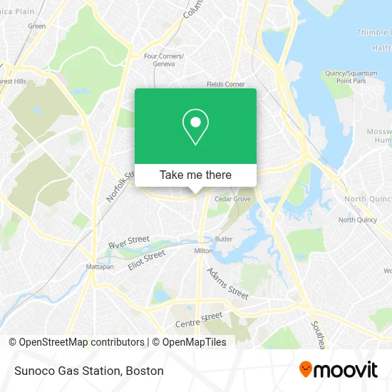
See Sunoco Gas Station, Boston, on the map
Public Transit to Sunoco Gas Station in Boston
Wondering how to get to Sunoco Gas Station in Boston? Moovit helps you find the best way to get to Sunoco Gas Station with step-by-step directions from the nearest public transit station.
Moovit provides free maps and live directions to help you navigate through your city. View schedules, routes, timetables, and find out how long does it take to get to Sunoco Gas Station in real time.
Looking for the nearest stop or station to Sunoco Gas Station? Check out this list of stops closest to your destination: Gallivan Blvd @ Owencroft Rd; Washington St @ Gallivan Blvd; Dorchester Ave And Galivan Blvd; Dorchester Ave @ Gallivan Blvd; Cedar Grove; Morton Street.
Bus: 21, 26, 12, 15, 24, 215, 217, 240.Train: FAIRMOUNT, FAIRMOUNT LINE SHUTTLE, FRANKLIN/FOXBORO, PROVIDENCE/STOUGHTON.Subway: RED LINE, MATTAPAN LINE.
Want to see if there’s another route that gets you there at an earlier time? Moovit helps you find alternative routes or times. Get directions from and directions to Sunoco Gas Station easily from the Moovit App or Website.
We make riding to Sunoco Gas Station easy, which is why over 1.7 million users, including users in Boston, trust Moovit as the best app for public transit. You don’t need to download an individual bus app or train app, Moovit is your all-in-one transit app that helps you find the best bus time or train time available.
For information on prices of bus, subway and train, costs and ride fares to Sunoco Gas Station, please check the Moovit app.
Use the app to navigate to popular places including to the airport, hospital, stadium, grocery store, mall, coffee shop, school, college, and university.
Sunoco Gas Station Address: 976 Washington St street in Boston
- WESTERN UNION,
- Washington St,
- Boston Strong Tax,
- Carney Hospital,
- Yoo Foot & Ankle Podiatry,
- Boston Primary Care,
- Eye Health Services,
- Seton Medical Building,
- Ankur Patel, MD - Boston Primary Care,
- Marina Rabin, MD,
- Michael Young, MD,
- Bay Cove Human Service,
- Sleep Better Clinic - Adrian Velasquez MD MPH,
- 02124,
- Peter Greene Field,
- N Miller Masonry & Construction,
- Pope John Paul II Catholic Academy,
- Express Locksmith Inc,
- Sisters Columban,
- Dorchester Park
Places Near Sunoco Gas Station (Boston)
- Isabella Stewart Gardner Museum, Boston,
- Leader Bank Pavilion (Leader Bank Pavillion), Boston,
- Cheers, Boston,
- Seaport District, Boston,
- Boston Common, Boston,
- Boston Children's Hospital, Boston,
- Td Garden, Boston,
- Massachusetts General Hospital, Boston,
- Faneuil Hall, Boston,
- Prudential Center, Boston,
- Boston Medical Center, Boston,
- Boston Convention & Exhibition Center, Boston,
- Wang Theater, Boston,
- House Of Blues, Boston,
- North End, Boston,
- Museum Of Science, Boston,
- Mgm Music Hall, Boston,
- Castle Island, Boston,
- Wilbur Theatre, Boston,
- Quincy Market, Boston
How to get to popular places in Boston with public transit
Get around Boston by public transit!
Traveling around Boston has never been so easy. See step by step directions as you travel to any attraction, street or major public transit station. View bus and train schedules, arrival times, service alerts and detailed routes on a map, so you know exactly how to get to anywhere in Boston.
When traveling to any destination around Boston use Moovit's Live Directions with Get Off Notifications to know exactly where and how far to walk, how long to wait for your line, and how many stops are left. Moovit will alert you when it's time to get off — no need to constantly re-check whether yours is the next stop.
Wondering how to use public transit in Boston or how to pay for public transit in Boston? Moovit public transit app can help you navigate your way with public transit easily, and at minimum cost. It includes public transit fees, ticket prices, and costs. Looking for a map of Boston public transit lines? Moovit public transit app shows all public transit maps in Boston with all Bus, Train, Subway and Ferry routes and stops on an interactive map.
Boston has 4 transit type(s), including: Bus, Train, Subway and Ferry, operated by several transit agencies, including MBTA, Southeastern Regional Transit Authority, MetroWest Regional Transit Authority, Rhode Island Public Transit Authority, WRTA, Lowell Regional Transit Authority, Merrimack Valley Transit, Montachusett Regional Transit Authority, Cape Cod Regional Transit Authority, Brockton Area Transit Authority, Martha's Vineyard Transit Authority, the WAVE - Nantucket Regional Transit Authority, GATRA, Cape Ann Transportation Authority and Massport