Directions to Swamy Vivekananda Road station (Bengaluru) with public transit
The following transit lines have routes that pass near Swamy Vivekananda Road
How to get to Swamy Vivekananda Road station by bus?
Click on the bus route to see step by step directions with maps, line arrival times and updated time schedules.
Bus stops near Swamy Vivekananda Road in Bengaluru
- Tin Factory, 1 min walk,
- K.R.Puram Metro Station, 11 min walk,
- Benniganahalli Bridge, 16 min walk,
Metro stations near Swamy Vivekananda Road in Bengaluru
- Benniganahalli, 1 min walk,
- Swami Vivekananda Road, 18 min walk,
Bus lines to Swamy Vivekananda Road station in Bengaluru
- 290-Y YTTMC-KRPGH, Yeshawanthapura Bus Station - K.R.Puram Government Hospital,
- 293BC, Beguru - Central Silk Board,
- 301R, Naduvatti Colony - Hebbala Bridge,
- 304, Krishnarajendra Market - Arehalli,
- 304-D, Shivajinagara Bus Station - Medi Mallasandra,
- 304-V, K.R.Market - Chikka Thirupathi,
- 304B, Hoodi - Kempegowda Bus Station,
- 304C, Krishnarajendra Market - Channasandra,
- 304E, Kallukunte Agrahara - Krishnarajendra Market,
- 304H, Arehalli - Kempegowda Bus Station,
- 304J, Kallukunte Agrahara - Kempegowda Bus Station,
- 304M, Alambadi - Krishnarajendra Market,
- 304N, Anugondanahalli - Krishnarajendra Market,
- 304P, Yattukodi - Krishnarajendra Market,
- 304Q, Ganagaluru - Krishnarajendra Market,
- 304T, Dunnasandra Cross - Krishnarajendra Market,
- 304VA, Tin Factory - Shivanapura,
- 304VB, Chikka Thirupathi - Tin Factory,
- 304X, Kempegowda Bus Station - Arehalli,
- 304Z, Chikka Tirupathi - Kempegowda Bus Station,
What are the closest stations to Swamy Vivekananda Road?
The closest stations to Swamy Vivekananda Road are:
- Tin Factory is 24 meters away, 1 min walk.
- Benniganahalli is 50 meters away, 1 min walk.
- K.R.Puram Metro Station is 805 meters away, 11 min walk.
- Benniganahalli Bridge is 1189 meters away, 16 min walk.
- Swami Vivekananda Road is 1411 meters away, 18 min walk.
Which bus lines stop near Swamy Vivekananda Road?
These bus lines stop near Swamy Vivekananda Road: 305Q, 311E, 311J, 500-BA, KBS-12HK, V-317A, V-500D, V-500HS.
What’s the nearest metro station to Swamy Vivekananda Road in Bengaluru?
The nearest metro station to Swamy Vivekananda Road in Bengaluru is Benniganahalli. It’s a 1 min walk away.
What’s the nearest bus station to Swamy Vivekananda Road in Bengaluru?
The nearest bus station to Swamy Vivekananda Road in Bengaluru is Tin Factory. It’s a 1 min walk away.
What time is the first metro to Swamy Vivekananda Road in Bengaluru?
The PURPLE is the first metro that goes to Swamy Vivekananda Road in Bengaluru. It stops nearby at 7:21 AM.
What time is the last metro to Swamy Vivekananda Road in Bengaluru?
The PURPLE is the last metro that goes to Swamy Vivekananda Road in Bengaluru. It stops nearby at 12:04 AM.
What time is the first bus to Swamy Vivekananda Road in Bengaluru?
The 502-CT YTTMC-GGP-KRPMS is the first bus that goes to Swamy Vivekananda Road in Bengaluru. It stops nearby at 3:00 AM.
What time is the last bus to Swamy Vivekananda Road in Bengaluru?
The KIA-8C is the last bus that goes to Swamy Vivekananda Road in Bengaluru. It stops nearby at 4:17 AM.
See Swamy Vivekananda Road, Bengaluru, on the map
Public Transit to Swamy Vivekananda Road in Bengaluru
Wondering how to get to Swamy Vivekananda Road in Bengaluru, India? Moovit helps you find the best way to get to Swamy Vivekananda Road with step-by-step directions from the nearest public transit station.
Moovit provides free maps and live directions to help you navigate through your city. View schedules, routes, timetables, and find out how long does it take to get to Swamy Vivekananda Road in real time.
Looking for the nearest stop or station to Swamy Vivekananda Road? Check out this list of stops closest to your destination: Tin Factory; Benniganahalli; K.R.Puram Metro Station; Benniganahalli Bridge; Swami Vivekananda Road.
Bus: 305Q, 311E, 311J, 500-BA, KBS-12HK, V-317A, V-500D, V-500HS, 290-Y YTTMC-KRPGH, 293BC, 301R, 304, 304-D, 355D, 380-BA, 381-A, 500-A BSK-D10G, 500-A ISROM-HBL-GGP-PSS, 328HB, KIA-6A, KIA-8, KIA-8A, KIA-8C, 507A, KIA-6.Metro: PURPLE, PURPLE, PURPLE, PURPLE, PURPLE, PURPLE, PURPLE.
Want to see if there’s another route that gets you there at an earlier time? Moovit helps you find alternative routes or times. Get directions from and directions to Swamy Vivekananda Road easily from the Moovit App or Website.
We make riding to Swamy Vivekananda Road easy, which is why over 1.5 million users, including users in Bengaluru, trust Moovit as the best app for public transit. You don’t need to download an individual bus app or train app, Moovit is your all-in-one transit app that helps you find the best bus time or train time available.
For information on prices of bus, costs and ride fares to Swamy Vivekananda Road, please check the Moovit app.
Use the app to navigate to popular places including to the airport, hospital, stadium, grocery store, mall, coffee shop, school, college, and university.
Swamy Vivekananda Road Address: Swamy Vivekananda Rd, Krishna Reddy Industrial Estate, Dooravani Nagar, Bengaluru, Karnataka 560016, India street in Bengaluru
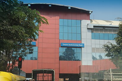
Swami Vivekananda Road (commonly referred to as SV Road) is an elevated metro station on the East-West corridor of the Purple Line of Namma Metro in Bangalore, India.Wiki
Places Near Swamy Vivekananda Road (Bengaluru)
How to get to popular places in Bengaluru with public transit
Get around Bengaluru by public transit!
Traveling around Bengaluru has never been so easy. See step by step directions as you travel to any attraction, street or major public transit station. View bus and train schedules, arrival times, service alerts and detailed routes on a map, so you know exactly how to get to anywhere in Bengaluru.
When traveling to any destination around Bengaluru use Moovit's Live Directions with Get Off Notifications to know exactly where and how far to walk, how long to wait for your line, and how many stops are left. Moovit will alert you when it's time to get off — no need to constantly re-check whether yours is the next stop.
Wondering how to use public transit in Bengaluru or how to pay for public transit in Bengaluru? Moovit public transit app can help you navigate your way with public transit easily, and at minimum cost. It includes public transit fees, ticket prices, and costs. Looking for a map of Bengaluru public transit lines? Moovit public transit app shows all public transit maps in Bengaluru with all Bus and Metro routes and stops on an interactive map.
Bengaluru has 2 transit type(s), including: Bus and Metro, operated by several transit agencies, including Namma Metro (BMRCL), Vayu-Vajra BMTC (Airport AC Services), Vajra BMTC (AC Services), Metro Feeder BMTC (MF Buses), BMTC (Bengaluru Metropolitan Transport Corporation) and NICE Road Services BMTC (NICE Buses)