Directions to T And S Auto Body And Storage (Boston) with public transportation
The following transit lines have routes that pass near T And S Auto Body And Storage
 Bus: 32, 33, 14, 30, 39.
- Train: NEEDHAM, FRANKLIN/FOXBORO, ORANGE LINE, PROVIDENCE/STOUGHTON, FAIRMOUNT.
- Subway: ORANGE LINE.
How to get to T And S Auto Body And Storage by bus?
Click on the bus route to see step by step directions with maps, line arrival times and updated time schedules.
From Long Wharf Station, Boston
72 minFrom Regina Pizzeria, Boston
61 minFrom Spaulding Hospital, Cambridge
74 minFrom Tip O'Neil Building, Boston
70 minFrom Hotel Aka Back Bay (Hotel Back Bay), Boston
44 minFrom Modern Pastry Shop, Boston
72 minFrom Boston City Hall, Boston
40 minFrom Td Garden, Boston
70 minFrom The Westin Copley Place, Boston, Boston
43 minFrom Boston Burger Company - Boston, Boston
44 min
How to get to T And S Auto Body And Storage by train?
Click on the train route to see step by step directions with maps, line arrival times and updated time schedules.
From Long Wharf Station, Boston
53 minFrom Regina Pizzeria, Boston
75 minFrom Tip O'Neil Building, Boston
58 minFrom Hotel Aka Back Bay (Hotel Back Bay), Boston
35 minFrom Modern Pastry Shop, Boston
54 minFrom Boston City Hall, Boston
42 minFrom Td Garden, Boston
60 minFrom The Westin Copley Place, Boston, Boston
35 minFrom Boston Burger Company - Boston, Boston
44 min
How to get to T And S Auto Body And Storage by subway?
Click on the subway route to see step by step directions with maps, line arrival times and updated time schedules.
From Long Wharf Station, Boston
51 minFrom Regina Pizzeria, Boston
78 minFrom Spaulding Hospital, Cambridge
72 minFrom Tip O'Neil Building, Boston
48 minFrom Hotel Aka Back Bay (Hotel Back Bay), Boston
42 minFrom Modern Pastry Shop, Boston
49 minFrom Boston City Hall, Boston
37 minFrom Td Garden, Boston
49 minFrom The Westin Copley Place, Boston, Boston
42 minFrom Boston Burger Company - Boston, Boston
47 min
Bus stops near T And S Auto Body And Storage in Boston
Train stations near T And S Auto Body And Storage in Boston
Bus lines to T And S Auto Body And Storage in Boston
What are the closest stations to T And S Auto Body And Storage?
The closest stations to T And S Auto Body And Storage are:
- Hyde Park Ave @ Southbourne Rd is 90 yards away, 2 min walk.
- Cummins Hwy @ Brown Ave is 348 yards away, 5 min walk.
- Bellevue is 1049 yards away, 13 min walk.
- Forest Hills is 1298 yards away, 16 min walk.
- Blue Hill Avenue is 3341 yards away, 40 min walk.
Which bus line stops near T And S Auto Body And Storage?
32 (Wolcott Square)
Which train line stops near T And S Auto Body And Storage?
NEEDHAM (#625 | Needham Heights)
Which subway line stops near T And S Auto Body And Storage?
ORANGE LINE (Forest Hills)
What’s the nearest train station to T And S Auto Body And Storage in Boston?
The nearest train station to T And S Auto Body And Storage in Boston is Bellevue. It’s a 13 min walk away.
What’s the nearest bus station to T And S Auto Body And Storage in Boston?
The nearest bus station to T And S Auto Body And Storage in Boston is Hyde Park Ave @ Southbourne Rd. It’s a 2 min walk away.
What time is the first subway to T And S Auto Body And Storage in Boston?
The ORANGE LINE is the first subway that goes to T And S Auto Body And Storage in Boston. It stops nearby at 5:15 AM.
What time is the last subway to T And S Auto Body And Storage in Boston?
The ORANGE LINE is the last subway that goes to T And S Auto Body And Storage in Boston. It stops nearby at 1:58 AM.
What time is the first train to T And S Auto Body And Storage in Boston?
The FAIRMOUNT is the first train that goes to T And S Auto Body And Storage in Boston. It stops nearby at 4:36 AM.
What time is the last train to T And S Auto Body And Storage in Boston?
The PROVIDENCE/STOUGHTON is the last train that goes to T And S Auto Body And Storage in Boston. It stops nearby at 12:08 AM.
What time is the first bus to T And S Auto Body And Storage in Boston?
The 39 is the first bus that goes to T And S Auto Body And Storage in Boston. It stops nearby at 4:32 AM.
What time is the last bus to T And S Auto Body And Storage in Boston?
The 32 is the last bus that goes to T And S Auto Body And Storage in Boston. It stops nearby at 1:38 AM.
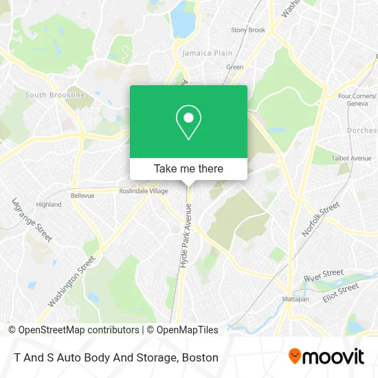
See T And S Auto Body And Storage, Boston, on the map
Public Transit to T And S Auto Body And Storage in Boston
Wondering how to get to T And S Auto Body And Storage in Boston? Moovit helps you find the best way to get to T And S Auto Body And Storage with step-by-step directions from the nearest public transit station.
Moovit provides free maps and live directions to help you navigate through your city. View schedules, routes, timetables, and find out how long does it take to get to T And S Auto Body And Storage in real time.
Looking for the nearest stop or station to T And S Auto Body And Storage? Check out this list of stops closest to your destination: Hyde Park Ave @ Southbourne Rd; Cummins Hwy @ Brown Ave; Bellevue; Forest Hills; Blue Hill Avenue.
Bus: 32, 33, 14, 30, 39.Train: NEEDHAM, FRANKLIN/FOXBORO, ORANGE LINE, PROVIDENCE/STOUGHTON, FAIRMOUNT.Subway: ORANGE LINE.
Want to see if there’s another route that gets you there at an earlier time? Moovit helps you find alternative routes or times. Get directions from and directions to T And S Auto Body And Storage easily from the Moovit App or Website.
We make riding to T And S Auto Body And Storage easy, which is why over 1.7 million users, including users in Boston, trust Moovit as the best app for public transit. You don’t need to download an individual bus app or train app, Moovit is your all-in-one transit app that helps you find the best bus time or train time available.
For information on prices of bus, subway and train, costs and ride fares to T And S Auto Body And Storage, please check the Moovit app.
Use the app to navigate to popular places including to the airport, hospital, stadium, grocery store, mall, coffee shop, school, college, and university.
T And S Auto Body And Storage Address: 415 Hyde Park Ave street in Boston
- Pay Attention To Detail,
- USPS Collection Box - Blue Box,
- Chùa Việt Nam Boston,
- La Nubian Experience,
- MBTA Commuter Rail Train #2707,
- US Army Reserve Center,
- 4040 Washington St Condos,
- Little Luff Childcare,
- Guira Y Tambora,
- Montello,
- Grunber,
- El Fogon Tipico Dominicano,
- Anomia Press,
- Roslindale,
- Little Caesars Pizza,
- Dale,
- Registry of Motor Vehicles,
- St Michaels Cemetery,
- Roslindale Sewr and Drain,
- Roslindale
Places Near T And S Auto Body And Storage (Boston)
- Isabella Stewart Gardner Museum, Boston,
- Wang Theater, Boston,
- House Of Blues, Boston,
- Cheers, Boston,
- Faneuil Hall, Boston,
- Leader Bank Pavilion (Leader Bank Pavillion), Boston,
- Td Garden, Boston,
- Castle Island, Boston,
- Massachusetts General Hospital, Boston,
- Mgm Music Hall, Boston,
- Prudential Center, Boston,
- North End, Boston,
- Museum Of Science, Boston,
- Seaport District, Boston,
- Boston Children's Hospital, Boston,
- Quincy Market, Boston,
- Boston Common, Boston,
- Boston Medical Center, Boston,
- Boston Convention & Exhibition Center, Boston,
- Wilbur Theatre, Boston
How to get to popular places in Boston with public transit
Get around Boston by public transit!
Traveling around Boston has never been so easy. See step by step directions as you travel to any attraction, street or major public transit station. View bus and train schedules, arrival times, service alerts and detailed routes on a map, so you know exactly how to get to anywhere in Boston.
When traveling to any destination around Boston use Moovit's Live Directions with Get Off Notifications to know exactly where and how far to walk, how long to wait for your line, and how many stops are left. Moovit will alert you when it's time to get off — no need to constantly re-check whether yours is the next stop.
Wondering how to use public transit in Boston or how to pay for public transit in Boston? Moovit public transit app can help you navigate your way with public transit easily, and at minimum cost. It includes public transit fees, ticket prices, and costs. Looking for a map of Boston public transit lines? Moovit public transit app shows all public transit maps in Boston with all Bus, Train, Subway and Ferry routes and stops on an interactive map.
Boston has 4 transit type(s), including: Bus, Train, Subway and Ferry, operated by several transit agencies, including MBTA, Southeastern Regional Transit Authority, MetroWest Regional Transit Authority, Rhode Island Public Transit Authority, WRTA, Lowell Regional Transit Authority, Merrimack Valley Transit, Montachusett Regional Transit Authority, Cape Cod Regional Transit Authority, Brockton Area Transit Authority, Martha's Vineyard Transit Authority, the WAVE - Nantucket Regional Transit Authority, GATRA, Cape Ann Transportation Authority and Massport