How to get to Td Bank Atm by bus?
Click on the bus route to see step by step directions with maps, line arrival times and updated time schedules.
From Fresh Pond Mall, Cambridge
90 minFrom Boston University Track and Tennis Center, Boston
96 minFrom Beth Israel Deaconess Medical Center (Shapiro Garage), Boston
94 minFrom Nahant Beach, Nahant
59 minFrom Trident Booksellers & Cafe, Boston
74 minFrom MBTA Alewife Station, Cambridge
89 minFrom 98 Binney St, Boston
93 minFrom South Boston Waterfront, Boston
35 minFrom Harvard Stadium, Boston
81 minFrom Hatch Shell, Boston
46 min
How to get to Td Bank Atm by train?
Click on the train route to see step by step directions with maps, line arrival times and updated time schedules.
How to get to Td Bank Atm by subway?
Click on the subway route to see step by step directions with maps, line arrival times and updated time schedules.
From Fresh Pond Mall, Cambridge
92 minFrom Boston University Track and Tennis Center, Boston
89 minFrom Beth Israel Deaconess Medical Center (Shapiro Garage), Boston
84 minFrom Trident Booksellers & Cafe, Boston
66 minFrom MBTA Alewife Station, Cambridge
78 minFrom 98 Binney St, Boston
84 minFrom South Boston Waterfront, Boston
71 minFrom Harvard Stadium, Boston
89 minFrom Hatch Shell, Boston
72 min
Bus stops near Td Bank Atm in Chelsea
Train station near Td Bank Atm in Chelsea
- Chelsea, 22 min walk,VIEW
Subway station near Td Bank Atm in Chelsea
- Revere Beach, 26 min walk,VIEW
Bus lines to Td Bank Atm in Chelsea
What are the closest stations to Td Bank Atm?
The closest stations to Td Bank Atm are:
- Broadway @ Beach St is 75 yards away, 2 min walk.
- Beach St @ Wilson St is 141 yards away, 2 min walk.
- Hillside Ave @ Crest Ave is 262 yards away, 4 min walk.
- Chelsea is 1850 yards away, 22 min walk.
- Revere Beach is 2185 yards away, 26 min walk.
Which bus lines stop near Td Bank Atm?
These bus lines stop near Td Bank Atm: 110, 112, 116.
Which train line stops near Td Bank Atm?
NEWBURYPORT/ROCKPORT (#125 | Newburyport)
Which subway line stops near Td Bank Atm?
BLUE LINE (Wonderland)
What’s the nearest subway station to Td Bank Atm in Chelsea?
The nearest subway station to Td Bank Atm in Chelsea is Revere Beach. It’s a 26 min walk away.
What’s the nearest train station to Td Bank Atm in Chelsea?
The nearest train station to Td Bank Atm in Chelsea is Chelsea. It’s a 22 min walk away.
What’s the nearest bus station to Td Bank Atm in Chelsea?
The nearest bus stations to Td Bank Atm in Chelsea are Broadway @ Beach St and Beach St @ Wilson St. The closest one is a 2 min walk away.
What time is the first subway to Td Bank Atm in Chelsea?
The BLUE LINE is the first subway that goes to Td Bank Atm in Chelsea. It stops nearby at 5:08 AM.
What time is the last subway to Td Bank Atm in Chelsea?
The BLUE LINE is the last subway that goes to Td Bank Atm in Chelsea. It stops nearby at 2:08 AM.
What time is the first train to Td Bank Atm in Chelsea?
The NEWBURYPORT/ROCKPORT is the first train that goes to Td Bank Atm in Chelsea. It stops nearby at 5:40 AM.
What time is the last train to Td Bank Atm in Chelsea?
The NEWBURYPORT/ROCKPORT is the last train that goes to Td Bank Atm in Chelsea. It stops nearby at 12:06 AM.
What time is the first bus to Td Bank Atm in Chelsea?
The 116 is the first bus that goes to Td Bank Atm in Chelsea. It stops nearby at 4:28 AM.
What time is the last bus to Td Bank Atm in Chelsea?
The 116 is the last bus that goes to Td Bank Atm in Chelsea. It stops nearby at 2:23 AM.
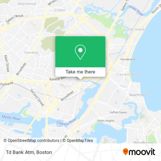
See Td Bank Atm, Chelsea, on the map
Public Transit to Td Bank Atm in Chelsea
Wondering how to get to Td Bank Atm in Chelsea? Moovit helps you find the best way to get to Td Bank Atm with step-by-step directions from the nearest public transit station.
Moovit provides free maps and live directions to help you navigate through your city. View schedules, routes, timetables, and find out how long does it take to get to Td Bank Atm in real time.
Looking for the nearest stop or station to Td Bank Atm? Check out this list of stops closest to your destination: Broadway @ Beach St; Beach St @ Wilson St; Hillside Ave @ Crest Ave; Chelsea; Revere Beach.
Bus: 110, 112, 116, 119.Train: NEWBURYPORT/ROCKPORT.Subway: BLUE LINE.
Want to see if there’s another route that gets you there at an earlier time? Moovit helps you find alternative routes or times. Get directions from and directions to Td Bank Atm easily from the Moovit App or Website.
We make riding to Td Bank Atm easy, which is why over 1.7 million users, including users in Chelsea, trust Moovit as the best app for public transit. You don’t need to download an individual bus app or train app, Moovit is your all-in-one transit app that helps you find the best bus time or train time available.
For information on prices of bus, subway and train, costs and ride fares to Td Bank Atm, please check the Moovit app.
Use the app to navigate to popular places including to the airport, hospital, stadium, grocery store, mall, coffee shop, school, college, and university.
Td Bank Atm Address: 1010 Broadway street in Chelsea
- Walgreens Pharmacy,
- Walgreens #3759,
- WESTERN UNION,
- Holiday Inn Boston Logan Airport - Chelsea,
- Holiday Inn Boston Logan Airport - Chelsea,
- Atm Walgreens,
- Bidhc,
- Beth Israel Deaconess Urgent Care at Chelsea,
- Beth Israel Deaconess Medical Center (Narayanaswami Pushpa MD Beth Israel Deaconess Healthcare),
- Holiday Inn Boston Logan Airport - Chelsea Fitness Center,
- Liam Trucking Corp.,
- Jose Abrego, Md,
- Felipe’S Driving School,
- P.F.C. Dennis J. Sullivan Bridge,
- D'Joel Barbershop,
- Margolis Apartments,
- Petraslim,
- Crest Printing Co.,
- Bispo Paulo Tenorio Ap Boston,
- Una Nueva Vida En Cristo
Places Near Td Bank Atm (Chelsea)
- Td Garden, Boston,
- House Of Blues, Boston,
- Museum Of Science, Boston,
- Castle Island, Boston,
- Boston Children's Hospital, Boston,
- Quincy Market, Boston,
- Faneuil Hall, Boston,
- Mgm Music Hall, Boston,
- Boston Common, Boston,
- Seaport District, Boston,
- Wilbur Theatre, Boston,
- North End, Boston,
- Boston Medical Center, Boston,
- Leader Bank Pavilion (Leader Bank Pavillion), Boston,
- Massachusetts General Hospital, Boston,
- Cheers, Boston,
- Wang Theater, Boston,
- Prudential Center, Boston,
- Boston Convention & Exhibition Center, Boston,
- Isabella Stewart Gardner Museum, Boston
How to get to popular places in Boston with public transit
Get around Chelsea by public transit!
Traveling around Chelsea has never been so easy. See step by step directions as you travel to any attraction, street or major public transit station. View bus and train schedules, arrival times, service alerts and detailed routes on a map, so you know exactly how to get to anywhere in Chelsea.
When traveling to any destination around Chelsea use Moovit's Live Directions with Get Off Notifications to know exactly where and how far to walk, how long to wait for your line, and how many stops are left. Moovit will alert you when it's time to get off — no need to constantly re-check whether yours is the next stop.
Wondering how to use public transit in Chelsea or how to pay for public transit in Chelsea? Moovit public transit app can help you navigate your way with public transit easily, and at minimum cost. It includes public transit fees, ticket prices, and costs. Looking for a map of Chelsea public transit lines? Moovit public transit app shows all public transit maps in Chelsea with all Bus, Train, Subway and Ferry routes and stops on an interactive map.
Boston has 4 transit type(s), including: Bus, Train, Subway and Ferry, operated by several transit agencies, including MBTA, Southeastern Regional Transit Authority, MetroWest Regional Transit Authority, Rhode Island Public Transit Authority, WRTA, Lowell Regional Transit Authority, Merrimack Valley Transit, Montachusett Regional Transit Authority, Cape Cod Regional Transit Authority, Brockton Area Transit Authority, Martha's Vineyard Transit Authority, the WAVE - Nantucket Regional Transit Authority, GATRA, Cape Ann Transportation Authority and Massport