Directions to Temple Ohabei Shalom Cemetery (Boston) with public transportation
The following transit lines have routes that pass near Temple Ohabei Shalom Cemetery
How to get to Temple Ohabei Shalom Cemetery by bus?
Click on the bus route to see step by step directions with maps, line arrival times and updated time schedules.
How to get to Temple Ohabei Shalom Cemetery by train?
Click on the train route to see step by step directions with maps, line arrival times and updated time schedules.
How to get to Temple Ohabei Shalom Cemetery by subway?
Click on the subway route to see step by step directions with maps, line arrival times and updated time schedules.
Bus stations near Temple Ohabei Shalom Cemetery in Boston
- Bennington St @ Byron St, 3 min walk,
- Mcclellan Highway Opp Addison St, 11 min walk,
- Chelsea St Opp Curtis St, 21 min walk,
Subway stations near Temple Ohabei Shalom Cemetery in Boston
- Wood Island, 13 min walk,
Bus lines to Temple Ohabei Shalom Cemetery in Boston
- 120, Maverick Via Jeffries Point,
- 450, Salem Depot,
- 112, Wood Island Via Market Basket & Admiral's Hill,
What are the closest stations to Temple Ohabei Shalom Cemetery?
The closest stations to Temple Ohabei Shalom Cemetery are:
- Bennington St @ Byron St is 101 yards away, 3 min walk.
- Mcclellan Highway Opp Addison St is 808 yards away, 11 min walk.
- Wood Island is 982 yards away, 13 min walk.
- Chelsea St Opp Curtis St is 1652 yards away, 21 min walk.
Which bus lines stop near Temple Ohabei Shalom Cemetery?
These bus lines stop near Temple Ohabei Shalom Cemetery: 120, 450, BRAINTREE, SL3.
Which train line stops near Temple Ohabei Shalom Cemetery?
NEWBURYPORT/ROCKPORT
Which subway line stops near Temple Ohabei Shalom Cemetery?
BLUE LINE
What’s the nearest subway station to Temple Ohabei Shalom Cemetery in Boston?
The nearest subway station to Temple Ohabei Shalom Cemetery in Boston is Wood Island. It’s a 13 min walk away.
What’s the nearest bus stop to Temple Ohabei Shalom Cemetery in Boston?
The nearest bus stop to Temple Ohabei Shalom Cemetery in Boston is Bennington St @ Byron St. It’s a 3 min walk away.
See Temple Ohabei Shalom Cemetery, Boston, on the map
Public Transit to Temple Ohabei Shalom Cemetery in Boston
Wondering how to get to Temple Ohabei Shalom Cemetery in Boston, United States? Moovit helps you find the best way to get to Temple Ohabei Shalom Cemetery with step-by-step directions from the nearest public transit station.
Moovit provides free maps and live directions to help you navigate through your city. View schedules, routes, timetables, and find out how long does it take to get to Temple Ohabei Shalom Cemetery in real time.
Looking for the nearest stop or station to Temple Ohabei Shalom Cemetery? Check out this list of stops closest to your destination: Bennington St @ Byron St; Mcclellan Highway Opp Addison St; Wood Island; Chelsea St Opp Curtis St.
Bus: 120, 450, BRAINTREE, SL3, 112.Train: NEWBURYPORT/ROCKPORT.Subway: BLUE LINE.
Want to see if there’s another route that gets you there at an earlier time? Moovit helps you find alternative routes or times. Get directions from and directions to Temple Ohabei Shalom Cemetery easily from the Moovit App or Website.
We make riding to Temple Ohabei Shalom Cemetery easy, which is why over 1.5 million users, including users in Boston, trust Moovit as the best app for public transit. You don’t need to download an individual bus app or train app, Moovit is your all-in-one transit app that helps you find the best bus time or train time available.
For information on prices of subway, bus and train, costs and ride fares to Temple Ohabei Shalom Cemetery, please check the Moovit app.
Use the app to navigate to popular places including to the airport, hospital, stadium, grocery store, mall, coffee shop, school, college, and university.
Temple Ohabei Shalom Cemetery Address: Byron Street street in Boston
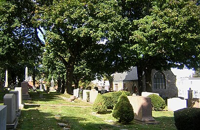
Temple Ohabei Shalom Cemetery is a historic Jewish cemetery located at 147 Wordsworth Street in East Boston, Massachusetts.Wiki
Attractions near Temple Ohabei Shalom Cemetery
Salesian Boys And Girls Club of East Boston,225 Horace St,Festa Field,Edward Brooke Charter School - East Boston,185 Wordsworth St,Fmder Cleaning E Repair,A Plus24 Hour Locksmiths,East Boston Neighborhood Health Center Education & Training Institute,Constitution Beach,Belle Isle Marsh Reservation,175 William F McClellan Highway,Porrazzo Memorial Skating Rink,Carlo's Market & Cold Cut Center (Sammy Carlo's Delicatessen & Catering),11 Trustman Terrace,courtyard marriot crew lounge,Courtyard Boston Logan Airport,Courtyard by Marriott Boston Logan Airport,Constitution Beach,Orient Heights Beach,Maverick MillsHow to get to popular attractions in Boston with public transit
Target, Lowell,Simmons College, Boston,Dana Farber Cancer Institute, Boston,bank of america pavilion, Boston,South Boston, Boston,Dorchester Ave, Boston,Woburn, MA,Mgm Music Hall, Boston,Wellington Station, Medford,Wang Theater, Boston,Somerville, MA, Somerville,North Andover,Boston Medical Center, Boston,Foxborough, Foxborough,Boston Beer Co-Samuel Adams Brewery, Boston,Nantasket Beach, Hull,Northeastern University, Boston,South Boston Waterfront, Boston,The Mall At Chestnut Hill, Newton,East Boston, BostonGet around Boston by public transit!
Traveling around Boston has never been so easy. See step by step directions as you travel to any attraction, street or major public transit station. View bus and train schedules, arrival times, service alerts and detailed routes on a map, so you know exactly how to get to anywhere in Boston.
When traveling to any destination around Boston use Moovit's Live Directions with Get Off Notifications to know exactly where and how far to walk, how long to wait for your line, and how many stops are left. Moovit will alert you when it's time to get off — no need to constantly re-check whether yours is the next stop.
Wondering how to use public transit in Boston or how to pay for public transit in Boston? Moovit public transit app can help you navigate your way with public transit easily, and at minimum cost. It includes public transit fees, ticket prices, and costs. Looking for a map of Boston public transit lines? Moovit public transit app shows all public transit maps in Boston with all Bus, Train, Subway and Ferry routes and stops on an interactive map.
Boston has 4 transit type(s), including: Bus, Train, Subway and Ferry, operated by several transit agencies, including MBTA, Southeastern Regional Transit Authority, MetroWest Regional Transit Authority, Rhode Island Public Transit Authority, WRTA, Lowell Regional Transit Authority, Merrimack Valley Transit, Montachusett Regional Transit Authority, Cape Cod Regional Transit Authority, Brockton Area Transit Authority, Martha's Vineyard Transit Authority, the WAVE - Nantucket Regional Transit Authority, GATRA, Cape Ann Transportation Authority, Massport