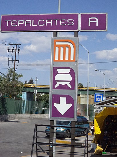
Directions to Tepalcates station (Venustiano Carranza) with public transit
The following transit lines have routes that pass near Tepalcates
How to get to Tepalcates station by bus?
Click on the bus route to see step by step directions with maps, line arrival times and updated time schedules.
How to get to Tepalcates station by metro?
Click on the metro route to see step by step directions with maps, line arrival times and updated time schedules.
Bus stops near Tepalcates in Venustiano Carranza
- José Arrese Y Miguel Hidalgo, 1 min walk,
- José Arrese - Mina, 2 min walk,
- José Arrese - Cda. Miguel Hidalgo, 3 min walk,
- Fray Jesús Almaza Y Miguel Hidalgo, 5 min walk,
- Av. Gral. Antonio de León Loyola - Cetram Tepalcates, 6 min walk,
Metro stations near Tepalcates in Venustiano Carranza
- Guelatao, 25 min walk,
- Pantitlán, 25 min walk,
Bus lines to Tepalcates station in Venustiano Carranza
- 9A, La Valenciana - Tacubaya Por Qro.,
- 9B, Metro Puebla Por Sur 8 - La Valenciana,
- 9C, La Valenciana - Tacubaya Por Contraflujo,
- 9D, Metro Puebla Por Sur 20 - La Valenciana,
- 9E, Tacubaya Por Campeche - Tepalcates,
- RUTA 31, Xola,
- RUTA 31, Tepalcates,
- RUTA 110, Chapultepec,
- 14A, Metro Tepalcates - San Antonio Abad,
- RUTA 51, Tepalcates,
- 108, Metro Tepalcates,
What are the closest stations to Tepalcates?
The closest stations to Tepalcates are:
- José Arrese Y Miguel Hidalgo is 55 meters away, 1 min walk.
- José Arrese - Mina is 91 meters away, 2 min walk.
- José Arrese - Cda. Miguel Hidalgo is 172 meters away, 3 min walk.
- Fray Jesús Almaza Y Miguel Hidalgo is 309 meters away, 5 min walk.
- Av. Gral. Antonio de León Loyola - Cetram Tepalcates is 396 meters away, 6 min walk.
- Guelatao is 1893 meters away, 25 min walk.
- Pantitlán is 1904 meters away, 25 min walk.
Which bus lines stop near Tepalcates?
These bus lines stop near Tepalcates: 2, 89-2, 9C, 9E, RUTA 104, RUTA 31.
Which metro line stops near Tepalcates?
A (Dirección La Paz)
What’s the nearest metro station to Tepalcates in Venustiano Carranza?
The nearest metro stations to Tepalcates in Venustiano Carranza are Guelatao and Pantitlán. The closest one is a 25 min walk away.
What’s the nearest bus station to Tepalcates in Venustiano Carranza?
The nearest bus station to Tepalcates in Venustiano Carranza is José Arrese Y Miguel Hidalgo. It’s a 1 min walk away.
What time is the first metro to Tepalcates in Venustiano Carranza?
The 5 is the first metro that goes to Tepalcates in Venustiano Carranza. It stops nearby at 7:00 AM.
What time is the last metro to Tepalcates in Venustiano Carranza?
The 1 is the last metro that goes to Tepalcates in Venustiano Carranza. It stops nearby at 12:46 AM.
What time is the first bus to Tepalcates in Venustiano Carranza?
The 9E is the first bus that goes to Tepalcates in Venustiano Carranza. It stops nearby at 5:00 AM.
What time is the last bus to Tepalcates in Venustiano Carranza?
The 9A is the last bus that goes to Tepalcates in Venustiano Carranza. It stops nearby at 12:18 AM.
See Tepalcates, Venustiano Carranza, on the map
Public Transit to Tepalcates in Venustiano Carranza
How to get to Tepalcates in Venustiano Carranza, México?
It’s easy with Moovit. Type in your street address and Moovit’s route finder will locate the fastest way to get you there! Not sure where to get off on the street? Download the Moovit App to find live directions (including where to get off on Tepalcates), see timetables and get the estimated arrival times for your favorite bus or metro lines.
Looking for the nearest stop or station to Tepalcates? Check out this list of closest stops available to your destination: José Arrese Y Miguel Hidalgo; José Arrese - Mina; José Arrese - Cda. Miguel Hidalgo; Fray Jesús Almaza Y Miguel Hidalgo; Av. Gral. Antonio de León Loyola - Cetram Tepalcates; Guelatao; Pantitlán.
Bus: 2, 89-2, 9C, 9E, RUTA 104, RUTA 31, 9A, 9B, 9D, RUTA 110, 14A.Metro: A, 1, 5, 9.
Download the Moovit App to see the current schedule and routes available for Venustiano Carranza. No need to install a special bus app to check the bus time or a train app to get train time. Moovit is the only all-in-one transit app that helps you get where you need to go.
We make riding on public transit to Tepalcates easy, which is why over 1.5 million users, including users in Venustiano Carranza trust Moovit as the best app for public transit.
Use the app to navigate to popular places including to the airport, hospital, stadium, grocery store, mall, coffee shop, school, college, and university.
Location: Venustiano Carranza, Ciudad de Mexico
Streets near Tepalcates, Venustiano Carranza
Get around Venustiano Carranza by public transit!
Traveling around Venustiano Carranza has never been so easy. See step by step directions as you travel to any attraction, street or major public transit station. View bus and train schedules, arrival times, service alerts and detailed routes on a map, so you know exactly how to get to anywhere in Venustiano Carranza.
When traveling to any destination around Venustiano Carranza use Moovit's Live Directions with Get Off Notifications to know exactly where and how far to walk, how long to wait for your line, and how many stops are left. Moovit will alert you when it's time to get off — no need to constantly re-check whether yours is the next stop.
Wondering how to use public transit in Venustiano Carranza or how to pay for public transit in Venustiano Carranza? Moovit public transit app can help you navigate your way with public transit easily, and at minimum cost. It includes public transit fees, ticket prices, and costs. Looking for a map of Venustiano Carranza public transit lines? Moovit public transit app shows all public transit maps in Venustiano Carranza with all Bus, Train, Metro, Cable Car and Gondola routes and stops on an interactive map.
Ciudad de Mexico has 5 transit type(s), including: Bus, Train, Metro, Cable Car and Gondola, operated by several transit agencies, including STC (Metro CDMX), Ferrocarriles Suburbanos, Trolebús, Puma Bus, Mexibus, Autobuses / Combis, Tren Ligero, Mexicable, Peseros, Cablebús, Trolebús elevado, Corredores Concesionados, RTP, Metrobús and Tren El Insurgente