Directions to The Boston Central Adult High School with public transportation
The following transit lines have routes that pass near The Boston Central Adult High School
 Bus: 15, 23, 28, 44, 45.
- Train: NEEDHAM, PROVIDENCE/STOUGHTON, FRANKLIN/FOXBORO.
- Subway: ORANGE LINE, GREEN LINE E.
How to get to The Boston Central Adult High School by bus?
Click on the bus route to see step by step directions with maps, line arrival times and updated time schedules.
From MBTA Suffolk Downs Station
79 minFrom Chelsea, MA
72 minFrom Suffolk Downs
75 minFrom Boston College (BC)
62 minFrom Georgetown, Massachusetts
65 minFrom Downeast Cider House
72 minFrom Academy Of the Pacific Rim Charter Public School
76 minFrom St. Elizabeth's Medical Center
33 minFrom Silver Line Stop Terminal B
47 minFrom Winthrop
130 min
How to get to The Boston Central Adult High School by train?
Click on the train route to see step by step directions with maps, line arrival times and updated time schedules.
How to get to The Boston Central Adult High School by subway?
Click on the subway route to see step by step directions with maps, line arrival times and updated time schedules.
Bus stops near The Boston Central Adult High School
Subway stations near The Boston Central Adult High School
Train station near The Boston Central Adult High School
- Ruggles, 23 min walk,VIEW
Bus lines to The Boston Central Adult High School
- 14, Heath St,VIEW
- 41, Jfk/Umass,VIEW
- 45, Ruggles,VIEW
- 15, Ruggles - Fields Corner,VIEW
- 19, Kenmore - Fields Corner,VIEW
- 23, Ruggles - Ashmont,VIEW
- 28, Ruggles - Mattapan,VIEW
- 44, Ruggles - Jackson Square,VIEW
- 66, Nubian via Allston - Harvard via Allston,VIEW
- 22, Kenmore Via Ruggles,VIEW
- 8, Harbor Point Via South Bay Center,VIEW
- 47, Broadway,VIEW
What are the closest stations to The Boston Central Adult High School?
The closest stations to The Boston Central Adult High School are:
- 42a John Eliot Sq is 66 yards away, 2 min walk.
- Malcolm X Blvd @ Shawmut Ave is 68 yards away, 1 min walk.
- Tremont St @ Prentiss St is 142 yards away, 2 min walk.
- Longwood Medical Area is 501 yards away, 7 min walk.
- Ruggles St @ Cabot St is 601 yards away, 8 min walk.
- Roxbury Crossing is 1900 yards away, 23 min walk.
- Ruggles is 1949 yards away, 23 min walk.
Which bus lines stop near The Boston Central Adult High School?
These bus lines stop near The Boston Central Adult High School: 15, 23, 28, 44, 45, 66, BB.
Which train lines stop near The Boston Central Adult High School?
These train lines stop near The Boston Central Adult High School: NEEDHAM, PROVIDENCE/STOUGHTON.
Which subway line stops near The Boston Central Adult High School?
ORANGE LINE (Forest Hills)
What’s the nearest subway station to The Boston Central Adult High School?
The nearest subway station to The Boston Central Adult High School is Longwood Medical Area. It’s a 7 min walk away.
What’s the nearest train station to The Boston Central Adult High School?
The nearest train station to The Boston Central Adult High School is Ruggles. It’s a 23 min walk away.
What’s the nearest bus station to The Boston Central Adult High School?
The nearest bus stations to The Boston Central Adult High School are 42a John Eliot Sq and Tremont St @ Prentiss St. The closest one is a 2 min walk away.
What time is the first subway to The Boston Central Adult High School?
The GREEN LINE E is the first subway that goes to The Boston Central Adult High School. It stops nearby at 5:20 AM.
What time is the last subway to The Boston Central Adult High School?
The GREEN LINE E is the last subway that goes to The Boston Central Adult High School. It stops nearby at 2:07 AM.
What time is the first train to The Boston Central Adult High School?
The PROVIDENCE/STOUGHTON is the first train that goes to The Boston Central Adult High School. It stops nearby at 4:28 AM.
What time is the last train to The Boston Central Adult High School?
The PROVIDENCE/STOUGHTON is the last train that goes to The Boston Central Adult High School. It stops nearby at 12:34 AM.
What time is the first bus to The Boston Central Adult High School?
The 66 is the first bus that goes to The Boston Central Adult High School. It stops nearby at 4:46 AM.
What time is the last bus to The Boston Central Adult High School?
The 66 is the last bus that goes to The Boston Central Adult High School. It stops nearby at 2:32 AM.
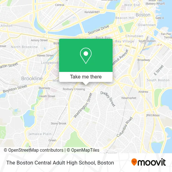
See The Boston Central Adult High School on the map
Public Transportation to The Boston Central Adult High School
Wondering how to get to The Boston Central Adult High School? Moovit helps you find the best way to get to The Boston Central Adult High School with step-by-step directions from the nearest public transit station.
Moovit provides free maps and live directions to help you navigate through your city. View schedules, routes, timetables, and find out how long does it take to get to The Boston Central Adult High School in real time.
Looking for the nearest stop or station to The Boston Central Adult High School? Check out this list of stops closest to your destination: 42a John Eliot Sq; Malcolm X Blvd @ Shawmut Ave; Tremont St @ Prentiss St; Longwood Medical Area; Ruggles St @ Cabot St; Roxbury Crossing; Ruggles.
Bus: 15, 23, 28, 44, 45, 66, BB, 19, 14, 41, 22.Train: NEEDHAM, PROVIDENCE/STOUGHTON, FRANKLIN/FOXBORO.Subway: ORANGE LINE, GREEN LINE E.
Want to see if there’s another route that gets you there at an earlier time? Moovit helps you find alternative routes or times. Get directions from and directions to The Boston Central Adult High School easily from the Moovit App or Website.
We make riding to The Boston Central Adult High School easy, which is why over 1.7 million users, including users in Boston, trust Moovit as the best app for public transit. You don’t need to download an individual bus app or train app, Moovit is your all-in-one transit app that helps you find the best bus time or train time available.
For information on prices of bus, subway and train, costs and ride fares to The Boston Central Adult High School, please check the Moovit app.
Use the app to navigate to popular places including to the airport, hospital, stadium, grocery store, mall, coffee shop, school, college, and university.
The Boston Central Adult High School Address: 55 Malcolm X Blvd street in Boston
- Madison Park Technical Vocational High School,
- O'Bryant High School,
- Laundry Locales,
- Statewide Black Clergy,
- Safohaircom,
- Safo Hair,
- Roxbury Crossing,
- Premiere Customized Services,
- Acedone,
- Black Economic Council of Ma,
- Psi Omega Chapter of Alpha Kappa Alpha Sorority,
- Amazon Counter-Health Mart Pharmacy,
- Health Mart Pharmacy,
- Pharmaluxe Pharmacy,
- Omega Locksmith,
- Visit Nubian Square,
- Roxbury,
- Boston Town 25 Locks Change,
- Whittier Street Health Center,
- Dillaway School
Places Near The Boston Central Adult High School
- Massachusetts General Hospital, Boston,
- Boston Common, Boston,
- Prudential Center, Boston,
- Td Garden, Boston,
- Boston Medical Center, Boston,
- Boston Children's Hospital, Boston,
- House Of Blues, Boston,
- Boston Convention & Exhibition Center, Boston,
- Museum Of Science, Boston,
- Wang Theater, Boston,
- Isabella Stewart Gardner Museum, Boston,
- Quincy Market, Boston,
- Leader Bank Pavilion (Leader Bank Pavillion), Boston,
- Cheers, Boston,
- Castle Island, Boston,
- North End, Boston,
- Mgm Music Hall, Boston,
- Wilbur Theatre, Boston,
- Seaport District, Boston,
- Faneuil Hall, Boston
How to get to popular places in Boston with public transit
Get around Boston by public transit!
Traveling around Boston has never been so easy. See step by step directions as you travel to any attraction, street or major public transit station. View bus and train schedules, arrival times, service alerts and detailed routes on a map, so you know exactly how to get to anywhere in Boston.
When traveling to any destination around Boston use Moovit's Live Directions with Get Off Notifications to know exactly where and how far to walk, how long to wait for your line, and how many stops are left. Moovit will alert you when it's time to get off — no need to constantly re-check whether yours is the next stop.
Wondering how to use public transit in Boston or how to pay for public transit in Boston? Moovit public transit app can help you navigate your way with public transit easily, and at minimum cost. It includes public transit fees, ticket prices, and costs. Looking for a map of Boston public transit lines? Moovit public transit app shows all public transit maps in Boston with all Bus, Train, Subway and Ferry routes and stops on an interactive map.
Boston has 4 transit type(s), including: Bus, Train, Subway and Ferry, operated by several transit agencies, including MBTA, Southeastern Regional Transit Authority, MetroWest Regional Transit Authority, Rhode Island Public Transit Authority, WRTA, Lowell Regional Transit Authority, Merrimack Valley Transit, Montachusett Regional Transit Authority, Cape Cod Regional Transit Authority, Brockton Area Transit Authority, Martha's Vineyard Transit Authority, the WAVE - Nantucket Regional Transit Authority, GATRA, Cape Ann Transportation Authority and Massport