Directions to The Curl Nook (Watertown Town) with public transportation
The following transit lines have routes that pass near The Curl Nook
 Bus: 70, 64, 71.
- Train: FRAMINGHAM/WORCESTER.
- Subway: GREEN LINE B.
How to get to The Curl Nook by bus?
Click on the bus route to see step by step directions with maps, line arrival times and updated time schedules.
From Capo Restaurant & Supper Club, Boston
73 minFrom Canopy by Hilton Boston Downtown, Boston
63 minFrom new hampshire!, Boston
57 minFrom Aloft Boston Seaport, Boston
60 minFrom Capo, Boston
73 minFrom Aloft-Boston Seaport Dist, Boston
59 minFrom Downtown, Boston
47 minFrom Boston Temple, Boston
57 minFrom Faneuil Hall, Boston
55 minFrom The Tall Ship, Boston
102 min
How to get to The Curl Nook by train?
Click on the train route to see step by step directions with maps, line arrival times and updated time schedules.
How to get to The Curl Nook by subway?
Click on the subway route to see step by step directions with maps, line arrival times and updated time schedules.
From Capo Restaurant & Supper Club, Boston
97 minFrom Canopy by Hilton Boston Downtown, Boston
82 minFrom Aloft Boston Seaport, Boston
100 minFrom Capo, Boston
97 minFrom Aloft-Boston Seaport Dist, Boston
104 minFrom Downtown, Boston
78 minFrom Boston Temple, Boston
72 minFrom Faneuil Hall, Boston
81 minFrom The Tall Ship, Boston
94 min
Bus stops near The Curl Nook in Watertown Town
Subway station near The Curl Nook in Watertown Town
- Chiswick Road, 14 min walk,VIEW
Bus lines to The Curl Nook in Watertown Town
What are the closest stations to The Curl Nook?
The closest stations to The Curl Nook are:
- Birmingham Pkwy @ Soldiers Field Rd is 361 yards away, 5 min walk.
- Arsenal St @ Talcott Ave is 442 yards away, 6 min walk.
- Mt Auburn St @ Winthrop St is 749 yards away, 9 min walk.
- Chiswick Road is 1183 yards away, 14 min walk.
Which bus line stops near The Curl Nook?
70 (Market Place Dr)
Which train line stops near The Curl Nook?
FRAMINGHAM/WORCESTER (#525 | Worcester)
Which subway line stops near The Curl Nook?
GREEN LINE B (Boston College)
What’s the nearest subway station to The Curl Nook in Watertown Town?
The nearest subway station to The Curl Nook in Watertown Town is Chiswick Road. It’s a 14 min walk away.
What’s the nearest bus station to The Curl Nook in Watertown Town?
The nearest bus station to The Curl Nook in Watertown Town is Birmingham Pkwy @ Soldiers Field Rd. It’s a 5 min walk away.
What time is the first subway to The Curl Nook in Watertown Town?
The GREEN LINE B is the first subway that goes to The Curl Nook in Watertown Town. It stops nearby at 5:01 AM.
What time is the last subway to The Curl Nook in Watertown Town?
The GREEN LINE B is the last subway that goes to The Curl Nook in Watertown Town. It stops nearby at 2:39 AM.
What time is the first bus to The Curl Nook in Watertown Town?
The 70 is the first bus that goes to The Curl Nook in Watertown Town. It stops nearby at 4:35 AM.
What time is the last bus to The Curl Nook in Watertown Town?
The 64 is the last bus that goes to The Curl Nook in Watertown Town. It stops nearby at 1:23 AM.
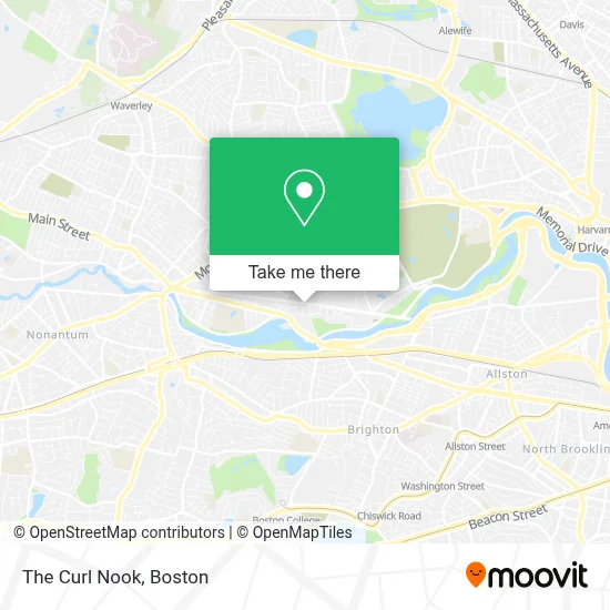
See The Curl Nook, Watertown Town, on the map
Public Transit to The Curl Nook in Watertown Town
Wondering how to get to The Curl Nook in Watertown Town? Moovit helps you find the best way to get to The Curl Nook with step-by-step directions from the nearest public transit station.
Moovit provides free maps and live directions to help you navigate through your city. View schedules, routes, timetables, and find out how long does it take to get to The Curl Nook in real time.
Looking for the nearest stop or station to The Curl Nook? Check out this list of stops closest to your destination: Birmingham Pkwy @ Soldiers Field Rd; Arsenal St @ Talcott Ave; Mt Auburn St @ Winthrop St; Chiswick Road.
Bus: 70, 64, 71.Train: FRAMINGHAM/WORCESTER.Subway: GREEN LINE B.
Want to see if there’s another route that gets you there at an earlier time? Moovit helps you find alternative routes or times. Get directions from and directions to The Curl Nook easily from the Moovit App or Website.
We make riding to The Curl Nook easy, which is why over 1.7 million users, including users in Watertown Town, trust Moovit as the best app for public transit. You don’t need to download an individual bus app or train app, Moovit is your all-in-one transit app that helps you find the best bus time or train time available.
For information on prices of bus, subway and train, costs and ride fares to The Curl Nook, please check the Moovit app.
Use the app to navigate to popular places including to the airport, hospital, stadium, grocery store, mall, coffee shop, school, college, and university.
The Curl Nook Address: Arsenal St street in Watertown Town
- Arsenal Mall,
- Harvard Vanguard Medical Associates, Watertown,
- athenahealth,
- Ember Therapeutics,
- Hampton Inn & Suites-Hampton Watertown Boston ,
- The People's Barbers,
- ATM,
- Unbank Bitcoin ATM,
- NESN,
- Winters Home Services,
- Ulta Beauty,
- Real Estate 109,
- Kosko Landscaping,
- Watertown Mall,
- DMV Watertown,
- Boston Sunshine Floors,
- Bayles Removal Unlimited,
- Roche Bros (Roche Brothers),
- Recon Roofing and Gutters,
- Watertown RMV Service Center
Places Near The Curl Nook (Watertown Town)
- North End, Boston,
- Wilbur Theatre, Boston,
- Boston Convention & Exhibition Center, Boston,
- Isabella Stewart Gardner Museum, Boston,
- Quincy Market, Boston,
- Leader Bank Pavilion (Leader Bank Pavillion), Boston,
- Boston Common, Boston,
- Boston Medical Center, Boston,
- Boston Children's Hospital, Boston,
- Museum Of Science, Boston,
- Cheers, Boston,
- Mgm Music Hall, Boston,
- House Of Blues, Boston,
- Prudential Center, Boston,
- Castle Island, Boston,
- Wang Theater, Boston,
- Faneuil Hall, Boston,
- Td Garden, Boston,
- Seaport District, Boston,
- Massachusetts General Hospital, Boston
How to get to popular places in Boston with public transit
Get around Watertown Town by public transit!
Traveling around Watertown Town has never been so easy. See step by step directions as you travel to any attraction, street or major public transit station. View bus and train schedules, arrival times, service alerts and detailed routes on a map, so you know exactly how to get to anywhere in Watertown Town.
When traveling to any destination around Watertown Town use Moovit's Live Directions with Get Off Notifications to know exactly where and how far to walk, how long to wait for your line, and how many stops are left. Moovit will alert you when it's time to get off — no need to constantly re-check whether yours is the next stop.
Wondering how to use public transit in Watertown Town or how to pay for public transit in Watertown Town? Moovit public transit app can help you navigate your way with public transit easily, and at minimum cost. It includes public transit fees, ticket prices, and costs. Looking for a map of Watertown Town public transit lines? Moovit public transit app shows all public transit maps in Watertown Town with all Bus, Train, Subway and Ferry routes and stops on an interactive map.
Boston has 4 transit type(s), including: Bus, Train, Subway and Ferry, operated by several transit agencies, including MBTA, Southeastern Regional Transit Authority, MetroWest Regional Transit Authority, Rhode Island Public Transit Authority, WRTA, Lowell Regional Transit Authority, Merrimack Valley Transit, Montachusett Regional Transit Authority, Cape Cod Regional Transit Authority, Brockton Area Transit Authority, Martha's Vineyard Transit Authority, the WAVE - Nantucket Regional Transit Authority, GATRA, Cape Ann Transportation Authority and Massport