Directions to The Custom Shop (Watertown Town) with public transportation
The following transit lines have routes that pass near The Custom Shop
 Bus: 70, 86, 71, 64.
- Train: FRAMINGHAM/WORCESTER.
- Subway: GREEN LINE B, RED LINE.
How to get to The Custom Shop by bus?
Click on the bus route to see step by step directions with maps, line arrival times and updated time schedules.
From Moderna Therapeutics - Corporate Headquarters, Cambridge
48 minFrom DoubleTree by Hilton Boston Logan Airport Chelsea, Chelsea
91 minFrom Washington St, Boston
89 minFrom Harpoon Brewery, Boston
70 minFrom Lemuel Shattuck Hospital, Boston
76 minFrom 200 Seaport Blvd, Boston
61 minFrom West Roxbury VA Medical Center, Boston
67 minFrom Commonwealth Pier, Boston
65 minFrom Embassy Suites-Boston, Boston
65 minFrom Embassy Suites by Hilton Boston at Logan Airport, Boston
66 min
How to get to The Custom Shop by train?
Click on the train route to see step by step directions with maps, line arrival times and updated time schedules.
How to get to The Custom Shop by subway?
Click on the subway route to see step by step directions with maps, line arrival times and updated time schedules.
Bus stops near The Custom Shop in Watertown Town
Subway station near The Custom Shop in Watertown Town
- Warren Street, 10 min walk,VIEW
Bus lines to The Custom Shop in Watertown Town
What are the closest stations to The Custom Shop?
The closest stations to The Custom Shop are:
- Arsenal St @ Forge Rd is 50 yards away, 1 min walk.
- Mt Auburn St @ Upland Rd is 72 yards away, 1 min walk.
- Birmingham Pkwy @ Soldiers Field Rd is 431 yards away, 6 min walk.
- Western Ave @ Mackin St is 649 yards away, 8 min walk.
- Warren Street is 849 yards away, 10 min walk.
Which bus lines stop near The Custom Shop?
These bus lines stop near The Custom Shop: 70, 86.
Which train line stops near The Custom Shop?
FRAMINGHAM/WORCESTER (#525 | Worcester)
Which subway lines stop near The Custom Shop?
These subway lines stop near The Custom Shop: GREEN LINE B, RED LINE.
What’s the nearest subway station to The Custom Shop in Watertown Town?
The nearest subway station to The Custom Shop in Watertown Town is Warren Street. It’s a 10 min walk away.
What’s the nearest bus station to The Custom Shop in Watertown Town?
The nearest bus stations to The Custom Shop in Watertown Town are Arsenal St @ Forge Rd and Mt Auburn St @ Upland Rd. The closest one is a 1 min walk away.
What time is the first subway to The Custom Shop in Watertown Town?
The GREEN LINE B is the first subway that goes to The Custom Shop in Watertown Town. It stops nearby at 5:10 AM.
What time is the last subway to The Custom Shop in Watertown Town?
The GREEN LINE B is the last subway that goes to The Custom Shop in Watertown Town. It stops nearby at 2:30 AM.
What time is the first bus to The Custom Shop in Watertown Town?
The 70 is the first bus that goes to The Custom Shop in Watertown Town. It stops nearby at 4:35 AM.
What time is the last bus to The Custom Shop in Watertown Town?
The 64 is the last bus that goes to The Custom Shop in Watertown Town. It stops nearby at 1:23 AM.
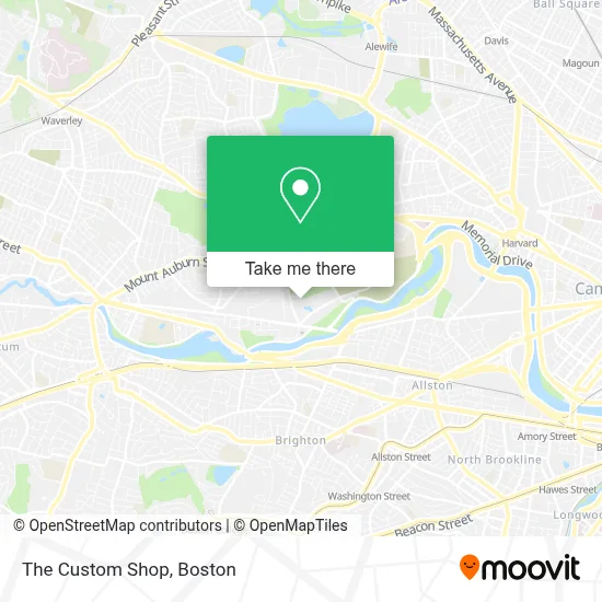
See The Custom Shop, Watertown Town, on the map
Public Transit to The Custom Shop in Watertown Town
Wondering how to get to The Custom Shop in Watertown Town? Moovit helps you find the best way to get to The Custom Shop with step-by-step directions from the nearest public transit station.
Moovit provides free maps and live directions to help you navigate through your city. View schedules, routes, timetables, and find out how long does it take to get to The Custom Shop in real time.
Looking for the nearest stop or station to The Custom Shop? Check out this list of stops closest to your destination: Arsenal St @ Forge Rd; Mt Auburn St @ Upland Rd; Birmingham Pkwy @ Soldiers Field Rd; Western Ave @ Mackin St; Warren Street.
Bus: 70, 86, 71, 64.Train: FRAMINGHAM/WORCESTER.Subway: GREEN LINE B, RED LINE.
Want to see if there’s another route that gets you there at an earlier time? Moovit helps you find alternative routes or times. Get directions from and directions to The Custom Shop easily from the Moovit App or Website.
We make riding to The Custom Shop easy, which is why over 1.7 million users, including users in Watertown Town, trust Moovit as the best app for public transit. You don’t need to download an individual bus app or train app, Moovit is your all-in-one transit app that helps you find the best bus time or train time available.
For information on prices of bus, subway and train, costs and ride fares to The Custom Shop, please check the Moovit app.
Use the app to navigate to popular places including to the airport, hospital, stadium, grocery store, mall, coffee shop, school, college, and university.
The Custom Shop Address: 86 Coolidge Ave street in Watertown Town
- Compass Kitchen Designs,
- Turo Vehicle Rental,
- Residence Inn by Marriott Boston Watertown,
- Target,
- Boston Granite Countertops (Watertown Countertops),
- Watertown Residence Inn,
- United Rentals,
- Watertown RMV Service Center,
- Nichols Locksmith Service,
- Linx,
- The Home Depot,
- Public Conversations Project,
- DMV Watertown,
- The Majestic 7,
- Filipello Park,
- C4 Therapeutics,
- Linx Watertown,
- Arsenal Mall,
- Phoenix Mechanical,
- Armenian Relief Society of Eastern USA
Places Near The Custom Shop (Watertown Town)
- Boston Medical Center, Boston,
- Wilbur Theatre, Boston,
- Museum Of Science, Boston,
- Seaport District, Boston,
- Boston Common, Boston,
- Cheers, Boston,
- Leader Bank Pavilion (Leader Bank Pavillion), Boston,
- Faneuil Hall, Boston,
- Wang Theater, Boston,
- North End, Boston,
- Td Garden, Boston,
- Castle Island, Boston,
- Quincy Market, Boston,
- Mgm Music Hall, Boston,
- Prudential Center, Boston,
- Boston Children's Hospital, Boston,
- Boston Convention & Exhibition Center, Boston,
- Massachusetts General Hospital, Boston,
- House Of Blues, Boston,
- Isabella Stewart Gardner Museum, Boston
How to get to popular places in Boston with public transit
Get around Watertown Town by public transit!
Traveling around Watertown Town has never been so easy. See step by step directions as you travel to any attraction, street or major public transit station. View bus and train schedules, arrival times, service alerts and detailed routes on a map, so you know exactly how to get to anywhere in Watertown Town.
When traveling to any destination around Watertown Town use Moovit's Live Directions with Get Off Notifications to know exactly where and how far to walk, how long to wait for your line, and how many stops are left. Moovit will alert you when it's time to get off — no need to constantly re-check whether yours is the next stop.
Wondering how to use public transit in Watertown Town or how to pay for public transit in Watertown Town? Moovit public transit app can help you navigate your way with public transit easily, and at minimum cost. It includes public transit fees, ticket prices, and costs. Looking for a map of Watertown Town public transit lines? Moovit public transit app shows all public transit maps in Watertown Town with all Bus, Train, Subway and Ferry routes and stops on an interactive map.
Boston has 4 transit type(s), including: Bus, Train, Subway and Ferry, operated by several transit agencies, including MBTA, Southeastern Regional Transit Authority, MetroWest Regional Transit Authority, Rhode Island Public Transit Authority, WRTA, Lowell Regional Transit Authority, Merrimack Valley Transit, Montachusett Regional Transit Authority, Cape Cod Regional Transit Authority, Brockton Area Transit Authority, Martha's Vineyard Transit Authority, the WAVE - Nantucket Regional Transit Authority, GATRA, Cape Ann Transportation Authority and Massport