Directions to The Factory on Wareham (Boston) with public transportation
The following transit lines have routes that pass near The Factory on Wareham
 Bus: 1, 10, 47, SL5, 8.
- Train: FRAMINGHAM/WORCESTER, NEEDHAM, FOXBORO EVENT SERVICE, FRANKLIN/FOXBORO, ORANGE LINE.
- Subway: GREEN LINE B, GREEN LINE D, ORANGE LINE, RED LINE.
How to get to The Factory on Wareham by bus?
Click on the bus route to see step by step directions with maps, line arrival times and updated time schedules.
From VFW Parkway, Boston
61 minFrom Boston College (BC), Boston
70 minFrom Hilton Garden Inn Boston Logan Airport, Boston
61 minFrom Newton, MA, Newton
45 minFrom Bow Market, Somerville
58 minFrom Winter Hill, Somerville
68 minFrom Newton, MA, Newton
65 minFrom Costco Wholesale, Everett
100 minFrom West Roxbury, Boston
59 minFrom FOUR POINTS BY SHERATON Boston Newton, Newton
30 min
How to get to The Factory on Wareham by train?
Click on the train route to see step by step directions with maps, line arrival times and updated time schedules.
How to get to The Factory on Wareham by subway?
Click on the subway route to see step by step directions with maps, line arrival times and updated time schedules.
Bus stops near The Factory on Wareham in Boston
Subway station near The Factory on Wareham in Boston
- Broadway, 13 min walk,VIEW
Train stations near The Factory on Wareham in Boston
Bus lines to The Factory on Wareham in Boston
What are the closest stations to The Factory on Wareham?
The closest stations to The Factory on Wareham are:
- Albany St Opp E Newton St is 61 yards away, 1 min walk.
- E Newton St @ Harrison Ave is 323 yards away, 4 min walk.
- Harrison Ave @ E Newton St is 332 yards away, 5 min walk.
- Washington St @ Union Pk is 490 yards away, 6 min walk.
- Broadway is 1035 yards away, 13 min walk.
- Back Bay - South End is 1345 yards away, 16 min walk.
- Newmarket is 2169 yards away, 26 min walk.
Which bus lines stop near The Factory on Wareham?
These bus lines stop near The Factory on Wareham: 1, 10, 47, SL5.
Which train lines stop near The Factory on Wareham?
These train lines stop near The Factory on Wareham: FRAMINGHAM/WORCESTER, NEEDHAM.
Which subway lines stop near The Factory on Wareham?
These subway lines stop near The Factory on Wareham: GREEN LINE B, GREEN LINE D, ORANGE LINE, RED LINE.
What’s the nearest subway station to The Factory on Wareham in Boston?
The nearest subway station to The Factory on Wareham in Boston is Broadway. It’s a 13 min walk away.
What’s the nearest train station to The Factory on Wareham in Boston?
The nearest train station to The Factory on Wareham in Boston is Back Bay - South End. It’s a 16 min walk away.
What’s the nearest bus station to The Factory on Wareham in Boston?
The nearest bus station to The Factory on Wareham in Boston is Albany St Opp E Newton St. It’s a 1 min walk away.
What time is the first subway to The Factory on Wareham in Boston?
The ORANGE LINE is the first subway that goes to The Factory on Wareham in Boston. It stops nearby at 5:26 AM.
What time is the last subway to The Factory on Wareham in Boston?
The RED LINE is the last subway that goes to The Factory on Wareham in Boston. It stops nearby at 1:53 AM.
What time is the first train to The Factory on Wareham in Boston?
The PROVIDENCE/STOUGHTON is the first train that goes to The Factory on Wareham in Boston. It stops nearby at 4:25 AM.
What time is the last train to The Factory on Wareham in Boston?
The LAKE SHORE LIMITED is the last train that goes to The Factory on Wareham in Boston. It stops nearby at 8:26 PM.
What time is the first bus to The Factory on Wareham in Boston?
The 15 is the first bus that goes to The Factory on Wareham in Boston. It stops nearby at 5:04 AM.
What time is the last bus to The Factory on Wareham in Boston?
The 47 is the last bus that goes to The Factory on Wareham in Boston. It stops nearby at 1:28 AM.
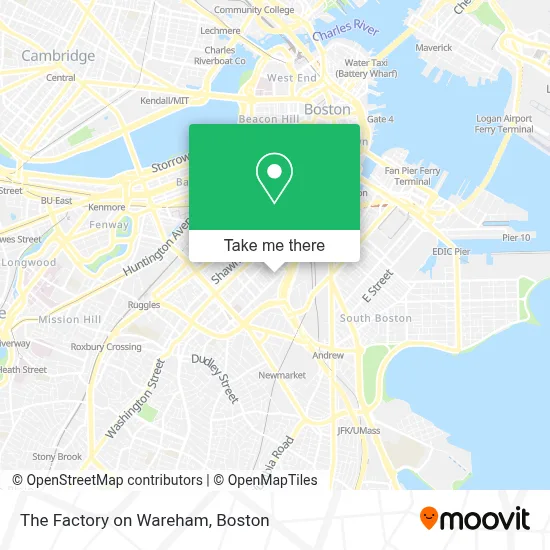
See The Factory on Wareham, Boston, on the map
Public Transit to The Factory on Wareham in Boston
Wondering how to get to The Factory on Wareham in Boston? Moovit helps you find the best way to get to The Factory on Wareham with step-by-step directions from the nearest public transit station.
Moovit provides free maps and live directions to help you navigate through your city. View schedules, routes, timetables, and find out how long does it take to get to The Factory on Wareham in real time.
Looking for the nearest stop or station to The Factory on Wareham? Check out this list of stops closest to your destination: Albany St Opp E Newton St; E Newton St @ Harrison Ave; Harrison Ave @ E Newton St; Washington St @ Union Pk; Broadway; Back Bay - South End; Newmarket.
Bus: 1, 10, 47, SL5, 8, CT3.Train: FRAMINGHAM/WORCESTER, NEEDHAM, FOXBORO EVENT SERVICE, FRANKLIN/FOXBORO, ORANGE LINE, FAIRMOUNT.Subway: GREEN LINE B, GREEN LINE D, ORANGE LINE, RED LINE.
Want to see if there’s another route that gets you there at an earlier time? Moovit helps you find alternative routes or times. Get directions from and directions to The Factory on Wareham easily from the Moovit App or Website.
We make riding to The Factory on Wareham easy, which is why over 1.7 million users, including users in Boston, trust Moovit as the best app for public transit. You don’t need to download an individual bus app or train app, Moovit is your all-in-one transit app that helps you find the best bus time or train time available.
For information on prices of bus, subway and train, costs and ride fares to The Factory on Wareham, please check the Moovit app.
Use the app to navigate to popular places including to the airport, hospital, stadium, grocery store, mall, coffee shop, school, college, and university.
The Factory on Wareham Address: 76 Wareham St street in Boston
- Eric Schapero (Schapero Eric Co.),
- Girard Apartments,
- Smith,
- Boyd Technologies,
- MBTA Albany Bus Garage,
- Exit 18/Mass Ave/S,
- Abcd,
- Gaslight,
- South End,
- Boston Dialysis (Davita Dialysis Center),
- Davita Dialysis Center,
- Davita Dialysis Boston,
- Mbta Albany Street Garage,
- The Edward and Joyce Fredkin Educational Resource Center,
- Cathedral Of the Holy Cross,
- Cathedral High School,
- Airport HOV Ln & RT-3,
- Cathedral of the Holy Cross ,
- Rotch Park Soccer Field,
- Ruth Lillian Barkley Apartments
Places Near The Factory on Wareham (Boston)
- Td Garden, Boston,
- Castle Island, Boston,
- Wilbur Theatre, Boston,
- Prudential Center, Boston,
- North End, Boston,
- Faneuil Hall, Boston,
- Massachusetts General Hospital, Boston,
- Seaport District, Boston,
- Boston Medical Center, Boston,
- House Of Blues, Boston,
- Boston Common, Boston,
- Boston Convention & Exhibition Center, Boston,
- Museum Of Science, Boston,
- Cheers, Boston,
- Boston Children's Hospital, Boston,
- Mgm Music Hall, Boston,
- Quincy Market, Boston,
- Isabella Stewart Gardner Museum, Boston,
- Wang Theater, Boston,
- Leader Bank Pavilion (Leader Bank Pavillion), Boston
How to get to popular places in Boston with public transit
Get around Boston by public transit!
Traveling around Boston has never been so easy. See step by step directions as you travel to any attraction, street or major public transit station. View bus and train schedules, arrival times, service alerts and detailed routes on a map, so you know exactly how to get to anywhere in Boston.
When traveling to any destination around Boston use Moovit's Live Directions with Get Off Notifications to know exactly where and how far to walk, how long to wait for your line, and how many stops are left. Moovit will alert you when it's time to get off — no need to constantly re-check whether yours is the next stop.
Wondering how to use public transit in Boston or how to pay for public transit in Boston? Moovit public transit app can help you navigate your way with public transit easily, and at minimum cost. It includes public transit fees, ticket prices, and costs. Looking for a map of Boston public transit lines? Moovit public transit app shows all public transit maps in Boston with all Bus, Train, Subway and Ferry routes and stops on an interactive map.
Boston has 4 transit type(s), including: Bus, Train, Subway and Ferry, operated by several transit agencies, including MBTA, Southeastern Regional Transit Authority, MetroWest Regional Transit Authority, Rhode Island Public Transit Authority, WRTA, Lowell Regional Transit Authority, Merrimack Valley Transit, Montachusett Regional Transit Authority, Cape Cod Regional Transit Authority, Brockton Area Transit Authority, Martha's Vineyard Transit Authority, the WAVE - Nantucket Regional Transit Authority, GATRA, Cape Ann Transportation Authority and Massport