Directions to The Friendly Toast (Cambridge) with public transportation
The following transit lines have routes that pass near The Friendly Toast
 Bus: 64, 85, EZRIDE, 68.
- Train: LOWELL, NEEDHAM, NEWBURYPORT/ROCKPORT.
- Subway: RED LINE, GREEN LINE D, GREEN LINE E, GREEN LINE B, GREEN LINE C.
How to get to The Friendly Toast by bus?
Click on the bus route to see step by step directions with maps, line arrival times and updated time schedules.
From West Roxbury, Boston
74 minFrom Suffolk Downs, Boston
63 minFrom Brighton, Boston
40 minFrom Everett, MA, Everett
37 minFrom 7F Everett Street, Revere
69 minFrom Dorchester, Boston
74 minFrom Winchester, MA, Winchester
73 minFrom Lower Mills, Boston
92 minFrom Best Western Adams Inn Quincy - Boston, Quincy
93 min
How to get to The Friendly Toast by train?
Click on the train route to see step by step directions with maps, line arrival times and updated time schedules.
How to get to The Friendly Toast by subway?
Click on the subway route to see step by step directions with maps, line arrival times and updated time schedules.
Bus stops near The Friendly Toast in Cambridge
Subway stations near The Friendly Toast in Cambridge
Bus lines to The Friendly Toast in Cambridge
- EZRIDE, Inbound To North Station Via Kendall And Lechmere,VIEW
- 64, Oak Square,VIEW
- 68, Kendall/MIT,VIEW
- EZRIDE, Inbound To North Station From Erie St,VIEW
- EZRIDE, Inbound Kendall To Lechmere,VIEW
- 85, Ruggles,VIEW
- EZRIDE, Outbound Lechemere To Kendall,VIEW
- EZRIDE, Outbound North Station To Erie St Via Lechmere And Kendall,VIEW
- EZRIDE, Outbound To Erie St From North Station,VIEW
What are the closest stations to The Friendly Toast?
The closest stations to The Friendly Toast are:
- Albany St./Main St. is 126 yards away, 2 min walk.
- Main St @ Galileo Way is 175 yards away, 3 min walk.
- Galileo Way @ Main St is 178 yards away, 3 min walk.
- Ames St @ Main St is 314 yards away, 4 min walk.
- Union Square is 947 yards away, 12 min walk.
- Central is 1063 yards away, 13 min walk.
- East Somerville Station is 1974 yards away, 24 min walk.
Which bus lines stop near The Friendly Toast?
These bus lines stop near The Friendly Toast: 64, 85, EZRIDE.
Which train lines stop near The Friendly Toast?
These train lines stop near The Friendly Toast: LOWELL, NEEDHAM, NEWBURYPORT/ROCKPORT.
Which subway line stops near The Friendly Toast?
RED LINE (Alewife)
What’s the nearest subway station to The Friendly Toast in Cambridge?
The nearest subway station to The Friendly Toast in Cambridge is Union Square. It’s a 12 min walk away.
What’s the nearest bus station to The Friendly Toast in Cambridge?
The nearest bus station to The Friendly Toast in Cambridge is Albany St./Main St.. It’s a 2 min walk away.
What time is the first subway to The Friendly Toast in Cambridge?
The GREEN LINE E is the first subway that goes to The Friendly Toast in Cambridge. It stops nearby at 4:49 AM.
What time is the last subway to The Friendly Toast in Cambridge?
The GREEN LINE E is the last subway that goes to The Friendly Toast in Cambridge. It stops nearby at 2:34 AM.
What time is the first bus to The Friendly Toast in Cambridge?
The 64 is the first bus that goes to The Friendly Toast in Cambridge. It stops nearby at 5:28 AM.
What time is the last bus to The Friendly Toast in Cambridge?
The 64 is the last bus that goes to The Friendly Toast in Cambridge. It stops nearby at 1:06 AM.
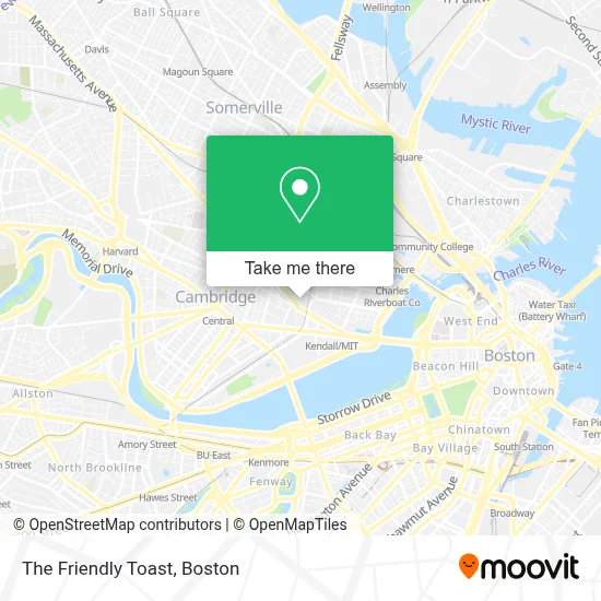
See The Friendly Toast, Cambridge, on the map
Public Transit to The Friendly Toast in Cambridge
Wondering how to get to The Friendly Toast in Cambridge? Moovit helps you find the best way to get to The Friendly Toast with step-by-step directions from the nearest public transit station.
Moovit provides free maps and live directions to help you navigate through your city. View schedules, routes, timetables, and find out how long does it take to get to The Friendly Toast in real time.
Looking for the nearest stop or station to The Friendly Toast? Check out this list of stops closest to your destination: Albany St./Main St.; Main St @ Galileo Way; Galileo Way @ Main St; Ames St @ Main St; Union Square; Central; East Somerville Station.
Bus: 64, 85, EZRIDE, 68.Train: LOWELL, NEEDHAM, NEWBURYPORT/ROCKPORT.Subway: RED LINE, GREEN LINE D, GREEN LINE E, GREEN LINE B, GREEN LINE C.
Want to see if there’s another route that gets you there at an earlier time? Moovit helps you find alternative routes or times. Get directions from and directions to The Friendly Toast easily from the Moovit App or Website.
We make riding to The Friendly Toast easy, which is why over 1.7 million users, including users in Cambridge, trust Moovit as the best app for public transit. You don’t need to download an individual bus app or train app, Moovit is your all-in-one transit app that helps you find the best bus time or train time available.
For information on prices of bus, subway and train, costs and ride fares to The Friendly Toast, please check the Moovit app.
Use the app to navigate to popular places including to the airport, hospital, stadium, grocery store, mall, coffee shop, school, college, and university.
The Friendly Toast Address: 1 Kendall Square street in Cambridge
- Abcam,
- Mamaleh's Delicatessen (Memaleh's Delicatessen Restaurant),
- 100,
- Kendall Square,
- Hampshire St @ Cardinal Medeiros Ave (Hampshire St @ Portland St),
- Spit Meter the Reckoning,
- Dante Alighieri Italian Cultural Center,
- Radius Health,
- MITSUBISHI Electric Research Laboratories - Merl,
- MERL,
- Kendall Square Parking Garage,
- Kendall Square Cinema ,
- Rubius Therapeutics (Relay Therapeutics),
- Glaxosmithkline / Astrazeneca,
- The Garment District,
- Akamai Technologies,
- The Charles Stark Draper Laboratory, Inc,
- Merck & Co. Inc - Cabridge Campus,
- The TARDIS,
- Biogen Idec, Bio-8
Places Near The Friendly Toast (Cambridge)
- Boston Children's Hospital, Boston,
- Museum Of Science, Boston,
- Cheers, Boston,
- Boston Common, Boston,
- Boston Medical Center, Boston,
- House Of Blues, Boston,
- Quincy Market, Boston,
- North End, Boston,
- Mgm Music Hall, Boston,
- Seaport District, Boston,
- Td Garden, Boston,
- Faneuil Hall, Boston,
- Boston Convention & Exhibition Center, Boston,
- Wang Theater, Boston,
- Leader Bank Pavilion (Leader Bank Pavillion), Boston,
- Castle Island, Boston,
- Isabella Stewart Gardner Museum, Boston,
- Massachusetts General Hospital, Boston,
- Wilbur Theatre, Boston,
- Prudential Center, Boston
How to get to popular places in Boston with public transit
Get around Cambridge by public transit!
Traveling around Cambridge has never been so easy. See step by step directions as you travel to any attraction, street or major public transit station. View bus and train schedules, arrival times, service alerts and detailed routes on a map, so you know exactly how to get to anywhere in Cambridge.
When traveling to any destination around Cambridge use Moovit's Live Directions with Get Off Notifications to know exactly where and how far to walk, how long to wait for your line, and how many stops are left. Moovit will alert you when it's time to get off — no need to constantly re-check whether yours is the next stop.
Wondering how to use public transit in Cambridge or how to pay for public transit in Cambridge? Moovit public transit app can help you navigate your way with public transit easily, and at minimum cost. It includes public transit fees, ticket prices, and costs. Looking for a map of Cambridge public transit lines? Moovit public transit app shows all public transit maps in Cambridge with all Bus, Train, Subway and Ferry routes and stops on an interactive map.
Boston has 4 transit type(s), including: Bus, Train, Subway and Ferry, operated by several transit agencies, including MBTA, Southeastern Regional Transit Authority, MetroWest Regional Transit Authority, Rhode Island Public Transit Authority, WRTA, Lowell Regional Transit Authority, Merrimack Valley Transit, Montachusett Regional Transit Authority, Cape Cod Regional Transit Authority, Brockton Area Transit Authority, Martha's Vineyard Transit Authority, the WAVE - Nantucket Regional Transit Authority, GATRA, Cape Ann Transportation Authority and Massport