How to get to The Groutsmith by bus?
Click on the bus route to see step by step directions with maps, line arrival times and updated time schedules.
From Massachusetts, Boston
93 minFrom Washington St, Boston
79 minFrom Warrior Ice Arena, Boston
94 minFrom Beth Israel Deaconess Medical Center West Campus, Boston
82 minFrom The Track at New Balance, Boston
93 minFrom Holiday Inn Express-Saugus, Saugus
89 minFrom Hyatt Regency Cambridge - Overlooking Boston, Cambridge
83 minFrom Dorchester, Boston
83 minFrom Harvard Medical School, Boston
72 min
How to get to The Groutsmith by subway?
Click on the subway route to see step by step directions with maps, line arrival times and updated time schedules.
From Massachusetts, Boston
73 minFrom Harvard Medical School, Boston
46 minFrom Washington St, Boston
40 minFrom Warrior Ice Arena, Boston
73 minFrom Beth Israel Deaconess Medical Center West Campus, Boston
48 minFrom The Track at New Balance, Boston
74 minFrom Hyatt Regency Cambridge - Overlooking Boston, Cambridge
55 minFrom Dorchester, Boston
57 min
Bus stop near The Groutsmith in Boston
- Wood Island, 1 min walk,VIEW
Subway station near The Groutsmith in Boston
- Maverick, 20 min walk,VIEW
Ferry station near The Groutsmith in Boston
- Lewis Mall Wharf, 25 min walk,VIEW
Bus lines to The Groutsmith in Boston
- 112, Wood Island via Market Basket & Admiral's Hill - Wellington via Admiral's Hill & Market Basket,VIEW
- 120, Maverick via Jeffries Point - Orient Heights via Waldemar,VIEW
- 121, Maverick - Eagle Square,VIEW
- BLUE LINE SHUTTLE, Orient Heights - Government Center (Local),VIEW
- BLUE LINE SHUTTLE, Airport - Wonderland,VIEW
- BLUE LINE SHUTTLE, Maverick - Wonderland,VIEW
- BLUE LINE SHUTTLE, Wonderland - Airport (Shuttle),VIEW
- BLUE LINE SHUTTLE, Wonderland - Government Center,VIEW
What are the closest stations to The Groutsmith?
The closest stations to The Groutsmith are:
- Wood Island is 43 yards away, 1 min walk.
- Maverick is 1659 yards away, 20 min walk.
- Lewis Mall Wharf is 2034 yards away, 25 min walk.
Which bus lines stop near The Groutsmith?
These bus lines stop near The Groutsmith: 112, 88, SL3.
Which subway line stops near The Groutsmith?
BLUE LINE (Wonderland)
What’s the nearest subway station to The Groutsmith in Boston?
The nearest subway station to The Groutsmith in Boston is Maverick. It’s a 20 min walk away.
What’s the nearest bus station to The Groutsmith in Boston?
The nearest bus station to The Groutsmith in Boston is Wood Island. It’s a 1 min walk away.
What’s the nearest ferry station to The Groutsmith in Boston?
The nearest ferry station to The Groutsmith in Boston is Lewis Mall Wharf. It’s a 25 min walk away.
What time is the first subway to The Groutsmith in Boston?
The BLUE LINE is the first subway that goes to The Groutsmith in Boston. It stops nearby at 5:08 AM.
What time is the last subway to The Groutsmith in Boston?
The BLUE LINE is the last subway that goes to The Groutsmith in Boston. It stops nearby at 2:03 AM.
What time is the first bus to The Groutsmith in Boston?
The 120 is the first bus that goes to The Groutsmith in Boston. It stops nearby at 5:31 AM.
What time is the last bus to The Groutsmith in Boston?
The 120 is the last bus that goes to The Groutsmith in Boston. It stops nearby at 1:25 AM.
What time is the first ferry to The Groutsmith in Boston?
The EAST is the first ferry that goes to The Groutsmith in Boston. It stops nearby at 5:55 AM.
What time is the last ferry to The Groutsmith in Boston?
The EAST BOSTON FERRY is the last ferry that goes to The Groutsmith in Boston. It stops nearby at 7:55 PM.
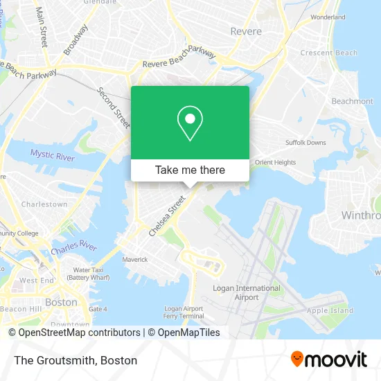
See The Groutsmith, Boston, on the map
Public Transit to The Groutsmith in Boston
Wondering how to get to The Groutsmith in Boston? Moovit helps you find the best way to get to The Groutsmith with step-by-step directions from the nearest public transit station.
Moovit provides free maps and live directions to help you navigate through your city. View schedules, routes, timetables, and find out how long does it take to get to The Groutsmith in real time.
Looking for the nearest stop or station to The Groutsmith? Check out this list of stops closest to your destination: Wood Island; Maverick; Lewis Mall Wharf.
Bus: 112, 88, SL3, 120, 121, BLUE LINE SHUTTLE, BLUE LINE SHUTTLE.Subway: BLUE LINE.Ferry: EAST BOSTON FERRY, EAST.
Want to see if there’s another route that gets you there at an earlier time? Moovit helps you find alternative routes or times. Get directions from and directions to The Groutsmith easily from the Moovit App or Website.
We make riding to The Groutsmith easy, which is why over 1.7 million users, including users in Boston, trust Moovit as the best app for public transit. You don’t need to download an individual bus app or train app, Moovit is your all-in-one transit app that helps you find the best bus time or train time available.
For information on prices of subway, bus and train, costs and ride fares to The Groutsmith, please check the Moovit app.
Use the app to navigate to popular places including to the airport, hospital, stadium, grocery store, mall, coffee shop, school, college, and university.
The Groutsmith Address: 2 Neptune Rd street in Boston
- Superior Luggage (Luggage Repair),
- Xtreme Cycles East Boston,
- Suculento Restaurant,
- Pondejuancho,
- Jeveli's (Jeveli's Restaurant East Boston, MA),
- Rose - International Tapas & Bar,
- Shelby St. hq,
- 100 Percentage Reliable,
- Tufts Medical Center/ Floating Hospital For Children at Tufts Medical Center,
- Super Cargo,
- Accountax Services Corp,
- Wood Island Station,
- Family Daycare,
- Pollos A La Brasa Beto's,
- Westfarms Mall,
- Clean With Care,
- Barrales Law,
- El Palmar Restaurant (El Palma Restaurant),
- Retoques Boston,
- Tea Time Together
Places Near The Groutsmith (Boston)
- Wilbur Theatre, Boston,
- Cheers, Boston,
- Isabella Stewart Gardner Museum, Boston,
- Seaport District, Boston,
- Mgm Music Hall, Boston,
- Quincy Market, Boston,
- Wang Theater, Boston,
- Leader Bank Pavilion (Leader Bank Pavillion), Boston,
- Td Garden, Boston,
- Boston Medical Center, Boston,
- House Of Blues, Boston,
- Boston Children's Hospital, Boston,
- Faneuil Hall, Boston,
- Museum Of Science, Boston,
- Boston Common, Boston,
- Boston Convention & Exhibition Center, Boston,
- Castle Island, Boston,
- North End, Boston,
- Prudential Center, Boston,
- Massachusetts General Hospital, Boston
How to get to popular places in Boston with public transit
Get around Boston by public transit!
Traveling around Boston has never been so easy. See step by step directions as you travel to any attraction, street or major public transit station. View bus and train schedules, arrival times, service alerts and detailed routes on a map, so you know exactly how to get to anywhere in Boston.
When traveling to any destination around Boston use Moovit's Live Directions with Get Off Notifications to know exactly where and how far to walk, how long to wait for your line, and how many stops are left. Moovit will alert you when it's time to get off — no need to constantly re-check whether yours is the next stop.
Wondering how to use public transit in Boston or how to pay for public transit in Boston? Moovit public transit app can help you navigate your way with public transit easily, and at minimum cost. It includes public transit fees, ticket prices, and costs. Looking for a map of Boston public transit lines? Moovit public transit app shows all public transit maps in Boston with all Bus, Train, Subway and Ferry routes and stops on an interactive map.
Boston has 4 transit type(s), including: Bus, Train, Subway and Ferry, operated by several transit agencies, including MBTA, Southeastern Regional Transit Authority, MetroWest Regional Transit Authority, Rhode Island Public Transit Authority, WRTA, Lowell Regional Transit Authority, Merrimack Valley Transit, Montachusett Regional Transit Authority, Cape Cod Regional Transit Authority, Brockton Area Transit Authority, Martha's Vineyard Transit Authority, the WAVE - Nantucket Regional Transit Authority, GATRA, Cape Ann Transportation Authority and Massport