Thunder Bay Airport stop - Thursday schedule
| Line | Direction | Time |
|---|---|---|
| 14 | Arthur To Airport | 6:27 AM |
| 14 | Arthur To Jumbo Gardens | 6:27 AM |
| 14 | Arthur To Airport | 6:53 AM |
| 14 | Arthur To Jumbo Gardens | 6:57 AM |
| 14 | Arthur To Airport | 7:23 AM |
| 14 | Arthur To Jumbo Gardens | 7:27 AM |
| 14 | Arthur To Airport | 7:53 AM |
| 14 | Arthur To Jumbo Gardens | 7:57 AM |
| 14 | Arthur To Airport | 8:23 AM |
| 14 | Arthur To Jumbo Gardens | 8:27 AM |
| 14 | Arthur To Airport | 8:53 AM |
| 14 | Arthur To Jumbo Gardens | 8:57 AM |
| 14 | Arthur To Airport | 9:23 AM |
| 14 | Arthur To Jumbo Gardens | 9:27 AM |
| 14 | Arthur To Airport | 9:53 AM |
| 14 | Arthur To Jumbo Gardens | 9:57 AM |
| 14 | Arthur To Airport | 10:23 AM |
| 14 | Arthur To Jumbo Gardens | 10:27 AM |
| 14 | Arthur To Airport | 10:53 AM |
| 14 | Arthur To Jumbo Gardens | 10:57 AM |
| 14 | Arthur To Airport | 11:25 AM |
| 14 | Arthur To Jumbo Gardens | 11:27 AM |
| 14 | Arthur To Airport | 11:55 AM |
| 14 | Arthur To Jumbo Gardens | 11:57 AM |
| 14 | Arthur To Airport | 12:25 PM |
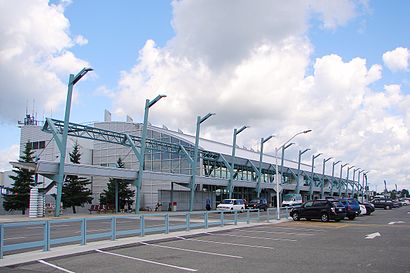
Directions to Thunder Bay Airport stop with public transit
The following transit lines have routes that pass near Thunder Bay Airport
How to get to Thunder Bay Airport stop by bus?
Click on the bus route to see step by step directions with maps, line arrival times and updated time schedules.
Bus stops near Thunder Bay Airport stop
- Arthur & Willard, 4 min walk,
- Mary & Neebing, 11 min walk,
Bus lines to Thunder Bay Airport stop
- 4, Neebing,
- 14, Arthur To Airport,
- 18, Westfort To Mary,
What are the closest stations to Thunder Bay Airport?
The closest stations to Thunder Bay Airport are:
- Arthur & Willard is 284 meters away, 4 min walk.
- Mary & Neebing is 843 meters away, 11 min walk.
Which bus line stops near Thunder Bay Airport?
14 (Arthur To Airport)
What’s the nearest bus station to Thunder Bay Airport?
The nearest bus station to Thunder Bay Airport is Arthur & Willard. It’s a 4 min walk away.
See Thunder Bay Airport stop on the map
Public transit to Thunder Bay Airport stop (ID: 1522)
Looking for directions to Thunder Bay Airport in Thunder Bay, Canada?
Download the Moovit App to find the current schedule and step-by-step directions for Bus routes that pass through Thunder Bay Airport.
Looking for the nearest stops closest to Thunder Bay Airport ? Check out this list of closest stops to your destination: Arthur & Willard; Mary & Neebing.
Bus: 14, 4, 18.
We make riding on public transit to Thunder Bay Airport easy, which is why over 1.5 million users, including users in Thunder Bay trust Moovit as the best app for public transit.
Use the app to navigate to popular places including to the airport, hospital, stadium, grocery store, mall, coffee shop, school, college, and university.
Thunder Bay Airport stop’s code is 1522
The first line to this stop is 14, at 6:27 AM, and the last line is 14 at 10:35 PM.
Princess Street, Thunder Bay, ON, Canada
This stop serves Thunder Bay Transit’s lines
Popular routes from Thunder Bay Airport stop
Popular public transit stations in Thunder Bay
Get around Thunder Bay by public transit!
Traveling around Thunder Bay has never been so easy. See step by step directions as you travel to any attraction, street or major public transit station. View bus and train schedules, arrival times, service alerts and detailed routes on a map, so you know exactly how to get to anywhere in Thunder Bay.
When traveling to any destination around Thunder Bay use Moovit's Live Directions with Get Off Notifications to know exactly where and how far to walk, how long to wait for your line, and how many stops are left. Moovit will alert you when it's time to get off — no need to constantly re-check whether yours is the next stop.
Wondering how to use public transit in Thunder Bay or how to pay for public transit in Thunder Bay? Moovit public transit app can help you navigate your way with public transit easily, and at minimum cost. It includes public transit fees, ticket prices, and costs. Looking for a map of Thunder Bay public transit lines? Moovit public transit app shows all public transit maps in Thunder Bay with all bus routes and stops on an interactive map.
Thunder Bay has 1 transit type(s), including: bus, operated by several transit agencies, including Thunder Bay Transit