Directions to Toronto Pearson International Airport (Mississauga) with public transportation
The following transit lines have routes that pass near Toronto Pearson International Airport
How to get to Toronto Pearson International Airport by bus?
Click on the bus route to see step by step directions with maps, line arrival times and updated time schedules.
How to get to Toronto Pearson International Airport by train?
Click on the train route to see step by step directions with maps, line arrival times and updated time schedules.
Which bus lines stop near Toronto Pearson International Airport?
These bus lines stop near Toronto Pearson International Airport: 115, 40, 7.
Which train line stops near Toronto Pearson International Airport?
UP
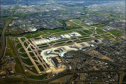
See Toronto Pearson International Airport, Mississauga, on the map
Public Transit to Toronto Pearson International Airport in Mississauga
Wondering how to get to Toronto Pearson International Airport in Mississauga, Canada? Moovit helps you find the best way to get to Toronto Pearson International Airport with step-by-step directions from the nearest public transit station.
Moovit provides free maps and live directions to help you navigate through your city. View schedules, routes, timetables, and find out how long does it take to get to Toronto Pearson International Airport in real time.
Bus: 115, 40, 7.Train: UP.
Want to see if there’s another route that gets you there at an earlier time? Moovit helps you find alternative routes or times. Get directions from and directions to Toronto Pearson International Airport easily from the Moovit App or Website.
We make riding to Toronto Pearson International Airport easy, which is why over 1.5 million users, including users in Mississauga, trust Moovit as the best app for public transit. You don’t need to download an individual bus app or train app, Moovit is your all-in-one transit app that helps you find the best bus time or train time available.
For information on prices of bus and train, costs and ride fares to Toronto Pearson International Airport, please check the Moovit app.
Use the app to navigate to popular places including to the airport, hospital, stadium, grocery store, mall, coffee shop, school, college, and university.
Toronto Pearson International Airport Address: Toronto Pearson International Airport (YYZ), Terminal 1, 6135 Silver Dart Dr, Mississauga, ON L5P 1 street in Mississauga
Attractions near Toronto Pearson International Airport
Dog Park Pearson Airport,GoodLife Fitness Centres,GoodLife Fitness Toronto Pearson,Goodlife Fitness,Toronto Airport-Term 1 Ground Level [South],Q Lounge,Brussels Airlines Check-in,Emirates check-in,Ink,Terminal 1 Parking,GTAA Airport Staff Pass Office,To's Featuring Tim Hortons,Brampton Transit 115 From Pearson,Alamo Car Rental,E/F Car Stand,Toronto Pearson Int'l-T1 Departures,Sunwing Check-in,Jazz Crew Lounge,Mi Way Bus 7 North, Westwood Mall,HertzHow to get to popular attractions in Mississauga with public transit
Beanfield Centre, Toronto,Milton Carpool Lot / GO Park & Ride, Milton,Toronto Premium Outlets, Halton Hills,Toronto Christmas Market, Toronto,Queen's Quay Terminal, Toronto,Centennial College, Toronto,Metro Toronto Convention Centre, Toronto,John C. Munro Hamilton International Airport, Hamilton,Leslieville, Toronto,Brandy Melville, Toronto,Providence HealthCare, Toronto,University of Toronto Scarborough, Toronto,Shops At Don Mills, Toronto,Go Bus Route 25C Express To Square One GO Terminal, Kitchener,OLG Slots at Woodbine, Toronto,Westwood Mall, Mississauga,Toronto Rehabilitation Institute, Toronto,Fairview Mall Parking Lot, Toronto,Go Train From Bradford To Union Statiom, Bradford West Gwillimbury,King's College Circle, TorontoGet around Toronto by public transit!
Traveling around Toronto has never been so easy. See step by step directions as you travel to any attraction, street or major public transit station. View bus and train schedules, arrival times, service alerts and detailed routes on a map, so you know exactly how to get to anywhere in Toronto.
When traveling to any destination around Toronto use Moovit's Live Directions with Get Off Notifications to know exactly where and how far to walk, how long to wait for your line, and how many stops are left. Moovit will alert you when it's time to get off — no need to constantly re-check whether yours is the next stop.
Wondering how to use public transit in Toronto or how to pay for public transit in Toronto? Moovit public transit app can help you navigate your way with public transit easily, and at minimum cost. It includes public transit fees, ticket prices, and costs. Looking for a map of Toronto public transit lines? Moovit public transit app shows all public transit maps in Toronto with all Bus, Train, Subway, Streetcar and Ferry routes and stops on an interactive map.
Toronto has 5 transit type(s), including: Bus, Train, Subway, Streetcar and Ferry, operated by several transit agencies, including TTC, TTC Streetcar, Toronto Subway, Brampton Transit, MiWay, York Region Transit, GO Transit Bus, GO Transit, Durham Region Transit, UP Express, Grand River Transit, Guelph Transit, grt, Hamilton Street Railway, Burlington Transit