Directions to Ups (Somerville) with public transportation
The following transit lines have routes that pass near Ups
 Bus: 109, 85, 91, GREEN LINE SHUTTLE, 69.
- Subway: GREEN LINE E, ORANGE LINE, GREEN LINE D, GREEN LINE B, GREEN LINE C.
How to get to Ups by bus?
Click on the bus route to see step by step directions with maps, line arrival times and updated time schedules.
From Spaulding Rehab, Boston
92 minFrom Heartbreak Hill, Newton
75 minFrom Medford Square, Medford
37 minFrom The Mall At Chestnut Hill, Newton
84 minFrom MBTA Jackson Square Station, Boston
69 minFrom Saugus, MA, Saugus
64 minFrom Alumni Stadium, Boston
81 minFrom Boston Municipal Court (Roxbury District Court), Boston
60 minFrom Roslindale, Boston
87 min
How to get to Ups by subway?
Click on the subway route to see step by step directions with maps, line arrival times and updated time schedules.
From Spaulding Rehab, Boston
70 minFrom Heartbreak Hill, Newton
81 minFrom Medford Square, Medford
46 minFrom The Mall At Chestnut Hill, Newton
89 minFrom MBTA Jackson Square Station, Boston
40 minFrom Alumni Stadium, Boston
91 minFrom Boston Municipal Court (Roxbury District Court), Boston
52 minFrom Roslindale, Boston
64 min
Bus stops near Ups in Somerville
Subway stations near Ups in Somerville
Bus lines to Ups in Somerville
- 85, Ruggles,VIEW
- 91, Central Square,VIEW
- 109, Linden Square Via Sullivan,VIEW
- GREEN LINE SHUTTLE, Union Square (Shuttle),VIEW
- 69, Lechmere - Harvard,VIEW
- 80, Lechmere - Arlington Center,VIEW
- 87, Lechmere - Arlington Center,VIEW
- 88, Lechmere - Clarendon Hill,VIEW
- GREEN LINE E SHUTTLE, Government Center - Medford/Tufts (Shuttle),VIEW
- GREEN LINE E SHUTTLE, Medford/Tufts - North Station,VIEW
- GREEN LINE E SHUTTLE, North Station - Medford/Tufts (Shuttle),VIEW
- GREEN LINE SHUTTLE, Medford/Tufts - Government Center via Union Square,VIEW
- GREEN LINE SHUTTLE, Lechmere - North Station,VIEW
- GREEN LINE SHUTTLE, North Station - Sullivan Square via East Somerville,VIEW
- EZRIDE, Weekend Shuttle Outbound,VIEW
- EZRIDE, Morning Shuttle Inbound,VIEW
- EZRIDE, After 11:30 AM Shuttle Outbound,VIEW
- EZRIDE, Weekend Shuttle Inbound,VIEW
- EZRIDE, Morning Shuttle Outbound,VIEW
- EZRIDE, After 11:30 AM Shuttle Inbound,VIEW
What are the closest stations to Ups?
The closest stations to Ups are:
- Washington St @ Inner Belt Rd is 83 yards away, 2 min walk.
- Lechmere - Monsignor O'Brien Hwy Opp Gore St is 323 yards away, 5 min walk.
- Lechmere is 364 yards away, 5 min walk.
- Lechmere - Water St @ Lechmere Busway is 375 yards away, 5 min walk.
- Sullivan Square Station is 526 yards away, 7 min walk.
- Sullivan Square is 526 yards away, 7 min walk.
- Union Square is 1095 yards away, 13 min walk.
- Main St @ Baldwin St is 2026 yards away, 25 min walk.
- East Somerville Station is 2075 yards away, 25 min walk.
Which bus lines stop near Ups?
These bus lines stop near Ups: 109, 85, 91.
Which subway lines stop near Ups?
These subway lines stop near Ups: GREEN LINE E, ORANGE LINE.
What’s the nearest subway station to Ups in Somerville?
The nearest subway station to Ups in Somerville is Sullivan Square. It’s a 7 min walk away.
What’s the nearest bus station to Ups in Somerville?
The nearest bus station to Ups in Somerville is Washington St @ Inner Belt Rd. It’s a 2 min walk away.
What time is the first subway to Ups in Somerville?
The GREEN LINE E is the first subway that goes to Ups in Somerville. It stops nearby at 4:49 AM.
What time is the last subway to Ups in Somerville?
The GREEN LINE E is the last subway that goes to Ups in Somerville. It stops nearby at 2:34 AM.
What time is the first bus to Ups in Somerville?
The 109 is the first bus that goes to Ups in Somerville. It stops nearby at 4:48 AM.
What time is the last bus to Ups in Somerville?
The 91 is the last bus that goes to Ups in Somerville. It stops nearby at 1:30 AM.
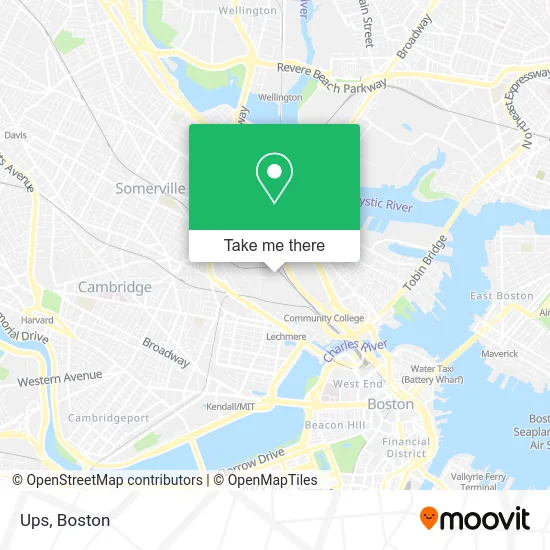
See Ups, Somerville, on the map
Public Transit to Ups in Somerville
Wondering how to get to Ups in Somerville? Moovit helps you find the best way to get to Ups with step-by-step directions from the nearest public transit station.
Moovit provides free maps and live directions to help you navigate through your city. View schedules, routes, timetables, and find out how long does it take to get to Ups in real time.
Looking for the nearest stop or station to Ups? Check out this list of stops closest to your destination: Washington St @ Inner Belt Rd; Lechmere - Monsignor O'Brien Hwy Opp Gore St; Lechmere; Lechmere - Water St @ Lechmere Busway; Sullivan Square Station; Sullivan Square; Union Square; Main St @ Baldwin St; East Somerville Station.
Bus: 109, 85, 91, GREEN LINE SHUTTLE, 69, 80, 87, 88, GREEN LINE E SHUTTLE.Subway: GREEN LINE E, ORANGE LINE, GREEN LINE D, GREEN LINE B, GREEN LINE C.
Want to see if there’s another route that gets you there at an earlier time? Moovit helps you find alternative routes or times. Get directions from and directions to Ups easily from the Moovit App or Website.
We make riding to Ups easy, which is why over 1.7 million users, including users in Somerville, trust Moovit as the best app for public transit. You don’t need to download an individual bus app or train app, Moovit is your all-in-one transit app that helps you find the best bus time or train time available.
For information on prices of bus and subway, costs and ride fares to Ups, please check the Moovit app.
Use the app to navigate to popular places including to the airport, hospital, stadium, grocery store, mall, coffee shop, school, college, and university.
Ups Address: 43 3rd Ave Somerville, MA 02143 street in Somerville
- MBTA Commuter Rail Haverhill / Reading Line,
- Metropolitan Pipe & Supply,
- Mbta Boston Engine Terminal,
- Innerbelt Rd,
- Inner Belt,
- BET,
- Mbta Commuter Rail Maintenance Facility,
- MBTA Purple Line,
- 200 Innerbelt Rd,
- Landry's Bicycles,
- Bunker Hill Community College H Building,
- BHCC-H Building,
- Amtrak CTEC,
- HP Hood (Hood H P),
- Holiday Inn Boston Bunker Hill an IHG Hotel Somerville,
- Crimson Charlestown,
- Standard Parking,
- 100 Hood Park Garage,
- Lechmere's Do-It Self Serve Car Wash,
- Boston Engine Terminal - CRMF
Places Near Ups (Somerville)
- Boston Children's Hospital, Boston,
- Cheers, Boston,
- Seaport District, Boston,
- Isabella Stewart Gardner Museum, Boston,
- Castle Island, Boston,
- Boston Medical Center, Boston,
- Wilbur Theatre, Boston,
- Leader Bank Pavilion (Leader Bank Pavillion), Boston,
- Quincy Market, Boston,
- North End, Boston,
- Faneuil Hall, Boston,
- Boston Convention & Exhibition Center, Boston,
- House Of Blues, Boston,
- Mgm Music Hall, Boston,
- Prudential Center, Boston,
- Wang Theater, Boston,
- Museum Of Science, Boston,
- Td Garden, Boston,
- Boston Common, Boston,
- Massachusetts General Hospital, Boston
How to get to popular places in Boston with public transit
Get around Somerville by public transit!
Traveling around Somerville has never been so easy. See step by step directions as you travel to any attraction, street or major public transit station. View bus and train schedules, arrival times, service alerts and detailed routes on a map, so you know exactly how to get to anywhere in Somerville.
When traveling to any destination around Somerville use Moovit's Live Directions with Get Off Notifications to know exactly where and how far to walk, how long to wait for your line, and how many stops are left. Moovit will alert you when it's time to get off — no need to constantly re-check whether yours is the next stop.
Wondering how to use public transit in Somerville or how to pay for public transit in Somerville? Moovit public transit app can help you navigate your way with public transit easily, and at minimum cost. It includes public transit fees, ticket prices, and costs. Looking for a map of Somerville public transit lines? Moovit public transit app shows all public transit maps in Somerville with all Bus, Train, Subway and Ferry routes and stops on an interactive map.
Boston has 4 transit type(s), including: Bus, Train, Subway and Ferry, operated by several transit agencies, including MBTA, Southeastern Regional Transit Authority, MetroWest Regional Transit Authority, Rhode Island Public Transit Authority, WRTA, Lowell Regional Transit Authority, Merrimack Valley Transit, Montachusett Regional Transit Authority, Cape Cod Regional Transit Authority, Brockton Area Transit Authority, Martha's Vineyard Transit Authority, the WAVE - Nantucket Regional Transit Authority, GATRA, Cape Ann Transportation Authority and Massport