How to get to Wellington at Springfield by bus?
Click on the bus route to see step by step directions with maps, line arrival times and updated time schedules.
From Dcu Center, Worcester
132 minFrom Foxwoods, Worcester
159 minFrom Worcester, MA, Worcester
130 minFrom Registry Of Motor Vehicles (Rmv) Branch Office, Worcester
134 minFrom South High Community School, Worcester
226 minFrom Polar Park, Worcester
131 minFrom Walmart Supercenter, Worcester
188 minFrom Palladium, Worcester
135 min
Bus stops near Wellington at Springfield in Boston
Bus lines to Wellington at Springfield in Boston
What are the closest stations to Wellington at Springfield?
The closest stations to Wellington at Springfield are:
- Wilbraham / Bellwood is 1161 yards away, 14 min walk.
- Boston / Morton (2) is 1455 yards away, 18 min walk.
Which bus lines stop near Wellington at Springfield?
These bus lines stop near Wellington at Springfield: B17, B7.
What’s the nearest bus station to Wellington at Springfield in Boston?
The nearest bus station to Wellington at Springfield in Boston is Wilbraham / Bellwood. It’s a 14 min walk away.
What time is the first bus to Wellington at Springfield in Boston?
The B7 is the first bus that goes to Wellington at Springfield in Boston. It stops nearby at 5:14 AM.
What time is the last bus to Wellington at Springfield in Boston?
The B7 is the last bus that goes to Wellington at Springfield in Boston. It stops nearby at 10:42 PM.
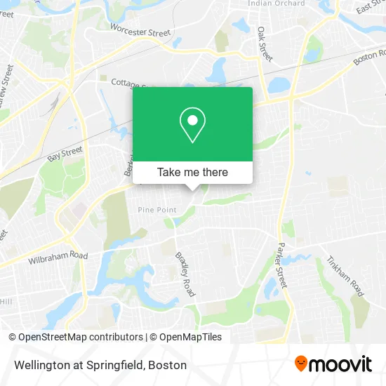
See Wellington at Springfield, Boston, on the map
Public Transit to Wellington at Springfield in Boston
Wondering how to get to Wellington at Springfield in Boston? Moovit helps you find the best way to get to Wellington at Springfield with step-by-step directions from the nearest public transit station.
Moovit provides free maps and live directions to help you navigate through your city. View schedules, routes, timetables, and find out how long does it take to get to Wellington at Springfield in real time.
Looking for the nearest stop or station to Wellington at Springfield? Check out this list of stops closest to your destination: Wilbraham / Bellwood; Boston / Morton (2).
Bus: B17, B7.
Want to see if there’s another route that gets you there at an earlier time? Moovit helps you find alternative routes or times. Get directions from and directions to Wellington at Springfield easily from the Moovit App or Website.
We make riding to Wellington at Springfield easy, which is why over 1.7 million users, including users in Boston, trust Moovit as the best app for public transit. You don’t need to download an individual bus app or train app, Moovit is your all-in-one transit app that helps you find the best bus time or train time available.
For information on prices of bus, costs and ride fares to Wellington at Springfield, please check the Moovit app.
Use the app to navigate to popular places including to the airport, hospital, stadium, grocery store, mall, coffee shop, school, college, and university.
Wellington at Springfield Address: 942 Grayson Dr Springfield, MA 01119 street in Boston
- Keystone Woods,
- Vision Entertainment,
- Longonot Transportation,
- Putnams Puddle Dam,
- Breckwood Park,
- USPS Collection Box - Blue Box,
- Wneu,
- EZ Construction,
- Pat's Jewelry Boutique,
- Springfield Luxury Limo,
- Breckwood Lake,
- North Branch Tributary Park,
- III Trucks,
- Balliet Middle School,
- Thomas Balliet Elementary School,
- Balliet Preschool,
- Church In the Acres Baptist Church,
- Pine Point,
- Seymour Dingle,
- Tripod Locksmith & Key
Places Near Wellington at Springfield (Boston)
- Faneuil Hall, Boston,
- Boston Medical Center, Boston,
- Museum Of Science, Boston,
- Td Garden, Boston,
- Castle Island, Boston,
- Mgm Music Hall, Boston,
- Prudential Center, Boston,
- Leader Bank Pavilion (Leader Bank Pavillion), Boston,
- Boston Children's Hospital, Boston,
- North End, Boston,
- Seaport District, Boston,
- Quincy Market, Boston,
- Cheers, Boston,
- Wang Theater, Boston,
- Isabella Stewart Gardner Museum, Boston,
- Wilbur Theatre, Boston,
- Massachusetts General Hospital, Boston,
- House Of Blues, Boston,
- Boston Common, Boston,
- Boston Convention & Exhibition Center, Boston
How to get to popular places in Boston with public transit
Get around Boston by public transit!
Traveling around Boston has never been so easy. See step by step directions as you travel to any attraction, street or major public transit station. View bus and train schedules, arrival times, service alerts and detailed routes on a map, so you know exactly how to get to anywhere in Boston.
When traveling to any destination around Boston use Moovit's Live Directions with Get Off Notifications to know exactly where and how far to walk, how long to wait for your line, and how many stops are left. Moovit will alert you when it's time to get off — no need to constantly re-check whether yours is the next stop.
Wondering how to use public transit in Boston or how to pay for public transit in Boston? Moovit public transit app can help you navigate your way with public transit easily, and at minimum cost. It includes public transit fees, ticket prices, and costs. Looking for a map of Boston public transit lines? Moovit public transit app shows all public transit maps in Boston with all Bus, Train, Subway and Ferry routes and stops on an interactive map.
Boston has 4 transit type(s), including: Bus, Train, Subway and Ferry, operated by several transit agencies, including MBTA, Southeastern Regional Transit Authority, MetroWest Regional Transit Authority, Rhode Island Public Transit Authority, WRTA, Lowell Regional Transit Authority, Merrimack Valley Transit, Montachusett Regional Transit Authority, Cape Cod Regional Transit Authority, Brockton Area Transit Authority, Martha's Vineyard Transit Authority, the WAVE - Nantucket Regional Transit Authority, GATRA, Cape Ann Transportation Authority and Massport