Directions to Westfield Century City (Century City, La) with public transportation
The following transit lines have routes that pass near Westfield Century City
How to get to Westfield Century City by bus?
Click on the bus route to see step by step directions with maps, line arrival times and updated time schedules.
Bus stations near Westfield Century City in Century City, La
- Santa Monica / Century Park West, 4 min walk,
- Century Park West / Santa Monica, 4 min walk,
- Century Park West NB & Santa Monica Ns, 4 min walk,
- Century Park West & Santa Monica Blvd (Northbound), 4 min walk,
- Century Prk West & Santa Monica Blvd, 4 min walk,
- Santa Monica Blvd & Avenue of the Stars (Eastbound), 5 min walk,
Light Rail stations near Westfield Century City in Century City, La
- Westwood / Rancho Park, 45 min walk,
Bus lines to Westfield Century City in Century City, La
- 4, Downtown LA - Broadway - Venice,
- 28, Cesar Chavez - Vignes,
- 5, Palms Station,
- CE573, Southbound,
- 792, Century City,
- 797, Santa Clarita,
- CE534, Westbound,
What are the closest stations to Westfield Century City?
The closest stations to Westfield Century City are:
- Santa Monica / Century Park West is 217 yards away, 4 min walk.
- Century Park West / Santa Monica is 241 yards away, 4 min walk.
- Century Park West NB & Santa Monica Ns is 250 yards away, 4 min walk.
- Century Park West & Santa Monica Blvd (Northbound) is 264 yards away, 4 min walk.
- Century Prk West & Santa Monica Blvd is 266 yards away, 4 min walk.
- Santa Monica Blvd & Avenue of the Stars (Eastbound) is 375 yards away, 5 min walk.
- Westwood / Rancho Park is 3770 yards away, 45 min walk.
Which bus lines stop near Westfield Century City?
These bus lines stop near Westfield Century City: 4, 5, CC 3.
What’s the nearest bus stop to Westfield Century City in Century City, La?
The nearest bus stops to Westfield Century City in Century City, La are Santa Monica / Century Park West, Century Park West / Santa Monica, Century Park West NB & Santa Monica Ns, Century Park West & Santa Monica Blvd (Northbound) and Century Prk West & Santa Monica Blvd. The closest one is a 4 min walk away.
What time is the first light rail to Westfield Century City in Century City, La?
The E LINE (EXPO) is the first light rail that goes to Westfield Century City in Century City, La. It stops nearby at 3:29 AM.
What time is the last light rail to Westfield Century City in Century City, La?
The E LINE (EXPO) is the last light rail that goes to Westfield Century City in Century City, La. It stops nearby at 12:50 AM.
What time is the first bus to Westfield Century City in Century City, La?
The 4 is the first bus that goes to Westfield Century City in Century City, La. It stops nearby at 3:04 AM.
What time is the last bus to Westfield Century City in Century City, La?
The 4 is the last bus that goes to Westfield Century City in Century City, La. It stops nearby at 3:33 AM.
How much is the subway fare to Westfield Century City?
The subway fare to Westfield Century City costs about $1.75.
See Westfield Century City, Century City, La, on the map
Public Transit to Westfield Century City in Century City, La
Wondering how to get to Westfield Century City in Century City, La, United States? Moovit helps you find the best way to get to Westfield Century City with step-by-step directions from the nearest public transit station.
Moovit provides free maps and live directions to help you navigate through your city. View schedules, routes, timetables, and find out how long does it take to get to Westfield Century City in real time.
Looking for the nearest stop or station to Westfield Century City? Check out this list of stops closest to your destination: Santa Monica / Century Park West; Century Park West / Santa Monica; Century Park West NB & Santa Monica Ns; Century Park West & Santa Monica Blvd (Northbound); Century Prk West & Santa Monica Blvd; Santa Monica Blvd & Avenue of the Stars (Eastbound); Westwood / Rancho Park.
Bus: 4, 5, CC 3, 28, 792, 797, CE573, CE534.
Want to see if there’s another route that gets you there at an earlier time? Moovit helps you find alternative routes or times. Get directions from and directions to Westfield Century City easily from the Moovit App or Website.
We make riding to Westfield Century City easy, which is why over 1.5 million users, including users in Century City, La, trust Moovit as the best app for public transit. You don’t need to download an individual bus app or train app, Moovit is your all-in-one transit app that helps you find the best bus time or train time available.
For information on prices of bus and subway, costs and ride fares to Westfield Century City, please check the Moovit app.
Get to Westfield Century City with public transit and pay for the ride in the Moovit app. In addition to all info you may need for your trip to Westfield Century City, including live directions, real-time arrivals and fare prices, you can also buy public transit passes for your rides. No need for cash or paper tickets to get to Westfield Century City - everything you need is accessible in the app with a click of the button.
Use the app to navigate to popular places including to the airport, hospital, stadium, grocery store, mall, coffee shop, school, college, and university.
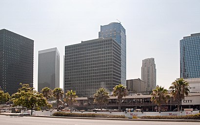
Westfield Century City Address: Santa Monica Boulevard street in Century City, La
Attractions near Westfield Century City
Bloomingdale's,Bloomingdale's,The Tumi Store,Westfield Century City (Century City Shopping Center),Aveda,LA Colombe Coffee Roasters,Mac Cosmetics,Herman Miller Retail,Sunglass Hut,Kate Spade New York,Skechers,Ramen Nagi,Currency Exchange International,Century City Optometry,Disney Store,Amazon Books,Kiehl's,Concierge Center,7 For All Mankind,AllbirdsHow to get to popular attractions in Century City, La with public transit
Costco Wholesale, Tustin,Sleeping Beauty Castle, Anaheim,City of Anaheim, Anaheim,Paradise Pier, Anaheim,Lax, Westchester, La,Alcove Cafe & Bakery, Los Feliz, La,Katella Cast Member Parking Lot (K-Lot), Anaheim,The District at Tustin Legacy, Tustin,City of Brea, Brea,The Hollywood Bowl, Hollywood Hills, La,MainPlace Mall, Santa Ana,Mickey & Friends Tram, Anaheim,Tito's Tacos, Culver City,Upland, CA, Upland,Marina del Rey, Del Rey, La,Harbor Pointe, Anaheim,Sawtelle / Little Japantown, Sawtelle, La,Laguna Beach, Laguna Beach,City of Irvine, Irvine,Interstate 405 (San Diego Freeway), CarsonGet around Los Angeles by public transit!
Traveling around Los Angeles has never been so easy. See step by step directions as you travel to any attraction, street or major public transit station. View bus and train schedules, arrival times, service alerts and detailed routes on a map, so you know exactly how to get to anywhere in Los Angeles.
When traveling to any destination around Los Angeles use Moovit's Live Directions with Get Off Notifications to know exactly where and how far to walk, how long to wait for your line, and how many stops are left. Moovit will alert you when it's time to get off — no need to constantly re-check whether yours is the next stop.
Wondering how to use public transit in Los Angeles or how to pay for public transit in Los Angeles? Moovit public transit app can help you navigate your way with public transit easily, and at minimum cost. It includes public transit fees, ticket prices, and costs. Looking for a map of Los Angeles public transit lines? Moovit public transit app shows all public transit maps in Los Angeles with all Bus, Train, Subway, Light Rail, Ferry and Funicular routes and stops on an interactive map.
Los Angeles has 6 transit type(s), including: Bus, Train, Subway, Light Rail, Ferry and Funicular, operated by several transit agencies, including Metro - Los Angeles, Metrolink Trains, METRO, Long Beach Transit, LADOT, OCTA, Foothill Transit, Big Blue Bus, Riverside Transit Agency, LAX FlyAway, Airporter Shuttle, Playa Vista Shuttle, Amtrak, OMNITRANS, Pasadena Transit