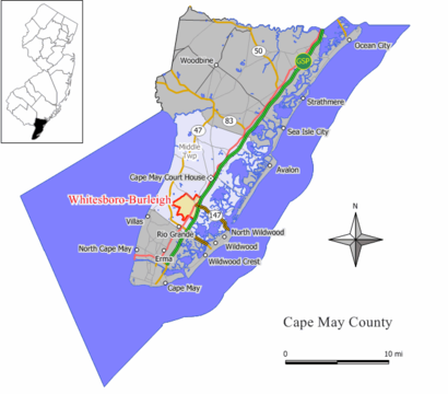
See Whitesboro Burleigh, Middle, Nj, on the map
Directions to Whitesboro Burleigh (Middle, Nj) with public transportation
The following transit lines have routes that pass near Whitesboro Burleigh
 Bus:
Bus:
How to get to Whitesboro Burleigh by bus?
Click on the bus route to see step by step directions with maps, line arrival times and updated time schedules.
Bus stations near Whitesboro Burleigh in Middle, Nj
- Us-9 at Main St,12 min walk,
Bus lines to Whitesboro Burleigh in Middle, Nj
- 552,Cape May Crest Haven,
What are the closest stations to Whitesboro Burleigh?
The closest stations to Whitesboro Burleigh are:
- Us-9 at Main St is 931 yards away, 12 min walk.
Which bus lines stop near Whitesboro Burleigh?
These bus lines stop near Whitesboro Burleigh: 319, 552.
What’s the nearest bus stop to Whitesboro Burleigh in Middle, Nj?
The nearest bus stop to Whitesboro Burleigh in Middle, Nj is Us-9 at Main St. It’s a 12 min walk away.
What time is the first bus to Whitesboro Burleigh in Middle, Nj?
The 552 is the first bus that goes to Whitesboro Burleigh in Middle, Nj. It stops nearby at 3:18 AM.
What time is the last bus to Whitesboro Burleigh in Middle, Nj?
The 552 is the last bus that goes to Whitesboro Burleigh in Middle, Nj. It stops nearby at 3:19 AM.
See Whitesboro Burleigh, Middle, Nj, on the map
Public Transit to Whitesboro Burleigh in Middle, Nj
Wondering how to get to Whitesboro Burleigh in Middle, Nj, United States? Moovit helps you find the best way to get to Whitesboro Burleigh with step-by-step directions from the nearest public transit station.
Moovit provides free maps and live directions to help you navigate through your city. View schedules, routes, timetables, and find out how long does it take to get to Whitesboro Burleigh in real time.
Looking for the nearest stop or station to Whitesboro Burleigh? Check out this list of stops closest to your destination: Us-9 at Main St.
Bus:
Want to see if there’s another route that gets you there at an earlier time? Moovit helps you find alternative routes or times. Get directions from and directions to Whitesboro Burleigh easily from the Moovit App or Website.
We make riding to Whitesboro Burleigh easy, which is why over 1.5 million users, including users in Middle, Nj, trust Moovit as the best app for public transit. You don’t need to download an individual bus app or train app, Moovit is your all-in-one transit app that helps you find the best bus time or train time available.
For information on prices of bus, costs and ride fares to Whitesboro Burleigh, please check the Moovit app.
Use the app to navigate to popular places including to the airport, hospital, stadium, grocery store, mall, coffee shop, school, college, and university.
Location: Middle, Nj, New York - New Jersey
Popular routes from Whitesboro Burleigh, Middle, Nj
Attractions near Whitesboro Burleigh
233 W Scott St,Raleigh Geo,Rpo Real Estate,Concerned Citizens of Whitesboro,Whitesboro,Whitesboro, New Jersey,Thousand Trails Sea Pines,USPS,United States Postal Service,Christ Gospel Church (Christ Gospel the Love Center),Queen Esther Household Of Ruth Cemetery,Peebles,WW Studio,Daniel Scull,Joyful Pets,Home Depot Cape May,Hi Tech Auto and Truck,Ewd-24-Rio Grande,Rio Grande Autoparts Warehouse,Stax *How to get to popular attractions in Middle, Nj with public transit
Time Life, Manhattan,Mad Dog & Beans Mexican Cantina, Manhattan,Rattle N Hum, Manhattan,Stout, Manhattan,I-80 (Interstate 80), Paterson, Nj,The Kunjip, Manhattan,Roberta's Pizza,Dinosaur Bar-B-Que, Manhattan,The Biergarten at The Standard, Manhattan,Grimaldi's Pizzeria,Freehold Raceway Mall, Freehold Township,Joe's Shanghai 鹿嗚春, Manhattan,Brass Monkey, Manhattan,Dos Toros Taquería, Manhattan,J.G. Melon, Manhattan,Ritz Bar & Lounge, Manhattan,Barrage, Manhattan,SoHo, Manhattan,5 Napkin Burger, Manhattan,Nan Xiang Xiao Long Bao, QueensGet around Middle, Nj by public transit!
Traveling around Middle, Nj has never been so easy. See step by step directions as you travel to any attraction, street or major public transit station. View bus and train schedules, arrival times, service alerts and detailed routes on a map, so you know exactly how to get to anywhere in Middle, Nj.
When traveling to any destination around Middle, Nj use Moovit's Live Directions with Get Off Notifications to know exactly where and how far to walk, how long to wait for your line, and how many stops are left. Moovit will alert you when it's time to get off — no need to constantly re-check whether yours is the next stop.
Wondering how to use public transit in Middle, Nj or how to pay for public transit in Middle, Nj? Moovit public transit app can help you navigate your way with public transit easily, and at minimum cost. It includes public transit fees, ticket prices, and costs. Looking for a map of Middle, Nj public transit lines? Moovit public transit app shows all public transit maps in Middle, Nj with all bus routes and stops on an interactive map.
Middle, Nj has 1 transit type(s), including: bus, operated by several transit agencies, including MTA Subway, Metro-North Railroad, LIRR, PATH, Shore Line East, MTA Bus Company, MTA New York City Transit - Express routes, MTA Bus, NJ Transit, NYC Ferry, NICE bus, Bee-Line Bus, NJ Transit Rail, NJ Transit Rail and Norwalk Transit District