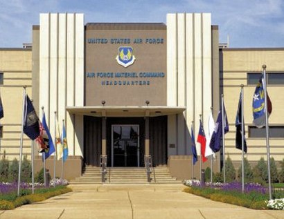
See Wright-Patterson Afb on the map
Directions to Wright-Patterson Afb with public transportation
The following transit lines have routes that pass near Wright-Patterson Afb
Bus:
Which Bus lines stop near Wright-Patterson Afb?
These Bus lines stop near Wright-Patterson Afb: 01
See Wright-Patterson Afb on the map

Public Transportation to Wright-Patterson Afb
Wondering how to get to Wright-Patterson Afb, United States? Moovit helps you find the best way to get to Wright-Patterson Afb with step-by-step directions from the nearest public transit station.
Moovit provides free maps and live directions to help you navigate through your city. View schedules, routes, timetables, and find out how long does it take to get to Wright-Patterson Afb in real time.
Bus:
Want to see if there’s another route that gets you there at an earlier time? Moovit helps you find alternative routes or times. Get directions from and directions to Wright-Patterson Afb easily from the Moovit App or Website.
We make riding to Wright-Patterson Afb easy, which is why over 1.5 million users, including users in Wright-Patterson Afb, trust Moovit as the best app for public transit. You don’t need to download an individual bus app or train app, Moovit is your all-in-one transit app that helps you find the best bus time or train time available.
For information on prices of Bus, costs and ride fares to Wright-Patterson Afb, please check the Moovit app.
Use the app to navigate to popular places including to the airport, hospital, stadium, grocery store, mall, coffee shop, school, college, and university.
Wright-Patterson Afb Address: Symmes Road street in Wright-Patterson Afb

Attractions near Wright-Patterson Afb
- Middy Dr
- College Park Apartments
- College Park Rd
- Fairborn
- Studio, One and Two Bedroom Apartments in Dayton, Ohio
- Charter Oak Pt
- Charter Grove Dr
- Wright State University
- Nutmeg Ct
- Reese Dr
- Wright-Patterson AFB-Gate 19b
- Cinnabar Pl
- Fawcett Hall
- Calder Ct
- Wwsu
- Wright State Dermatology
- Dayton Bombers Hockey Club
- Wright State University
- Rockafield Cemetery
- Ohio One Stop Shop Hop
How to get to popular attractions in Wright-Patterson Afb with public transit
- Stebbins High School, Riverside
- The Greene Town Center, Beavercreek
- 741 & 725, Miamisburg
- I-75 Exit 54 - OH-48 OH-4, Dayton
- Montgomery County Jail, Dayton
- Sexxxy Chocolate, Dayton
- Grandview Hospital Chapel, Dayton
- MVH BIESER AUDITORIUM, Dayton
- Centerville, Ohio, Centerville
- E Stroop & Dorothy Lane, Beavercreek
- Dayton Metro Library, Dayton
- Dayton VA Medical Center, Dayton
- Huber Heights, Ohio, Huber Heights
- Residence Inn Dayton North
- Gate 22B WPAFB, Wright-Patterson Afb
- Chaminade Julienne Student Conditioning Center, Dayton
- Southview Hospital
- FIC at Fairmont High School, Kettering
- Taylorsville Family Dental, Huber Heights
- Bob Driver Stadium, Trotwood