Directions to YWCA Central Massachusetts (Worcester) with public transportation
The following transit lines have routes that pass near YWCA Central Massachusetts
How to get to YWCA Central Massachusetts by bus?
Click on the bus route to see step by step directions with maps, line arrival times and updated time schedules.
Bus stations near YWCA Central Massachusetts in Worcester
- Main St + Dmv, 4 min walk,
- Southbridge St + Dmv, 4 min walk,
- Pleasant St + Irving St, 5 min walk,
- Pleasant St + Chestnut St, 6 min walk,
Bus lines to YWCA Central Massachusetts in Worcester
- 6, West Tatnuck via Chandler St.,
- 7, Washington Heights Apts.,
- 19, Webster Square – Clark University via Main St.,
- 27, Auburn Mall via Main St.,
- 33, Spencer – Brookfield via Main St. & Rt. 9,
- 825, Hub Center,
- 2, Hub Center,
- 3, Worcester State University via Highland St.,
- 31, Lincoln Plaza via Grove St. & West Boylston St.,
What are the closest stations to YWCA Central Massachusetts?
The closest stations to YWCA Central Massachusetts are:
- Main St + Dmv is 238 yards away, 4 min walk.
- Southbridge St + Dmv is 315 yards away, 4 min walk.
- Pleasant St + Irving St is 355 yards away, 5 min walk.
- Pleasant St + Chestnut St is 447 yards away, 6 min walk.
Which bus lines stop near YWCA Central Massachusetts?
These bus lines stop near YWCA Central Massachusetts: 19, 27, 4, 6, PETER PAN.
Which train line stops near YWCA Central Massachusetts?
FRAMINGHAM/WORCESTER
What’s the nearest bus stop to YWCA Central Massachusetts in Worcester?
The nearest bus stops to YWCA Central Massachusetts in Worcester are Main St + Dmv and Southbridge St + Dmv. The closest one is a 4 min walk away.
What time is the first bus to YWCA Central Massachusetts in Worcester?
The 7 is the first bus that goes to YWCA Central Massachusetts in Worcester. It stops nearby at 5:58 AM.
What time is the last bus to YWCA Central Massachusetts in Worcester?
The 19 is the last bus that goes to YWCA Central Massachusetts in Worcester. It stops nearby at 10:12 PM.
How much is the train fare to YWCA Central Massachusetts?
The train fare to YWCA Central Massachusetts costs about $2.40 - $12.25.
See YWCA Central Massachusetts, Worcester, on the map
Public Transit to YWCA Central Massachusetts in Worcester
Wondering how to get to YWCA Central Massachusetts in Worcester, United States? Moovit helps you find the best way to get to YWCA Central Massachusetts with step-by-step directions from the nearest public transit station.
Moovit provides free maps and live directions to help you navigate through your city. View schedules, routes, timetables, and find out how long does it take to get to YWCA Central Massachusetts in real time.
Looking for the nearest stop or station to YWCA Central Massachusetts? Check out this list of stops closest to your destination: Main St + Dmv; Southbridge St + Dmv; Pleasant St + Irving St; Pleasant St + Chestnut St.
Bus: 19, 27, 4, 6, PETER PAN, 7, 33, 825, 2, 3, 31.Train: FRAMINGHAM/WORCESTER.
Want to see if there’s another route that gets you there at an earlier time? Moovit helps you find alternative routes or times. Get directions from and directions to YWCA Central Massachusetts easily from the Moovit App or Website.
We make riding to YWCA Central Massachusetts easy, which is why over 1.5 million users, including users in Worcester, trust Moovit as the best app for public transit. You don’t need to download an individual bus app or train app, Moovit is your all-in-one transit app that helps you find the best bus time or train time available.
For information on prices of bus and train, costs and ride fares to YWCA Central Massachusetts, please check the Moovit app.
Use the app to navigate to popular places including to the airport, hospital, stadium, grocery store, mall, coffee shop, school, college, and university.
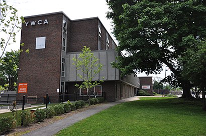
YWCA Central Massachusetts Address: 52 High St Worcester, MA 01609 street in Worcester
Attractions near YWCA Central Massachusetts
Small Business Insurance Agency,Fresh Start Wellness Center,Nursefinders,St Paul's Elder Outreach Program,ChargePoint,Laz Parking 550278s,JC Towing,VTT Management,Alaro Relaty,Lohxa Pharmaceuticals,Alternatives Unlimited,Equal Housing Opportunity and Greystar Fair Housing Statement,United States Government Bankruptcy Adm,Group Health & Benefit Administrtrs,Fanning Learning Center,African Community Education,Lamontagne, John R, Agt,US Government D,The Salvation Army,Faith FellowshipHow to get to popular attractions in Worcester with public transit
Wonderland Parking Garage (Wonderland Station), Revere,Revere Hotel Boston Common, Boston,Terminal B, Boston,Tremont Street, Boston,Stone Zoo, Stoneham,Salem, MA, Salem,Allston, Boston,Flynn Cruiseport Boston, Boston,Registry of Motor Vehicles Haymarket (Boston), Boston,Watertown, MA, Watertown Town,SoWa Vintage Market, Boston,725 Albany St, Boston,100 Hancock St, Quincy,Medfield, Medfield,Newbury St, Boston,Salem State University, Salem,Lynn, MA, Lynn,Trader Joe's, Boston,Union Square, Somerville,111 Huntington Ave, BostonGet around Boston by public transit!
Traveling around Boston has never been so easy. See step by step directions as you travel to any attraction, street or major public transit station. View bus and train schedules, arrival times, service alerts and detailed routes on a map, so you know exactly how to get to anywhere in Boston.
When traveling to any destination around Boston use Moovit's Live Directions with Get Off Notifications to know exactly where and how far to walk, how long to wait for your line, and how many stops are left. Moovit will alert you when it's time to get off — no need to constantly re-check whether yours is the next stop.
Wondering how to use public transit in Boston or how to pay for public transit in Boston? Moovit public transit app can help you navigate your way with public transit easily, and at minimum cost. It includes public transit fees, ticket prices, and costs. Looking for a map of Boston public transit lines? Moovit public transit app shows all public transit maps in Boston with all Bus, Train, Subway and Ferry routes and stops on an interactive map.
Boston has 4 transit type(s), including: Bus, Train, Subway and Ferry, operated by several transit agencies, including MBTA, Southeastern Regional Transit Authority, MetroWest Regional Transit Authority, Rhode Island Public Transit Authority, WRTA, Lowell Regional Transit Authority, Merrimack Valley Transit, Montachusett Regional Transit Authority, Cape Cod Regional Transit Authority, Brockton Area Transit Authority, Martha's Vineyard Transit Authority, the WAVE - Nantucket Regional Transit Authority, GATRA, Cape Ann Transportation Authority, Massport