Directions to Coco Bar (Kaifu District) with public transportation
The following transit lines have routes that pass near Coco Bar
 Bus: Route 112, Route 143 Inner Loop, 167, Route 171 Loop, Route 18.
- Metro: Line 1, Line 2, Line 1, Line 2.
How to get to Coco Bar by bus?
Click on the bus route to see step by step directions with maps, line arrival times and updated time schedules.
From Hunan Technology Vocational College - North Gate, Yuhua District
53 minFrom Meixi Lake Cultural Arts Center, Yuelu District
45 minFrom Changsha Tianxin District Public Security Bureau Population and Exit-Entry Reception Hall, Tianxin District
55 minFrom Changsha Kexin Tumor Hospital, Yuelu District
42 minFrom Hunan Foreign Economic College - Teaching Building 3, Yuelu District
53 minFrom Changsha Environmental Protection Vocational and Technical College - Environmental Impact Assessment Technical Center, Yuhua District
52 minFrom Sunshine 100 Houhai, Yuelu District
50 minFrom Hongxing Experimental Primary School, Tianxin District
60 minFrom Cadet Plaza - Rest Area, Yuhua District
43 minFrom Provincial Government Qingfeng Station, Tianxin District
47 min
How to get to Coco Bar by metro?
Click on the metro route to see step by step directions with maps, line arrival times and updated time schedules.
From Hunan Technology Vocational College - North Gate, Yuhua District
64 minFrom Meixi Lake Cultural Arts Center, Yuelu District
27 minFrom Changsha Tianxin District Public Security Bureau Population and Exit-Entry Reception Hall, Tianxin District
46 minFrom Changsha Kexin Tumor Hospital, Yuelu District
36 minFrom Changsha Environmental Protection Vocational and Technical College - Environmental Impact Assessment Technical Center, Yuhua District
64 minFrom Sunshine 100 Houhai, Yuelu District
48 minFrom Cadet Plaza - Rest Area, Yuhua District
40 minFrom Provincial Government Qingfeng Station, Tianxin District
32 min
Bus stops near Coco Bar in Kaifu District
Metro stations near Coco Bar in Kaifu District
Bus lines to Coco Bar in Kaifu District
- Route 168, East Bus Station,VIEW
- Route 203, Jinying Machinery,VIEW
- Temporary Route 106, Taohualing Bus Terminal,VIEW
- Route 142, Xingsha,VIEW
- Route 358, Central South University,VIEW
- Route 901, Xinkaipo,VIEW
- Route 123, South Bus Station,VIEW
- 167, Huaxia,VIEW
- Route 908, Peiyuan Bridge,VIEW
- Route 143 Outer Ring, Guitang River,VIEW
- Route 803 Outer Ring, Xinkai Road Junction,VIEW
- Route 171 Loop, Changsha Railway,VIEW
- Route 501 Outer Ring, Xingsha Tea Market,VIEW
- Route 501 Inner Loop, Xingsha Tea Market,VIEW
- Temporary Route 117, Changsha Railway Station - Guanshaling Community,VIEW
- Temporary Route 401, Changsha Railway Station - Chazishan Community,VIEW
- Tourist Route 1, Changsha Railway Station - Science Education New Village,VIEW
- Route 118, Changsha Railway Station - Information Industry Park,VIEW
- Route 401, Chazishan Community - Changsha Railway Station,VIEW
- Route 112, Xiangjiang Century City,VIEW
What are the closest stations to Coco Bar?
The closest stations to Coco Bar are:
- Martyrs Park South Gate is 116 meters away, 3 min walk.
- Shuifengjing is 250 meters away, 4 min walk.
- Pioneer Hall is 353 meters away, 5 min walk.
- Zhongshan Pavilion is 421 meters away, 6 min walk.
- Zhongshan Road is 555 meters away, 8 min walk.
- May 1st Square is 697 meters away, 9 min walk.
- Peiyuan Bridge is 755 meters away, 10 min walk.
- Xundao Street is 809 meters away, 11 min walk.
- Changsha Ferry is 869 meters away, 12 min walk.
- Furong Square is 1243 meters away, 17 min walk.
Which bus lines stop near Coco Bar?
These bus lines stop near Coco Bar: Route 112, Route 143 Inner Loop, 167, Route 171 Loop, Route 18, Route 203, Route 803 Inner Ring, Route 803 Outer Ring.
Which metro lines stop near Coco Bar?
These metro lines stop near Coco Bar: Line 1, Line 2.
What’s the nearest metro station to Coco Bar in Kaifu District?
The nearest metro station to Coco Bar in Kaifu District is Peiyuan Bridge. It’s a 15 min walk away.
What’s the nearest bus station to Coco Bar in Kaifu District?
The nearest bus station to Coco Bar in Kaifu District is Martyrs Park South Gate. It’s a 3 min walk away.
What time is the first metro to Coco Bar in Kaifu District?
The Line 2 is the first metro that goes to Coco Bar in Kaifu District. It stops nearby at 6:30 AM.
What time is the last metro to Coco Bar in Kaifu District?
The Line 1 is the last metro that goes to Coco Bar in Kaifu District. It stops nearby at 11:31 PM.
What time is the first bus to Coco Bar in Kaifu District?
The Temporary Route 401 is the first bus that goes to Coco Bar in Kaifu District. It stops nearby at 5:58 AM.
What time is the last bus to Coco Bar in Kaifu District?
The Route 401 is the last bus that goes to Coco Bar in Kaifu District. It stops nearby at 11:46 PM.
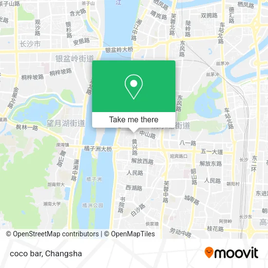
See Coco Bar, Kaifu District, on the map
Public Transit to Coco Bar in Kaifu District
Wondering how to get to Coco Bar in Kaifu District? Moovit helps you find the best way to get to Coco Bar with step-by-step directions from the nearest public transit station.
Moovit provides free maps and live directions to help you navigate through your city. View schedules, routes, timetables, and find out how long does it take to get to Coco Bar in real time.
Looking for the nearest stop or station to Coco Bar? Check out this list of stops closest to your destination: Martyrs Park South Gate; Shuifengjing; Pioneer Hall; Zhongshan Pavilion; Zhongshan Road; May 1st Square; Peiyuan Bridge; Xundao Street; Changsha Ferry; Furong Square.
Bus: Route 112, Route 143 Inner Loop, 167, Route 171 Loop, Route 18, Route 203, Route 803 Inner Ring, Route 803 Outer Ring, Route 168, Route 203, Temporary Route 106, Route 142, Route 358, Route 901, Route 123, 167, Route 908, Route 143 Outer Ring, Route 803 Outer Ring.Metro: Line 1, Line 2, Line 1, Line 2.
Want to see if there’s another route that gets you there at an earlier time? Moovit helps you find alternative routes or times. Get directions from and directions to Coco Bar easily from the Moovit App or Website.
We make riding to Coco Bar easy, which is why over 1.5 million users, including users in Kaifu District, trust Moovit as the best app for public transit. You don’t need to download an individual bus app or train app, Moovit is your all-in-one transit app that helps you find the best bus time or train time available.
For information on prices of bus and metro, costs and ride fares to Coco Bar, please check the Moovit app.
Use the app to navigate to popular places including to the airport, hospital, stadium, grocery store, mall, coffee shop, school, college, and university.
Coco Bar Address: Zhongshan Pavilion street in Kaifu District
- Zhongshan Pavilion (Pioneer Hall),
- Pioneer Hall (Zhongshan Pavilion),
- Urban Management Law Enforcement Point of Wangluyuan Street, Kaifu District,
- Changsha City Kaifuku District People's Hospital (Main Hospital),
- Oyster Hi Sen · Sea Grill (North Zheng Street Flagship Store),
- Flower Master Professional Ear Piercing (Changsha Branch),
- Jinmandi Business Street Area A,
- Laser Dragon Tattoo,
- Jinyuan Source Sauce and Braised Food (Zhongshan Flagship Store),
- Changsha Geriatric Hospital (Shuangyong Road),
- Just Me,
- Qingquan Pavilion Bun Shop (Zhongshan Road Branch),
- M H,
- Zhongshan Road / Jiegui Street (Intersection),
- U Do,
- KFC,
- ZOSDON,
- YOU YI KU,
- Big Big House,
- Mumgo
Places Near Coco Bar (Kaifu District)
- Yuelu Mountain Juzizhou Tourist Area, Yuelu District,
- First Club, Kaifu District,
- Changsha Yangming Mountain Funeral Home, Yuhua District,
- Changsha Bank (Sifang Branch), Kaifu District,
- Central South University Xiangya Second Hospital, Furong District,
- First Affiliated Hospital of Hunan University of Traditional Chinese Medicine - Outpatient Department, Yuhua District,
- Changsha South Station Square, Yuelu District,
- Changsha South Station, Yuhua District,
- Changsha Bank ATM (Sifang Branch), Kaifu District,
- National University of Defense Technology (North Gate), Kaifu District,
- Apple Authorized Dealer (Sam Changsha Store), Yuhua District,
- Du Fu River Pavilion, Tianxin District,
- Wanjiali International Mall, Furong District,
- Hunan Provincial Maternal and Child Health Hospital - Outpatient Department, Kaifu District,
- Hunan Provincial Museum - Multipurpose Hall, Kaifu District,
- Xingsha Police Station Songya Community Police Room, Changsha County,
- Hunan University of Traditional Chinese Medicine First Affiliated Hospital, Yuhua District,
- Zhongnan University Xiangya Hospital, Kaifu District,
- Desiqin City Square, Yuhua District,
- Hunan Province Tumor Hospital, Yuelu District
How to get to popular places in Changsha with public transit
Get around Kaifu District by public transit!
Traveling around Kaifu District has never been so easy. See step by step directions as you travel to any attraction, street or major public transit station. View bus and train schedules, arrival times, service alerts and detailed routes on a map, so you know exactly how to get to anywhere in Kaifu District.
When traveling to any destination around Kaifu District use Moovit's Live Directions with Get Off Notifications to know exactly where and how far to walk, how long to wait for your line, and how many stops are left. Moovit will alert you when it's time to get off — no need to constantly re-check whether yours is the next stop.
Wondering how to use public transit in Kaifu District or how to pay for public transit in Kaifu District? Moovit public transit app can help you navigate your way with public transit easily, and at minimum cost. It includes public transit fees, ticket prices, and costs. Looking for a map of Kaifu District public transit lines? Moovit public transit app shows all public transit maps in Kaifu District with all Bus and Metro routes and stops on an interactive map.
Changsha has 2 transit type(s), including: Bus and Metro, operated by several transit agencies, including Changsha Metro and Changsha Bus Group