
42 Bus Route Map
View the 42 route map and see all 42 stops along the route. The map of 42 shows where the bus travels and the location of each stop, making it easy to understand the entire route at a glance.
Explore MARTA routes on the map and see where MARTA bus services operate. Use the 42 map to find bus stops and see how the 42 connects different areas along its trip.
All 42 stops on the map are displayed in route order, helping you follow the 42 bus from the first stop to the last.
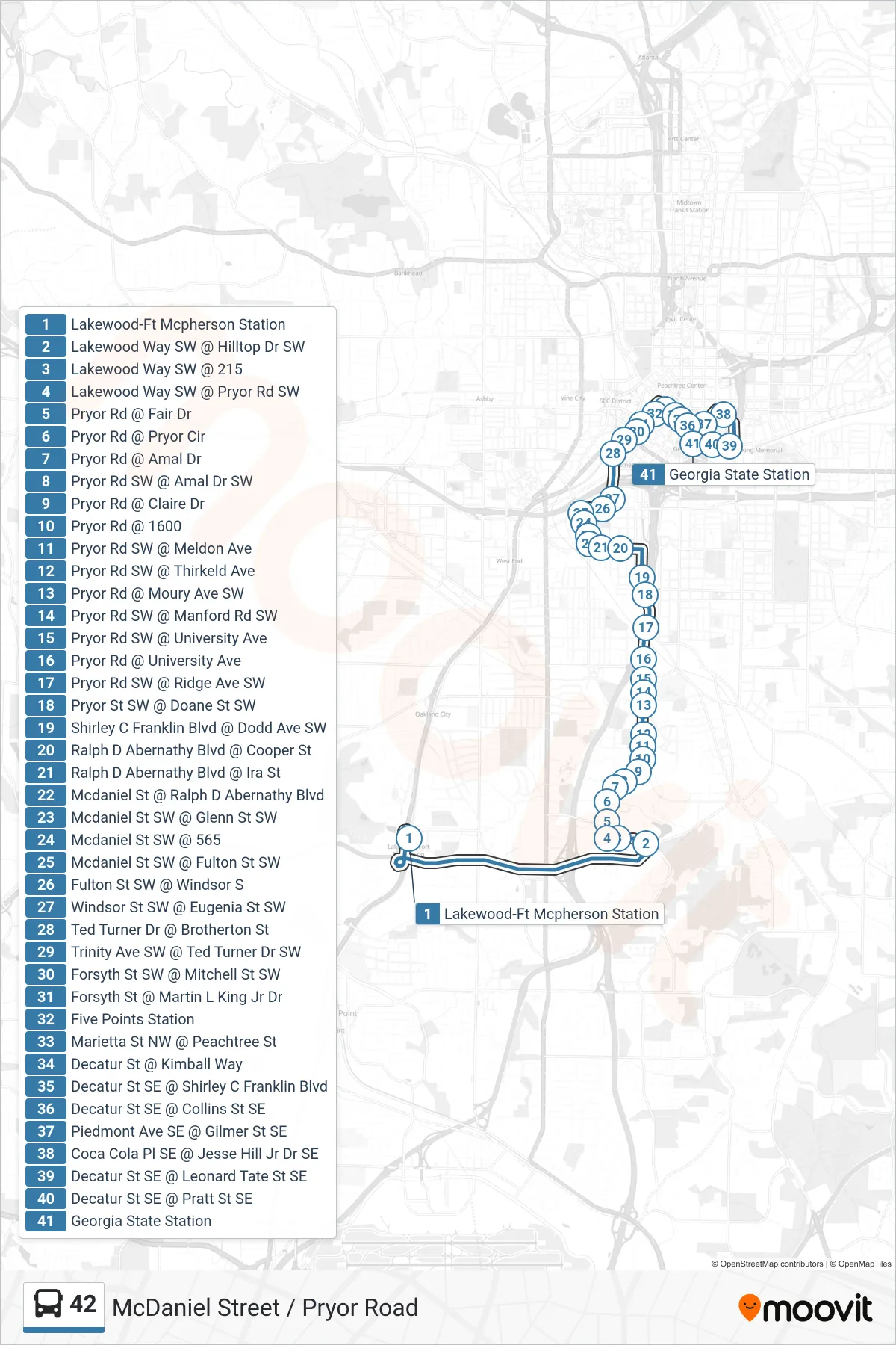
Stops list (42 - Five Points Stn)
- Lakewood-Ft Mcpherson Station
- Lakewood Way SW @ Hilltop Dr SW
- Lakewood Way SW @ 215
- Lakewood Way SW @ Pryor Rd SW
- Pryor Rd @ Fair Dr
- Pryor Rd @ Pryor Cir
- Pryor Rd @ Amal Dr
- Pryor Rd SW @ Amal Dr SW
- Pryor Rd @ Claire Dr
- Pryor Rd @ 1600
- Pryor Rd SW @ Meldon Ave
- Pryor Rd SW @ Thirkeld Ave
- Pryor Rd @ Moury Ave SW
- Pryor Rd SW @ Manford Rd SW
- Pryor Rd SW @ University Ave
- Pryor Rd @ University Ave
- Pryor Rd SW @ Ridge Ave SW
- Pryor St SW @ Doane St SW
- Shirley C Franklin Blvd @ Dodd Ave SW
- Ralph D Abernathy Blvd @ Cooper St
- Ralph D Abernathy Blvd @ Ira St
- Mcdaniel St @ Ralph D Abernathy Blvd
- Mcdaniel St SW @ Glenn St SW
- Mcdaniel St SW @ 565
- Mcdaniel St SW @ Fulton St SW
- Fulton St SW @ Windsor S
- Windsor St SW @ Eugenia St SW
- Ted Turner Dr @ Brotherton St
- Trinity Ave SW @ Ted Turner Dr SW
- Forsyth St SW @ Mitchell St SW
- Forsyth St @ Martin L King Jr Dr
- Five Points Station
- Marietta St NW @ Peachtree St
- Decatur St @ Kimball Way
- Decatur St SE @ Shirley C Franklin Blvd
- Decatur St SE @ Collins St SE
- Piedmont Ave SE @ Gilmer St SE
- Coca Cola Pl SE @ Jesse Hill Jr Dr SE
- Decatur St SE @ Leonard Tate St SE
- Decatur St SE @ Pratt St SE
- Georgia State Station