
ML Bus Route Map
View the ML route map and see all ML stops along the route. The map of ML shows where the bus travels and the location of each stop, making it easy to understand the entire route at a glance.
Explore Tahoe Truckee Area Regional Transit routes on the map and see where Tahoe Truckee Area Regional Transit bus services operate. Use the ML map to find bus stops and see how the ML connects different areas along its trip.
All ML stops on the map are displayed in route order, helping you follow the ML bus from the first stop to the last.
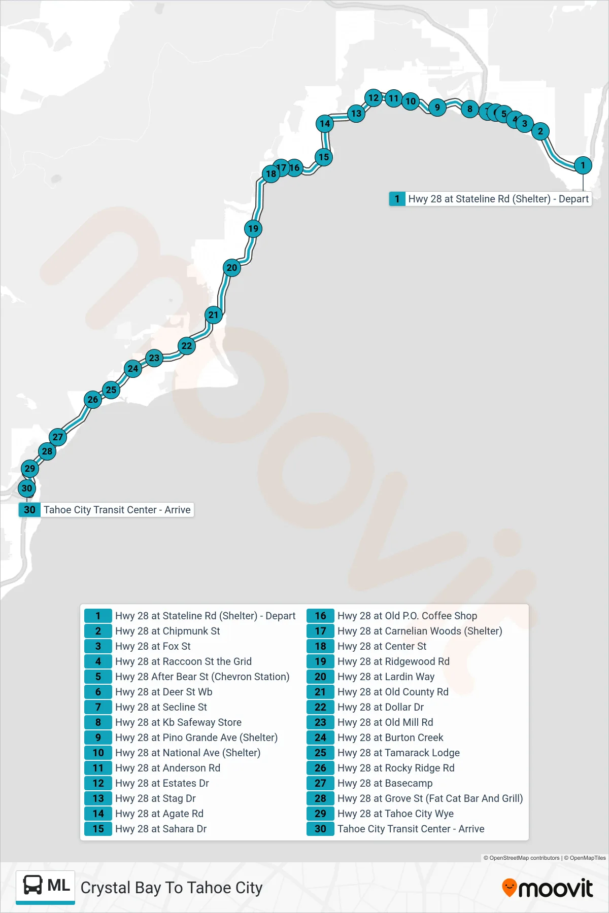
Stops list (ML - Crystal Bay To Tahoe City)
- Hwy 28 at Stateline Rd (Shelter) - Depart
- Hwy 28 at Chipmunk St
- Hwy 28 at Fox St
- Hwy 28 at Raccoon St the Grid
- Hwy 28 After Bear St (Chevron Station)
- Hwy 28 at Deer St Wb
- Hwy 28 at Secline St
- Hwy 28 at Kb Safeway Store
- Hwy 28 at Pino Grande Ave (Shelter)
- Hwy 28 at National Ave (Shelter)
- Hwy 28 at Anderson Rd
- Hwy 28 at Estates Dr
- Hwy 28 at Stag Dr
- Hwy 28 at Agate Rd
- Hwy 28 at Sahara Dr
- Hwy 28 at Old P.O. Coffee Shop
- Hwy 28 at Carnelian Woods (Shelter)
- Hwy 28 at Center St
- Hwy 28 at Ridgewood Rd
- Hwy 28 at Lardin Way
- Hwy 28 at Old County Rd
- Hwy 28 at Dollar Dr
- Hwy 28 at Old Mill Rd
- Hwy 28 at Burton Creek
- Hwy 28 at Tamarack Lodge
- Hwy 28 at Rocky Ridge Rd
- Hwy 28 at Basecamp
- Hwy 28 at Grove St (Fat Cat Bar And Grill)
- Hwy 28 at Tahoe City Wye
- Tahoe City Transit Center - Arrive
Change direction
- Route Map - ML - Tahoma To Tahoe City
- Route Map - ML - Incline To Tahoma
- Route Map - ML - Tahoe City To Incline
- Route Map - ML - Tahoe City To Tahoma
- Route Map - ML - Incline To Crystal Bay
- Route Map - ML - Tahoma To Incline
- Route Map - ML - Tahoma To Crystal Bay
- Route Map - ML - Crystal Bay To Incline
- Route Map - ML - Incline To Tahoe City