
ML Bus Route Map
View the ML route map and see all ML stops along the route. The map of ML shows where the bus travels and the location of each stop, making it easy to understand the entire route at a glance.
Explore Tahoe Truckee Area Regional Transit routes on the map and see where Tahoe Truckee Area Regional Transit bus services operate. Use the ML map to find bus stops and see how the ML connects different areas along its trip.
All ML stops on the map are displayed in route order, helping you follow the ML bus from the first stop to the last.
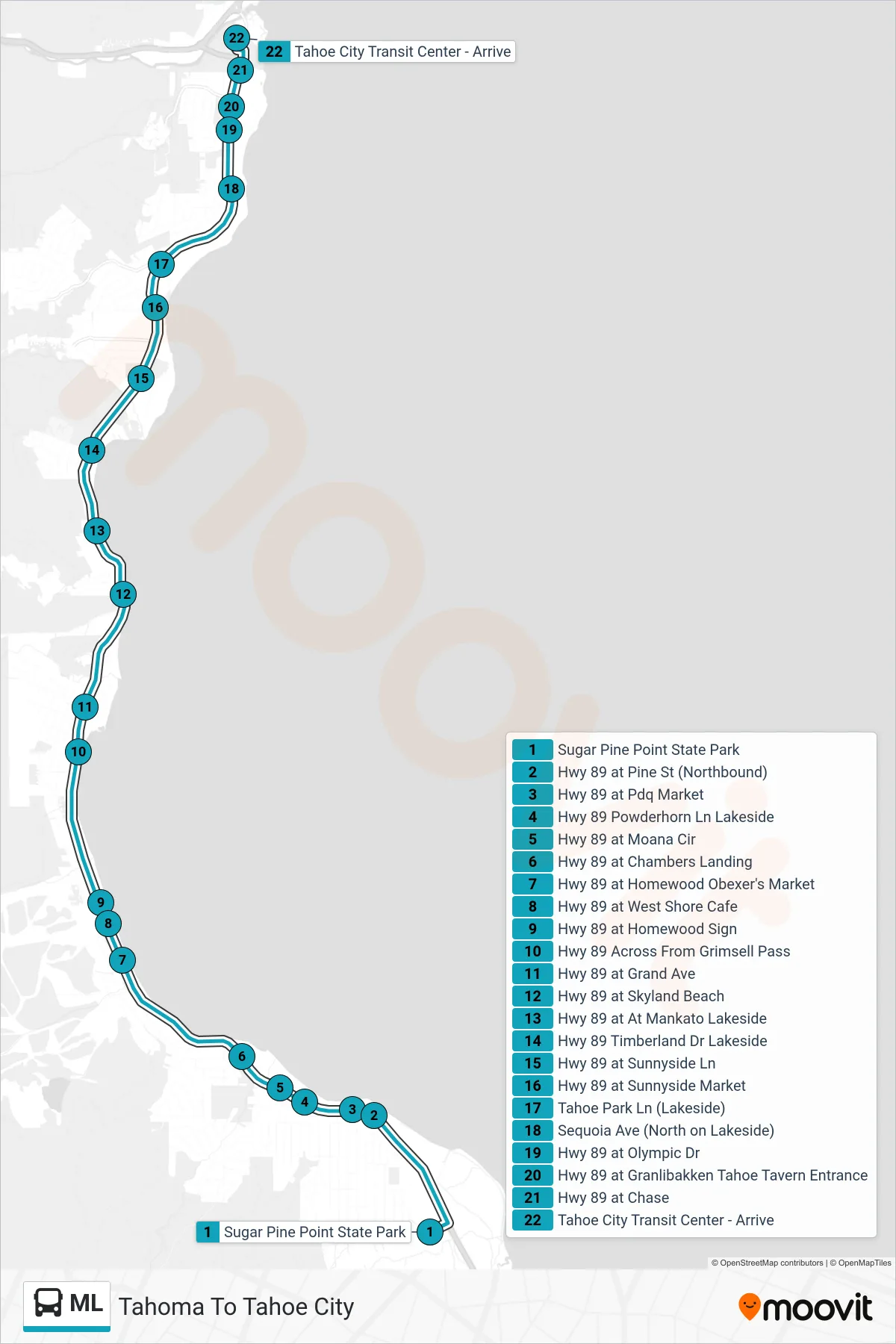
Stops list (ML - Tahoma To Tahoe City)
- Sugar Pine Point State Park
- Hwy 89 at Pine St (Northbound)
- Hwy 89 at Pdq Market
- Hwy 89 Powderhorn Ln Lakeside
- Hwy 89 at Moana Cir
- Hwy 89 at Chambers Landing
- Hwy 89 at Homewood Obexer's Market
- Hwy 89 at West Shore Cafe
- Hwy 89 at Homewood Sign
- Hwy 89 Across From Grimsell Pass
- Hwy 89 at Grand Ave
- Hwy 89 at Skyland Beach
- Hwy 89 at At Mankato Lakeside
- Hwy 89 Timberland Dr Lakeside
- Hwy 89 at Sunnyside Ln
- Hwy 89 at Sunnyside Market
- Tahoe Park Ln (Lakeside)
- Sequoia Ave (North on Lakeside)
- Hwy 89 at Olympic Dr
- Hwy 89 at Granlibakken Tahoe Tavern Entrance
- Hwy 89 at Chase
- Tahoe City Transit Center - Arrive
Change direction
- Route Map - ML - Incline To Tahoma
- Route Map - ML - Tahoe City To Incline
- Route Map - ML - Tahoe City To Tahoma
- Route Map - ML - Incline To Crystal Bay
- Route Map - ML - Tahoma To Incline
- Route Map - ML - Crystal Bay To Tahoe City
- Route Map - ML - Tahoma To Crystal Bay
- Route Map - ML - Crystal Bay To Incline
- Route Map - ML - Incline To Tahoe City