How to get to WCloset by bus?
Click on the bus route to see step by step directions with maps, line arrival times and updated time schedules.
From McCafe (Changsha South High-Speed Railway Station Restaurant), Yuhua District
45 minFrom Rongcheng Garden Hotel, Yuhua District
46 minFrom HappyB, Yuhua District
42 minFrom Friendship Road Fresh Produce Market, Tianxin District
34 minFrom Desiqin, Wangcheng District
53 minFrom Aoyama, Yuelu District
46 minFrom Hunan International Economics Institute - Economics Department, Yuelu District
50 minFrom Changjun Bilingual Experimental Middle School, Yuelu District
35 minFrom Yuelu District, Changsha City, Yuelu District
26 minFrom Hunan Foreign Language Vocational College (East Gate), Yuhua District
47 min
How to get to WCloset by metro?
Click on the metro route to see step by step directions with maps, line arrival times and updated time schedules.
Bus stops near WCloset in Kaifu District
Metro stations near WCloset in Kaifu District
Bus lines to WCloset in Kaifu District
- Route 358, Window of the World,VIEW
- Route 308 Express, Dezheng Garden - Yuelu District Government North,VIEW
- 11, Chigangchong - Yanhe Road Bus Terminal,VIEW
- Route 18, Dongfanghong Bus Terminal - Simenkou,VIEW
- Route 112, Xiangjiang Century City (West Jintai Road) - Yingpan Road Liuyang River Bridge West,VIEW
- Route 138, Yatang Village - Jiayi Former Residence,VIEW
- Route 145, Jia Yi Former Residence - Xiangfu Road Bridge East Bus Terminal,VIEW
- 167, Huaxia (Xinhe Road) - Lijun Community,VIEW
- Route 202, Changsha Railway Station - Wangjiawan,VIEW
- 308, Dezheng Garden - Chazi Mountain Road Gufeng Intersection,VIEW
- Route 368, Huaxia - Sports New City Bus Terminal,VIEW
- Route 804, New River Delta (Qiuyue Road) - Xinkaipo Intersection,VIEW
- Route 901, Xinkaipu - Poly Champagne International,VIEW
- Route 908, Peiyuan Bridge - Hunan University of Chinese Medicine South Gate,VIEW
- Route 143 Inner Loop, Guitang River - Guitang River,VIEW
- Route 803 Inner Ring, Xinkaipulu Intersection - Xinkaipulu Intersection,VIEW
- Route 143 Outer Ring, Guitang River,VIEW
- Route 803 Outer Ring, Xinkai Road Junction,VIEW
- Temporary Route 117, Changsha Railway Station - Guanshaling Community,VIEW
- Temporary Route 118, Information Industry Park - Changsha Railway Station,VIEW
What are the closest stations to WCloset?
The closest stations to WCloset are:
- East Simenkou is 283 meters away, 4 min walk.
- Simen Entrance is 320 meters away, 5 min walk.
- May 1st Square is 472 meters away, 7 min walk.
- Nier Education (Nanyang Street) is 567 meters away, 8 min walk.
- Huatu Education (Taiping Street) is 583 meters away, 8 min walk.
- Fanxi Lane is 666 meters away, 9 min walk.
- Xiangjiang Middle Road is 1115 meters away, 15 min walk.
- Huangxing Square is 1228 meters away, 16 min walk.
Which bus lines stop near WCloset?
These bus lines stop near WCloset: Route 145, Route 18, 308, Route 368, Route 908, Temporary Route 401.
Which metro line stops near WCloset?
Line 2 (Meixi Lake West)
What’s the nearest metro station to WCloset in Kaifu District?
The nearest metro station to WCloset in Kaifu District is Xiangjiang Middle Road. It’s a 15 min walk away.
What’s the nearest bus station to WCloset in Kaifu District?
The nearest bus station to WCloset in Kaifu District is East Simenkou. It’s a 4 min walk away.
What time is the first metro to WCloset in Kaifu District?
The Line 2 is the first metro that goes to WCloset in Kaifu District. It stops nearby at 6:30 AM.
What time is the last metro to WCloset in Kaifu District?
The Line 1 is the last metro that goes to WCloset in Kaifu District. It stops nearby at 11:29 PM.
What time is the first bus to WCloset in Kaifu District?
The Lishan Express is the first bus that goes to WCloset in Kaifu District. It stops nearby at 5:35 AM.
What time is the last bus to WCloset in Kaifu District?
The Temporary Route 314 is the last bus that goes to WCloset in Kaifu District. It stops nearby at 1:14 AM.
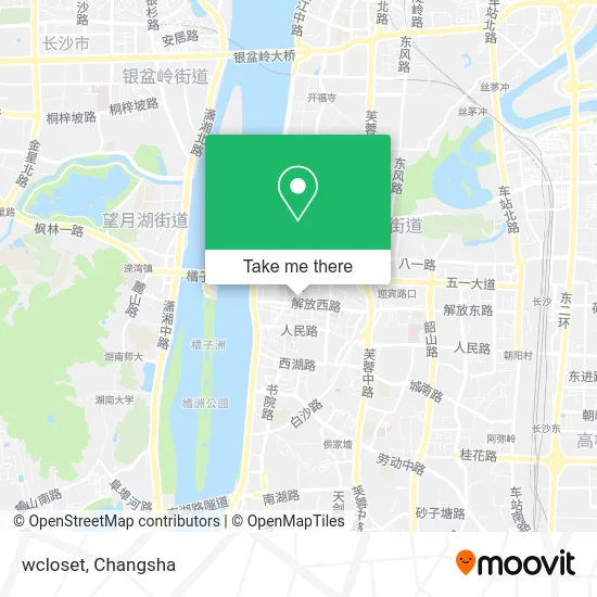
See WCloset, Kaifu District, on the map
Public Transit to WCloset in Kaifu District
Wondering how to get to WCloset in Kaifu District? Moovit helps you find the best way to get to WCloset with step-by-step directions from the nearest public transit station.
Moovit provides free maps and live directions to help you navigate through your city. View schedules, routes, timetables, and find out how long does it take to get to WCloset in real time.
Looking for the nearest stop or station to WCloset? Check out this list of stops closest to your destination: East Simenkou; Simen Entrance; May 1st Square; Nier Education (Nanyang Street); Huatu Education (Taiping Street); Fanxi Lane; Xiangjiang Middle Road; Huangxing Square.
Bus: Route 145, Route 18, 308, Route 368, Route 908, Temporary Route 401, Route 358, Route 308 Express, 11, Route 18, Route 112, Route 138, Route 143 Outer Ring, Route 803 Outer Ring, Temporary Route 117, Temporary Route 118, Temporary Route 401, Tourist Route 1, Route 401.Metro: Line 2, Line 2, Line 1.
Want to see if there’s another route that gets you there at an earlier time? Moovit helps you find alternative routes or times. Get directions from and directions to WCloset easily from the Moovit App or Website.
We make riding to WCloset easy, which is why over 1.5 million users, including users in Kaifu District, trust Moovit as the best app for public transit. You don’t need to download an individual bus app or train app, Moovit is your all-in-one transit app that helps you find the best bus time or train time available.
For information on prices of bus and metro, costs and ride fares to WCloset, please check the Moovit app.
Use the app to navigate to popular places including to the airport, hospital, stadium, grocery store, mall, coffee shop, school, college, and university.
WCloset Address: 长沙市天心区黄兴中路27号王府井百货F4 street in Kaifu District
- Xiaomi Store (Changsha Wangfujing Department Store),
- BUX,
- TIME ROAD,
- J.D.V,
- E Land Kids (Wang Fu Jing Department Store),
- V.S. Velsus,
- O.T,
- Changsha WFJ (Wang Fu Jing Department Store),
- Converse (Changsha Wangfujing 9th Floor Factory Store),
- I Love Choc (Wangfujing Department Store),
- MO&Co. (Wangfujing Department Store),
- ho Li (Wang Fu Jing Department Store),
- LA ROCHE-POSAY (Wangfujing Department Store),
- EVENEWYORK (Wangfujing Department Store Huangxing Middle Road Store),
- LePerfel (Wangfujing Department Store),
- CANUDILO H HOLIDAY (Wangfujing Department Store),
- DR Diamond Ring (Changsha Wuyi Square Guojin Street Store),
- Bassetia Specialty Store,
- Wang Fu Jing Department Store (Huangxing Middle Road),
- MICHAEL KORS (Wangfujing Department Store)
Places Near WCloset (Kaifu District)
- Hunan University of Traditional Chinese Medicine First Affiliated Hospital, Yuhua District,
- Hunan Provincial Maternal and Child Health Hospital - Outpatient Department, Kaifu District,
- Changsha Yangming Mountain Funeral Home, Yuhua District,
- Yuelu Mountain Juzizhou Tourist Area, Yuelu District,
- Wanjiali International Mall, Furong District,
- First Affiliated Hospital of Hunan University of Traditional Chinese Medicine - Outpatient Department, Yuhua District,
- National University of Defense Technology (North Gate), Kaifu District,
- Central South University Xiangya Second Hospital, Furong District,
- Apple Authorized Dealer (Sam Changsha Store), Yuhua District,
- Changsha South Station, Yuhua District,
- Hunan Provincial Museum - Multipurpose Hall, Kaifu District,
- Desiqin City Square, Yuhua District,
- Changsha South Station Square, Yuelu District,
- Hunan Province Tumor Hospital, Yuelu District,
- Xingsha Police Station Songya Community Police Room, Changsha County,
- Changsha Bank (Sifang Branch), Kaifu District,
- First Club, Kaifu District,
- Du Fu River Pavilion, Tianxin District,
- Changsha Bank ATM (Sifang Branch), Kaifu District,
- Zhongnan University Xiangya Hospital, Kaifu District
How to get to popular places in Changsha with public transit
Get around Kaifu District by public transit!
Traveling around Kaifu District has never been so easy. See step by step directions as you travel to any attraction, street or major public transit station. View bus and train schedules, arrival times, service alerts and detailed routes on a map, so you know exactly how to get to anywhere in Kaifu District.
When traveling to any destination around Kaifu District use Moovit's Live Directions with Get Off Notifications to know exactly where and how far to walk, how long to wait for your line, and how many stops are left. Moovit will alert you when it's time to get off — no need to constantly re-check whether yours is the next stop.
Wondering how to use public transit in Kaifu District or how to pay for public transit in Kaifu District? Moovit public transit app can help you navigate your way with public transit easily, and at minimum cost. It includes public transit fees, ticket prices, and costs. Looking for a map of Kaifu District public transit lines? Moovit public transit app shows all public transit maps in Kaifu District with all Bus and Metro routes and stops on an interactive map.
Changsha has 2 transit type(s), including: Bus and Metro, operated by several transit agencies, including Changsha Metro and Changsha Bus Group
Public transit lines with stations closest to WCloset in Kaifu District
Metro lines with stations closest to WCloset in Kaifu District
Bus lines with stations closest to WCloset in Kaifu District
May 1st Square
 Temporary Route 117Changsha Railway Station - Guanshaling Community
- Temporary Route 118Information Industry Park - Changsha Railway Station
- Temporary Route 401Changsha Railway Station - Chazishan Community
- Tourist Route 1Changsha Railway Station - Science Education New Village
- Route 401Chazishan Community - Changsha Railway Station